Ukrainian air monitors report one Russian guided glide bomb heading toward Donetsk Oblast
What happened
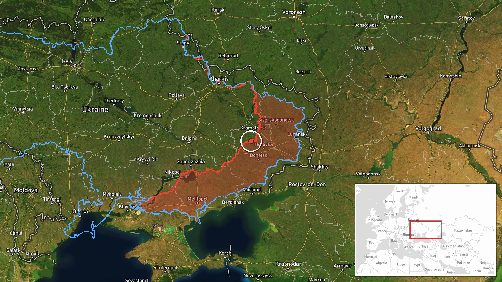
On 16 October 2026 at about 01:04 UTC, the Telegram channel @kpszsu reported one Russian guided glide bomb (KAB) moving toward Donetsk Oblast in eastern Ukraine. The original Ukrainian wording reads roughly as "KABs toward Donetsk region, course east of Dnipropetrovsk region," which indicates the bomb was tracked on a heading passing through the eastern edge of Dnipropetrovsk region. The report gives no impact location, no casualty information, and no confirmation of a strike. Because the event rests on one channel and a general regional bearing, the exact target and outcome remain unknown.
Context and assessment
Donetsk Oblast has been a central axis of the front for a long time, and glide bombs are a common tool there. Aircraft release these weapons from standoff distances, so the launch aircraft need not enter air defence range. They are typically used against fortified positions, logistics nodes, and settlements near the front line. The same day's related reporting shows a broader pattern. Earlier on 15 October, Ukrainian forces reportedly struck a Russian storage, preparation, and launch site for attack drones in the region, with explosions and air defence activity noted. Shahed-type jet drones were also tracked over Lazurnyi and Kalynivskyi that day. Ground activity was active as well: a Russian FPV drone reportedly hit Ukrainian soldiers evacuating civilians near Yampil', and DeepState recorded a Russian advance of about 6 square kilometres in the Minkivka sector without any settlement changing hands. Taken together, these events suggest sustained pressure on the sector, with aerial munitions and drones supporting ground operations. The glide bomb report alone does not show what it was aimed at.
Sources and confidence
The event is based on a single Telegram channel, @kpszsu, with no independent confirmation in the dataset. The confidence score of 8.0 reflects a credible monitoring channel and a clearly stated weapon type and direction, offset by the lack of a second source and the absence of any reported impact. Confidence would rise with corroboration from other Ukrainian official channels, regional military administration statements, or imagery or video of an impact. It would fall if later updates show the bomb was intercepted, lost track of, or diverted, or if no strike is reported at any plausible target.
Location
The location is recorded at region level, centred near 48.5 N, 37.5 E, within Donetsk Oblast. The source gives no settlement, facility, or grid reference, so the point marks the oblast rather than a target. Donetsk Oblast lies in eastern Ukraine and borders Dnipropetrovsk, Zaporizhzhia, Kharkiv, and Luhansk regions, as well as Russia. The reported bearing suggests the bomb crossed the eastern part of Dnipropetrovsk region before reaching Donetsk, so the true point of interest could lie anywhere along that path.
Related events nearby
- Ukrainian forces struck a Russian storage, preparation, and launch site for attack drones in Donetsk region. E2026-10-15 13:03 UTC · UAS Strike · Donetsk Oblast, Ukraine
- Ukrainian air monitoring: 1 Russian jet-powered Shahed (Geran-3) drone passing Lazurnyi, heading west.2026-10-15 07:24 UTC · Drone Transit · Lazurnyi, Ukraine
- Russian forces advanced (~6 km²) in the Minkivka sector per DeepState frontline update. No settlement center c2026-10-16 00:20 UTC · Combat · Minkivka sector, Ukraine
- Russian FPV drone struck Ukrainian soldiers while they were evacuating civilians. No casualty or location deta2026-10-15 21:51 UTC · FPV Drone · Near Yampil', Donetsk, Ukraine (front line, estima
- Ukrainian air monitoring: 1 Russian jet-powered Shahed (Geran-3) drone over Kalynivskyi.2026-10-15 18:30 UTC · Drone Transit · Kalynivskyi, Ukraine
▶ View this event on the live map

Intel Mapper aggregates open-source reports from monitored Telegram and X channels, geolocates them, cross-checks duplicates across sources and assigns a confidence score. Entries are updated as new confirmations arrive. Read how we verify events.