Jet-powered Shahed-type drone reported heading west past Kalynivka, Vinnytsia Oblast
What happened
Ukrainian air monitoring reported on 15 October 2026 at about 18:30 UTC that a single Russian jet-powered Shahed-type drone, described in the report as a Geran-3, was flying past Kalynivka in Vinnytsia Oblast on a westward course. The original post, published on the Telegram channel @kpszsu, is brief. It names the region and direction but gives no altitude, speed, or impact details. The report attributes the drone to Russia, consistent with how Shahed-type transits are described in this monitoring feed. The source text mentions no strike, casualties, or damage. The event is logged as a drone transit rather than a strike, and the account reflects the channel's own wording rather than independent confirmation of the flight path.
Context and assessment
Vinnytsia Oblast lies in west-central Ukraine, well behind the front line, so a drone recorded there is usually tracked as a transit rather than a frontline event. The same day's feed contains several related transits that together sketch a broader pattern. Earlier, at 03:35 UTC, a single Geran-3 was logged moving from Kharkiv Oblast toward Blyzniuky. At 07:24, another was reported passing Lazurnyi heading west. At 09:18, one was reported moving from Vinnytsia Oblast toward Kalynivskyi, and around 09:52 two or more were recorded east of Pavlohrad. Later, at 13:03, a separate report described a Ukrainian strike on a Russian storage, preparation, and launch site for attack drones in Donetsk Oblast, which indicates that launch infrastructure was active in the same period. Taken together, the sequence of westward-tracking jet-powered drones across several oblasts may suggest routing toward western Ukraine, or an effort to stretch air defenses across a wide area. Single-channel transit reports cannot establish intended targets, so the pattern is best read as evidence of sustained activity rather than proof of a specific objective.
Sources and confidence
This report rests on a single Telegram channel, @kpszsu, which is the only source listed. No independent outlet, second monitoring channel, or official statement is linked to this event in the data. The confidence score of 8.0 reflects a specialized monitoring feed that posts quickly and is generally reliable for transit reports, offset by single-source status and the brevity of the text. Confidence would rise if a second air monitoring channel, regional military administration, or visual report from Vinnytsia Oblast corroborated the flight path, or if the related transits from the same day were confirmed by other feeds. It would fall if the track were revised or the report were corrected.
Location
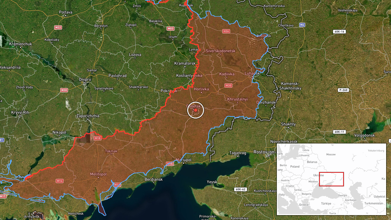
The location is listed at settlement precision as Kalynivskyi, with a high location confidence rating. However, the stored coordinates of roughly 48.01 N, 37.85 E fall in eastern Ukraine, in the Donetsk region, far from Kalynivka in Vinnytsia Oblast, which lies near 49 N, 28 E in the west-central part of the country. This mismatch suggests the marker may sit on a different settlement with a similar name, so the coordinates should be verified before reliance. Vinnytsia Oblast is a predominantly agricultural region drained by the Southern Bug river.
Related events nearby
- Ukrainian air monitoring: 1 Russian jet-powered Shahed (Geran-3) drone from Vinnytsia Oblast toward Kalynivsky2026-10-15 09:18 UTC · Drone Transit · Kalynivskyi, Ukraine
- Ukrainian forces struck a Russian storage, preparation, and launch site for attack drones in Donetsk region. E2026-10-15 13:03 UTC · UAS Strike · Donetsk Oblast, Ukraine
- Ukrainian air monitoring: 1 Russian jet-powered Shahed (Geran-3) drone passing Lazurnyi, heading west.2026-10-15 07:24 UTC · Drone Transit · Lazurnyi, Ukraine
- Russian FPV drone struck Ukrainian soldiers while they were evacuating civilians. No casualty or location deta2026-10-15 21:51 UTC · FPV Drone · Near Yampil', Donetsk, Ukraine (front line, estima
- Ukrainian air monitoring: 2+ Russian jet-powered Shahed (Geran-3) drones over east of Pavlohrad.2026-10-15 09:52 UTC · Drone Transit · east of Pavlohrad, Ukraine
▶ View this event on the live map

Intel Mapper aggregates open-source reports from monitored Telegram and X channels, geolocates them, cross-checks duplicates across sources and assigns a confidence score. Entries are updated as new confirmations arrive. Read how we verify events.