Ukraine strikes Russian attack drone storage and launch site in Donetsk
What happened
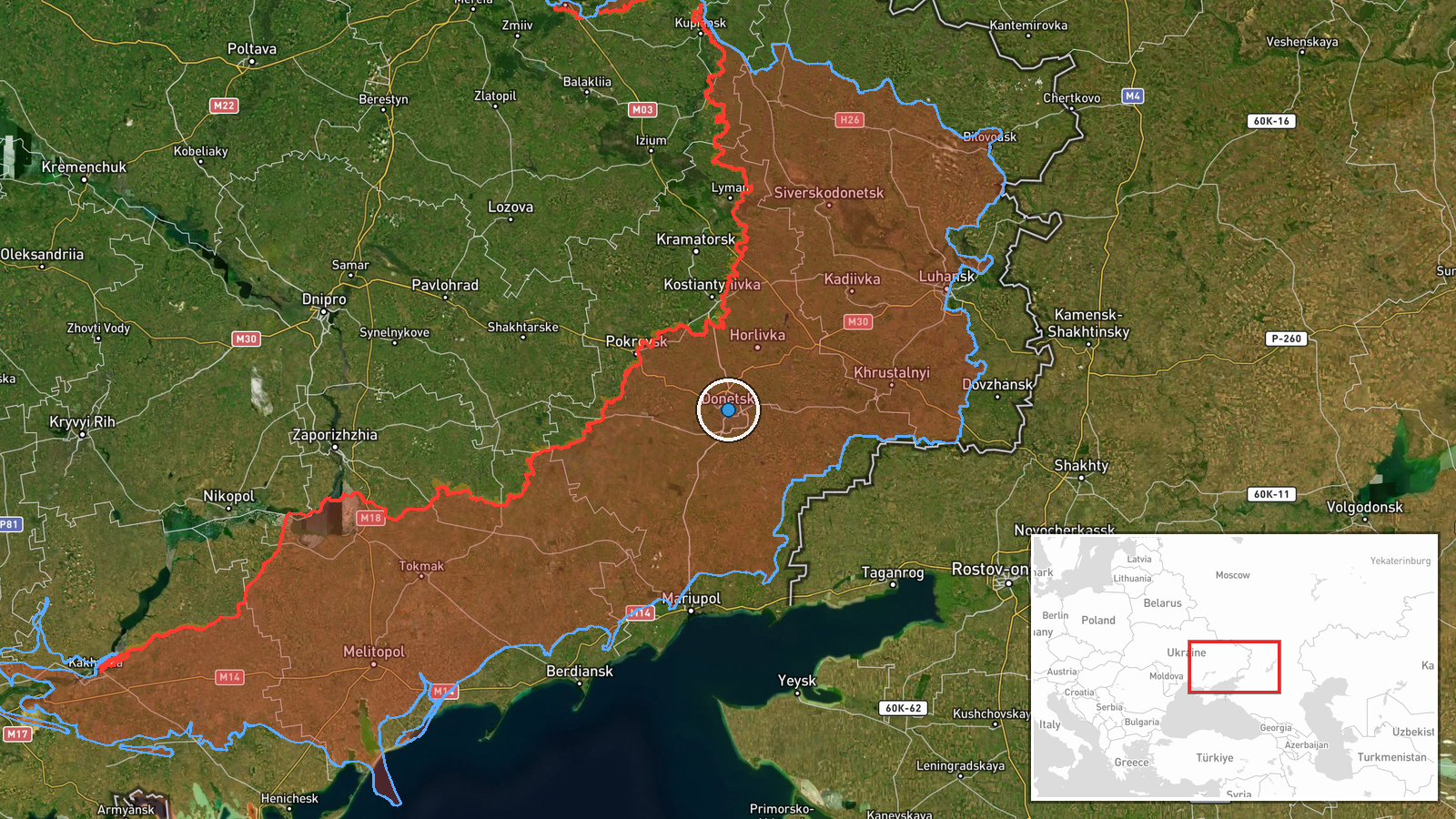
Ukrainian armed forces reportedly destroyed a Russian facility used for storing, preparing, and launching attack drones in Donetsk Oblast on the night of 14–15 October 2026. The General Staff of the Armed Forces of Ukraine reported explosions and Russian air defense activity in the area during the strike. No independent confirmation of the target's destruction or casualty figures was available at the time of reporting.
Context and assessment
Donetsk Oblast remains a focal point of Russian drone operations against Ukrainian territory. Multiple Russian Shahed-type cruise drones were detected transiting Ukrainian airspace on 15 October, originating from staging areas in Kharkiv and Vinnytsia Oblasts and heading toward central Ukrainian cities. Strike operations against Russian drone facilities form part of a sustained Ukrainian effort to degrade the enemy's long-range attack capability. Successful strikes on such sites can temporarily reduce drone sortie rates, though Russia maintains distributed launch infrastructure. The timing of this strike during active drone operations suggests Ukrainian intelligence tracked the facility's operational tempo.
Sources and confidence
Single source report from Telegram channel of Ukraine's General Staff. No cross-confirmation from independent observers or Russian military sources. Confidence score of 8.1 reflects official Ukrainian claim but lack of external verification. Score would increase with satellite imagery, captured documentation, or third-party confirmation; would decrease if Russian sources deny facility presence or damage.
Location
Donetsk Oblast, eastern Ukraine, at approximately 48.02°N, 37.80°E. Settlement-level precision. The location lies in territory contested between Ukrainian and Russian forces. Nearby geography includes the industrial Donbas region and major transport corridors used for drone staging and supply routes.
Related events nearby
- Ukrainian air monitoring: 1 Russian jet-powered Shahed (Geran-3) drone from Vinnytsia Oblast toward Kalynivsky2026-10-15 09:18 UTC · Drone Transit · Kalynivskyi, Ukraine
- Ukrainian air monitoring: 1 Russian jet-powered Shahed (Geran-3) drone passing Lazurnyi, heading west.2026-10-15 07:24 UTC · Drone Transit · Lazurnyi, Ukraine
- Ukrainian air monitoring: 2+ Russian jet-powered Shahed (Geran-3) drones over east of Pavlohrad.2026-10-15 09:52 UTC · Drone Transit · east of Pavlohrad, Ukraine
- Ukrainian air monitoring: 1 Russian jet-powered Shahed (Geran-3) drone from Kharkiv Oblast toward Blyzniuky.2026-10-15 03:35 UTC · Drone Transit · Blyzniuky, Ukraine
- Ukrainian air monitoring: 1 Russian Banderol mini cruise missile from Kharkiv Oblast toward Lozova.2026-10-15 13:49 UTC · Cruise Missile · Lozova, Ukraine
▶ View this event on the live map

Intel Mapper aggregates open-source reports from monitored Telegram and X channels, geolocates them, cross-checks duplicates across sources and assigns a confidence score. Entries are updated as new confirmations arrive. Read how we verify events.