Russian forces advance about 6 km² in Minkivka sector, DeepState reports
What happened
DeepState, a Ukrainian open-source frontline mapping service, reported on 16 October 2026 at 00:20 UTC that Russian forces advanced across roughly 6 square kilometres in the Minkivka sector of Ukraine. The update, as summarized in the event record, states that no settlement center changed hands in the sector. The location is attached to the sector rather than a specific village or street, and the report gives no casualty figures, unit identifications, or details of the fighting. The item rests on a single channel, and the original text field is empty, so the wording here is a summary of the source rather than a direct quotation.
Context and assessment
Minkivka lies in the Donetsk direction, where the front has been shaped for months by slow, infantry-led advances and heavy drone activity. Gains measured in square kilometres, rather than the capture of named settlements, usually signal incremental pressure rather than a breakthrough, and the explicit note that no settlement center changed hands fits that reading. The related events from the same day show the surrounding tempo. A Russian FPV drone reportedly struck Ukrainian soldiers evacuating civilians near Yampil', in the same broad front-line belt, with no casualty details given. Separately, air monitoring logged several jet-powered Geran-3 drones passing over or heading toward Lazurnyi and Kalynivskyi, which indicates ongoing long-range strike traffic but does not by itself link those flights to the ground movement. Ukraine also reportedly struck a Russian site used to store, prepare and launch attack drones in Donetsk Oblast the same day, suggesting both sides were active in the drone domain. Operationally, a territorial gain of this size may point to a localized push aimed at improving positions, though a single update cannot establish intent or durability.
Sources and confidence
The event rests on one channel, DeepStateMAP, and no other outlets or secondary sources are attached in the record, so cross-confirmation is absent. The confidence score of 7.5 reflects an established mapping source making a specific, checkable claim, tempered by the single-source status and the lack of corroborating imagery or official statements. Confidence would rise with confirmation from another mapping service, geolocated footage, or statements from military sources on either side. It would fall if later DeepState revisions reduced the claimed area or if the sector attribution proved imprecise.
Location
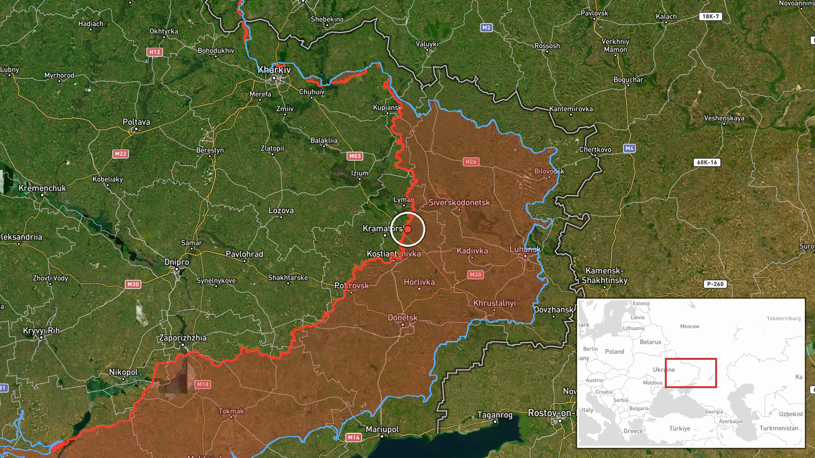
The location is recorded at sector level as Minkivka sector, Ukraine, with region-level geographic precision and high location confidence. The coordinates, approximately 48.79 N and 37.86 E, place the pin in Donetsk Oblast in eastern Ukraine rather than at a specific village or facility. The terrain is generally open farmland with scattered settlements, tree lines and mine belts, which shape how infantry and drones move. Treat the pin as an approximate center of the sector, not a precise battle location.
Related events nearby
- Russian FPV drone struck Ukrainian soldiers while they were evacuating civilians. No casualty or location deta2026-10-15 21:51 UTC · FPV Drone · Near Yampil', Donetsk, Ukraine (front line, estima
- Ukrainian air monitoring: 1 Russian jet-powered Shahed (Geran-3) drone passing Lazurnyi, heading west.2026-10-15 07:24 UTC · Drone Transit · Lazurnyi, Ukraine
- Ukrainian air monitoring: 1 Russian guided glide bomb (KAB) heading toward Donetsk Oblast.2026-10-16 01:04 UTC · Airstrike · Donetsk Oblast, Ukraine
- Ukrainian forces struck a Russian storage, preparation, and launch site for attack drones in Donetsk region. E2026-10-15 13:03 UTC · UAS Strike · Donetsk Oblast, Ukraine
- Ukrainian air monitoring: 1 Russian jet-powered Shahed (Geran-3) drone over Kalynivskyi.2026-10-15 18:30 UTC · Drone Transit · Kalynivskyi, Ukraine
▶ View this event on the live map

Intel Mapper aggregates open-source reports from monitored Telegram and X channels, geolocates them, cross-checks duplicates across sources and assigns a confidence score. Entries are updated as new confirmations arrive. Read how we verify events.