Jet-powered Shahed-type drone reported over Kropyvnytskyi district, heading west
What happened
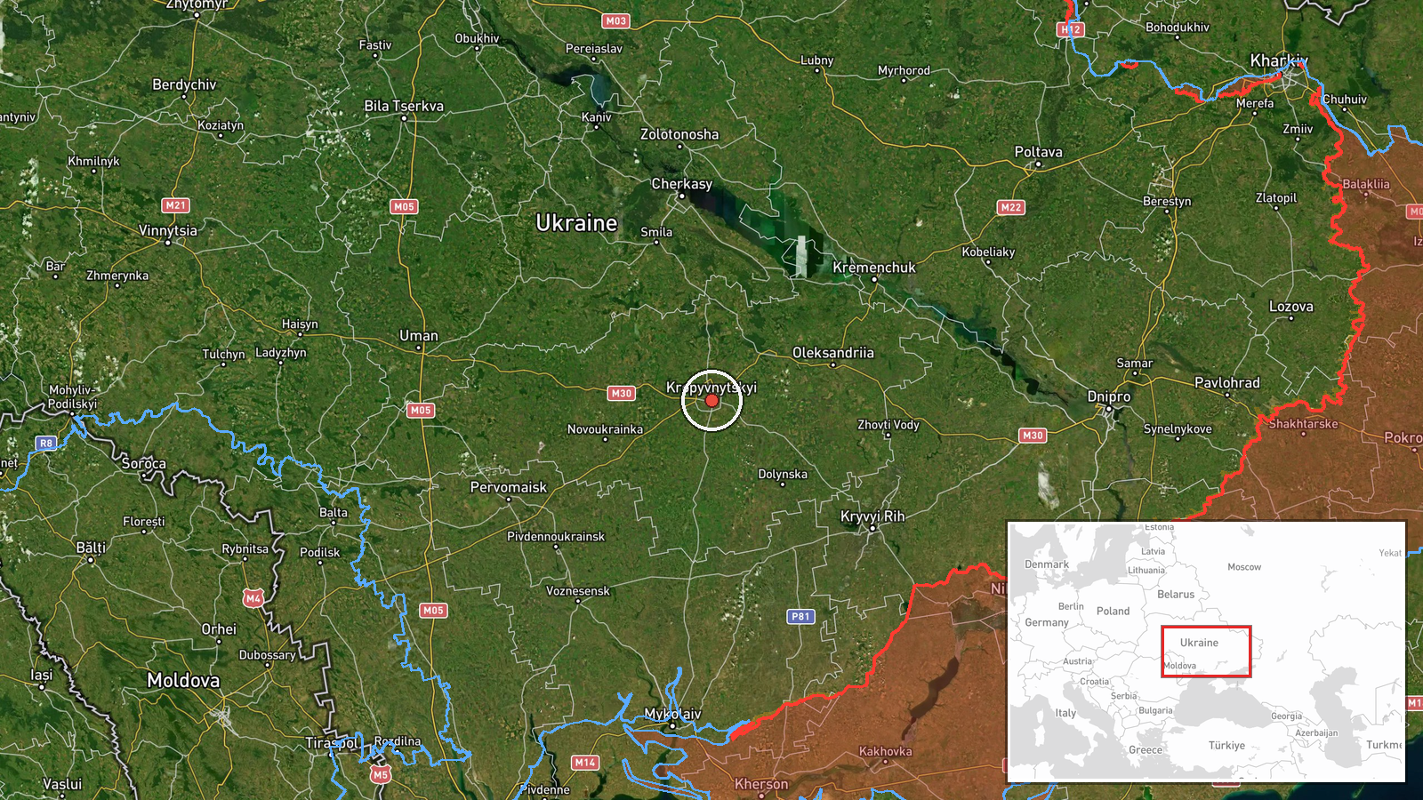
Ukrainian air monitoring reported one Russian jet-powered Shahed-type drone, identified in the source as a Geran-3, passing through Kropyvnytskyi district and heading west on 17 October 2026 at about 12:32 UTC. The alert was posted on Telegram by the channel @kpszsu. Its original Ukrainian-language message describes a jet-powered UAV moving in a western direction, marked with an arrow and no further detail. The report gives no reported impact, damage, casualties or intended target, and it does not say whether the drone was intercepted or lost. Because the post is a brief tracking notice, the event records an observed flight path rather than a confirmed strike. The attribution to Russia rests on the wording of the monitoring report and its Geran-3 designation.
Context and assessment
Kropyvnytskyi is the administrative centre of Kirovohrad Oblast in central Ukraine, a rail and road hub on the Inhul River. A drone crossing it is therefore significant as a transit point on routes across the region. The related reports show a sustained pattern on the same day. At 07:54 and again at 09:59 UTC, single Geran-3 drones were logged moving from Mykolaiv Oblast toward Kirovohrad Oblast. At 12:23 UTC another was tracked over Podilsk district heading northwest, and the earlier evening alert on 16 October concerned a Shahed-type drone bound for Kropyvnytskyi itself. Taken together, these tracks suggest drones entering from the south and crossing the oblast on several headings, a pattern consistent with routing toward multiple possible targets or with reconnaissance. The same morning, a statement described massed attacks on energy infrastructure, but the event data does not link these drones to any specific energy site. Operationally, the reports indicate movement rather than impact, and the purpose of each track cannot be determined from the information available.
Sources and confidence
The event rests on a single Telegram channel, @kpszsu, which posted the monitoring notice. The related Kirovohrad and Podilsk tracks come from similar air monitoring reports, but they do not independently confirm this specific flight. The confidence score of 8.0 reflects a specific, time-stamped and geographically clear report from a channel that regularly carries air alerts, combined with the single-source limitation. Confidence would rise with corroboration from other monitoring accounts, official Ukrainian air force statements, or independent flight-tracking data. It would fall if the channel corrected or withdrew the post, or if later reports placed the drone in a different district.
Location
The coordinates point to the settlement of Kropyvnytskyi, the city centre, because the report names the district rather than an exact flight position. The reported location is therefore approximate to the district. The city lies on the Inhul River in the flat Dnipro lowland of central Ukraine, an open steppe landscape with farmland, rivers and road and rail corridors. These features help explain why drones tracked across the region often follow river valleys and transport routes.
Related events nearby
- Ukrainian air monitoring: 1 Russian Shahed-type drone heading toward Kropyvnytskyi.2026-10-16 19:44 UTC · Drone Transit · Kropyvnytskyi, Ukraine
- Ukrainian air monitoring: 1 Russian jet-powered Shahed (Geran-3) drone from Mykolaiv Oblast toward Kirovohrad 2026-10-17 09:59 UTC · Drone Transit · Kirovohrad Oblast, Ukraine
- Ukrainian air monitoring: 1 Russian jet-powered Shahed (Geran-3) drone from Mykolaiv Oblast toward Kirovohrad 2026-10-17 07:54 UTC · Drone Transit · Kirovohrad Oblast, Ukraine
- Ukrainian air monitoring: 1 Russian jet-powered Shahed (Geran-3) drone passing Podilsk district, heading north2026-10-17 12:23 UTC · Drone Transit · Podilsk district, Ukraine
- Zelensky says Russia is launching massive energy infrastructure attacks while the US ignores the Lindsey Graha2026-10-17 09:09 UTC · Statement · Ukraine (energy infrastructure, multiple sites)
▶ View this event on the live map

Intel Mapper aggregates open-source reports from monitored Telegram and X channels, geolocates them, cross-checks duplicates across sources and assigns a confidence score. Entries are updated as new confirmations arrive. Read how we verify events.