Air monitoring reports Russian glide bomb heading toward northeastern Kharkiv Oblast
What happened
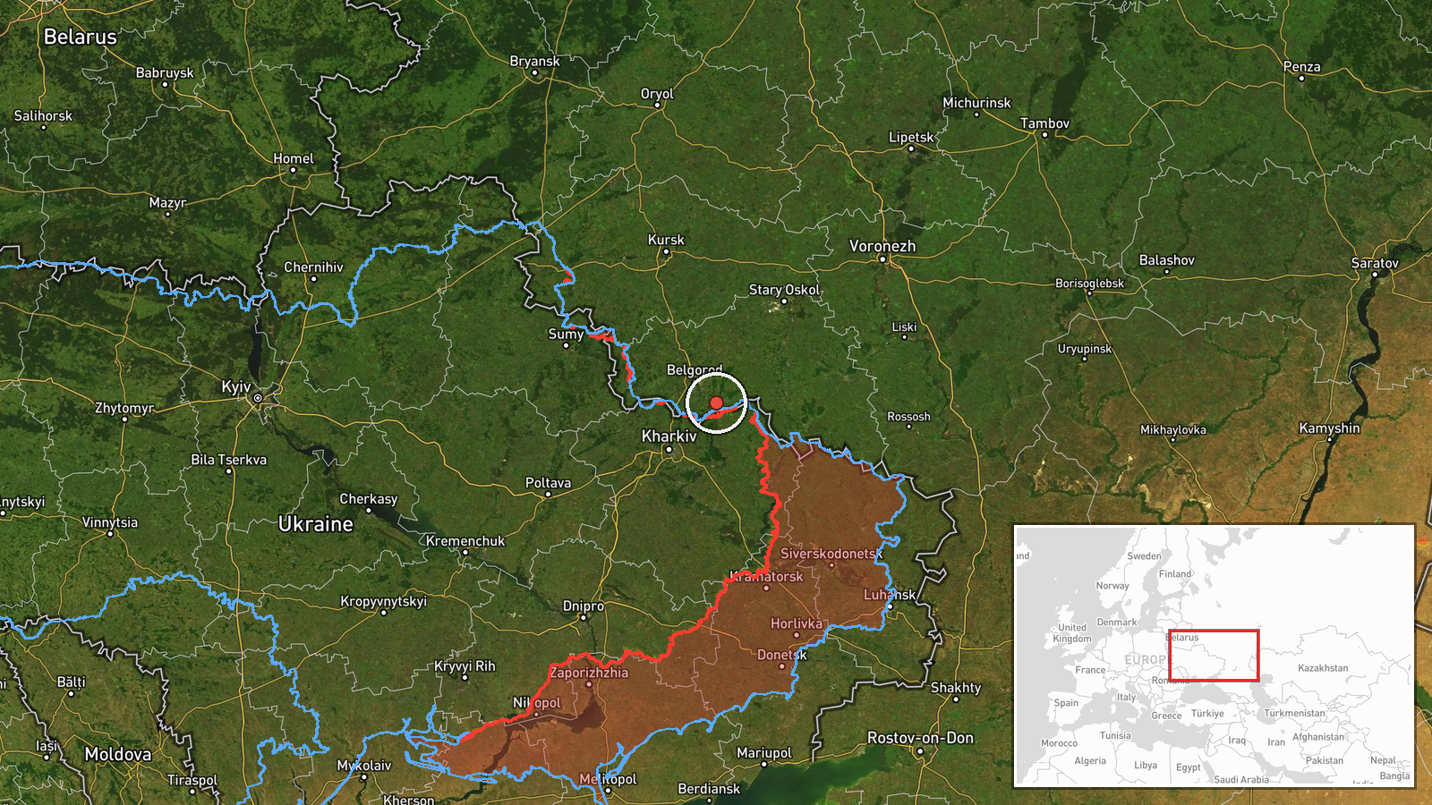
On 17 October 2026 at 12:49 UTC, the Telegram channel @kpszsu reported Ukrainian air monitoring of one Russian guided glide bomb (KAB) moving toward northeastern Kharkiv Oblast in Ukraine. The report names no settlement, target, or impact. Its original Ukrainian wording, 'КАБи на північний схід Харківщини!', uses the plural 'КАБи' (glide bombs), while the structured summary records a single munition. The post gives a direction and a region but no further detail, and no later report of a strike in the area appears in the dataset. The attack type is listed as airstrike and the actor as Russia.
Context and assessment
Northeastern Kharkiv Oblast lies close to the Russian border and to the front-adjacent communities that Russian forces have pressed since 2022, so it sees frequent air activity. Kharkiv city, the oblast's administrative center, is a recurring target for missiles and drones. Related reports show a dense sequence over the same day. Earlier that day, at 00:31 and 01:29 UTC, similar glide bomb warnings were logged for northern and eastern Kharkiv Oblast. On 16 October, the General Staff reported 22 combat clashes on the South Slobozhansky axis by 22:00, near Starytsia, Mala Vovcha, Chuhunivka and Radkivka. Banderol mini cruise missiles were reported heading toward Kharkiv at 19:22 that evening, and jet-powered Shahed (Geran-3) drones were reported passing through the oblast heading northwest at 11:40 on 17 October. Taken together, the pattern may indicate repeated aircraft launches of guided bombs against several sectors near the front, with the warnings reflecting air activity rather than confirmed strikes. Because glide bombs are typically released from aircraft at standoff range, a warning of this kind usually signals an aircraft launch rather than an immediate impact.
Sources and confidence
The event rests on one Telegram channel, @kpszsu, with no independent cross-confirmation in the dataset, which is why the confidence score is 8.0 and the source count is one. The channel's air-monitoring posts are often a first public indication of a launch, but a single post cannot establish the munition count, target, or whether impact occurred. Confidence would rise with corroboration from another monitoring source, regional military administration statements, or reports of an impact at a named location. It would fall if the count were revised, the post were corrected, or no impact or follow-up report emerged. The plural wording in the original text against the singular count in the summary is a discrepancy that deserves attention.
Location
The location is recorded at region level, with approximate coordinates of 50.41044 N, 36.88396 E, and the location confidence is marked low. These coordinates do not correspond to any named settlement in the report, so they should be read as a rough area within northeastern Kharkiv Oblast rather than a target. The area lies in open countryside near the Russian border, with farmland and small communities, and the coordinates appear to sit near the Belgorod border region. No specific landmark or facility is named in the source.
Related events nearby
- Ukrainian air monitoring: 1 Russian guided glide bomb (KAB) heading toward northern Kharkiv Oblast.2026-10-17 00:31 UTC · Airstrike · northern Kharkiv Oblast, Ukraine
- Ukrainian air monitoring: 1 Russian guided glide bomb (KAB) heading toward eastern Kharkiv Oblast.2026-10-17 01:29 UTC · Airstrike · eastern Kharkiv Oblast, Ukraine
- Ukrainian General Staff reports 22 combat clashes on the South Slobozhansky axis by 22:00 on 16 Oct near Stary2026-10-16 19:01 UTC · Combat · Chuhunivka, Kharkiv Oblast, Ukraine
- Ukrainian air monitoring: 2+ Russian Banderol mini cruise missiles heading toward Kharkiv.2026-10-16 19:22 UTC · Cruise Missile · Kharkiv, Ukraine
- Ukrainian air monitoring: 2+ Russian jet-powered Shahed (Geran-3) drones passing Kharkiv Oblast, heading north2026-10-17 11:40 UTC · Drone Transit · Kharkiv Oblast, Ukraine
▶ View this event on the live map

Intel Mapper aggregates open-source reports from monitored Telegram and X channels, geolocates them, cross-checks duplicates across sources and assigns a confidence score. Entries are updated as new confirmations arrive. Read how we verify events.