Jet-powered Geran-3 drone reported near Mahdalynivka in Dnipropetrovsk Oblast, moving west
What happened
Ukraine's air monitoring channel on Telegram, @kpszsu, reported at 13:22 UTC on 17 October 2026 that one jet-powered Shahed-type drone, identified in the summary as a Geran-3, was passing near Mahdalynivka in Dnipropetrovsk Oblast and moving in a westward direction. The original Ukrainian-language post uses the phrase 'повз Магдалинівку', meaning the drone was passing by the settlement rather than striking it. The report describes no impact, casualties, or damage. As a transit notice, it indicates the aircraft's track rather than a confirmed target. Because the information comes from a single channel and offers no detail on altitude, speed, or destination, it should be treated as an initial observation pending confirmation.
Context and assessment
Dnipropetrovsk Oblast lies along the middle Dnipro and has been a recurring corridor for Russian long-range strikes, with the city of Dnipro often named in Ukrainian air alerts. The related reports from the same day show a dense sequence over this area. Shortly before 01:00 UTC, a Shahed-type drone was reported heading toward Dnipro, while two or more jet-powered Geran-3 drones were noted further north over Chernihiv Oblast. At 06:32 a Shahed-type drone was reported heading northwest through the oblast. At 08:11 a guided glide bomb was reported heading toward the oblast, and at 13:13 another glide bomb was reported heading toward Dnipro, about nine minutes before the present drone notice. The sequence suggests repeated sorties crossing the region, with glide bombs and drones appearing in close succession. Operationally, a westward-moving jet-powered drone following glide-bomb activity could reflect a route change, a decoy or saturation element, or a separate flight path. The transit notices alone do not establish which, so follow-up alerts about impacts would be needed before drawing firmer conclusions.
Sources and confidence
The report comes from one Telegram channel, @kpszsu, which relays Ukrainian air monitoring alerts. No second channel, wire service, or official statement in the supplied data corroborates the drone's track, so cross-confirmation is absent. The confidence score of 8.0 reflects that the channel is an established air-alert source with a consistent format, but the item is single-sourced and describes a transit rather than a verified strike. Confidence would rise with independent confirmation from another monitoring outlet or local officials, and would fall if later updates revise the drone type or track.
Location
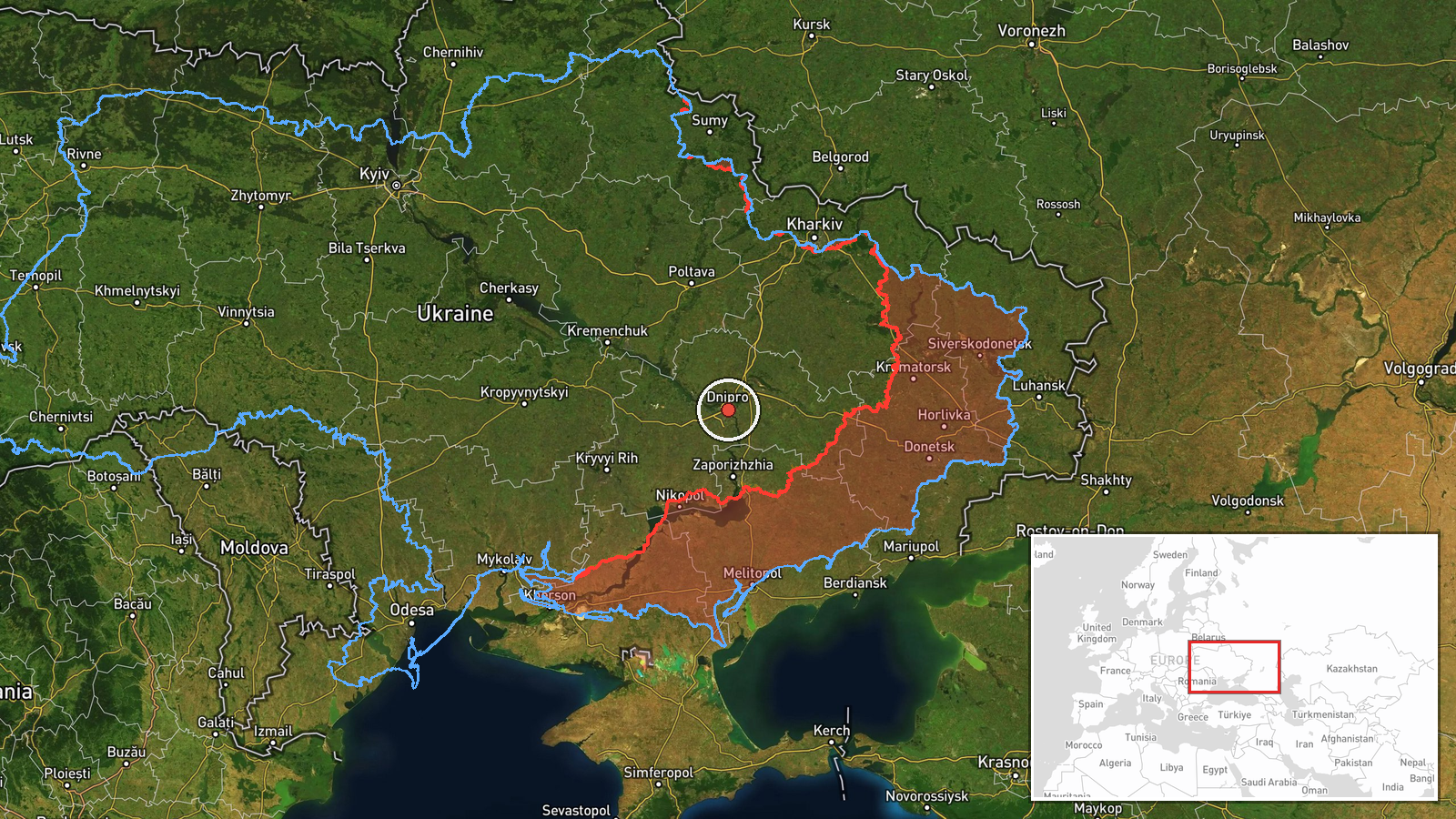
The location is region-level. The source names Mahdalynivka, a settlement in Dnipropetrovsk Oblast, but the supplied coordinates (48.46, 35.05) appear to be a generic point for the oblast's principal city, Dnipro, rather than a surveyed position for the village, so location confidence is low. The oblast is largely steppe with agricultural land and urban clusters, and the Dnipro River, which bisects the region, is a common navigational reference for aircraft tracks.
Related events nearby
- Ukrainian air monitoring: 1 Russian Shahed-type drone passing Dnipropetrovsk Oblast, heading west.2026-10-17 14:28 UTC · Drone Transit · Dnipropetrovsk Oblast, Ukraine
- Ukrainian air monitoring: 1 Russian guided glide bomb (KAB) heading toward Dnipropetrovsk Oblast.2026-10-17 13:31 UTC · Airstrike · Dnipropetrovsk Oblast, Ukraine
- Ukrainian air monitoring: 1 Russian guided glide bomb (KAB) heading toward Dnipro.2026-10-17 13:13 UTC · Airstrike · Dnipro, Ukraine
- Ukrainian air monitoring: 1 Russian guided glide bomb (KAB) heading toward Dnipropetrovsk Oblast.2026-10-17 08:11 UTC · Airstrike · Dnipropetrovsk Oblast, Ukraine
- Ukrainian air monitoring: 1 Russian Shahed-type drone passing Dnipropetrovsk Oblast, heading northwest.2026-10-17 06:32 UTC · Drone Transit · Dnipropetrovsk Oblast, Ukraine
▶ View this event on the live map

Intel Mapper aggregates open-source reports from monitored Telegram and X channels, geolocates them, cross-checks duplicates across sources and assigns a confidence score. Entries are updated as new confirmations arrive. Read how we verify events.