Ukrainian air monitoring reports one Russian guided glide bomb heading toward Dnipropetrovsk Oblast
What happened
Ukrainian air monitoring channel @kpszsu reported on Telegram at approximately 13:31 UTC on 17 October 2026 that one Russian guided glide bomb (KAB) was heading toward Dnipropetrovsk Oblast. The original post, written in Ukrainian, referred to KABs targeting Zaporizhzhia Oblast and Dnipropetrovshchyna, using a bomb emoji as a headline marker. The report describes a bomb in flight and does not state a point of impact, a casualty figure, or any damage. Because the post identifies only the oblast, the event is recorded at a regional level rather than at a specific settlement. The report is an air-alert style notice and should be read as a warning of an inbound weapon, not a confirmed strike.
Context and assessment
Dnipropetrovsk Oblast has been a recurring target area in the broader Russian strike campaign against central and eastern Ukraine, and the city of Dnipro sits among the largest urban and industrial centers in the country. The related events on the same day show a dense sequence. At 08:11 UTC a KAB was reported heading toward the oblast, and at 13:13 UTC another was reported heading toward Dnipro city. Between these, Shahed-type drones were logged transiting the oblast at 03:24, 06:32, and 13:22 UTC, with the most recent described as a jet-powered Geran-3 heading west. Glide bombs are typically launched from aircraft at a standoff distance, which allows them to be released outside air defense range of the target. A cluster of KAB and drone reports within a single day may suggest a sustained effort against the same area, though it is not possible to determine intent or target from this data alone. Repeated alerts do not by themselves confirm impacts, and the pattern should be treated as indicative rather than conclusive.
Sources and confidence
The event rests on a single Telegram channel, @kpszsu, which is the official channel for Ukrainian air monitoring reporting. No second independent channel or wire report is listed in the data. The confidence score of 8.0 reflects that an official channel issued a specific, time-stamped warning, but the score is tempered by the lack of cross-confirmation and the absence of any reported impact. Confidence would rise if independent outlets or local authorities corroborated the alert, or if a subsequent report confirmed the weapon's detonation or interception. It would fall if the alert were updated or withdrawn, or if the weapon were later reported as shot down or diverted without a strike.
Location
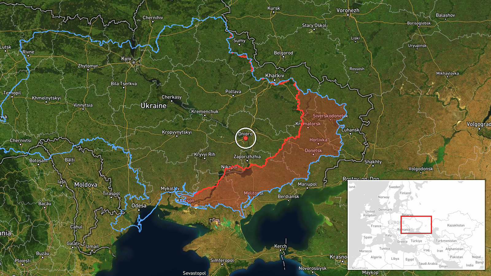
The location is recorded as Dnipropetrovsk Oblast, a regional-level placement with low location confidence. The coordinates given, approximately 48.46 north and 35.05 east, correspond to the oblast center area rather than to any named settlement, because the source did not name a specific target. Dnipropetrovsk Oblast lies in central-eastern Ukraine and is drained by the Dnipro River, which runs through the city of Dnipro. The area contains a mix of farmland, rail corridors, and industrial sites, and the river valley is a notable geographic feature across the region.
Related events nearby
- Ukrainian air monitoring: 1 Russian Shahed-type drone passing Dnipropetrovsk Oblast, heading west.2026-10-17 14:28 UTC · Drone Transit · Dnipropetrovsk Oblast, Ukraine
- Ukrainian air monitoring: 1 Russian jet-powered Shahed (Geran-3) drone passing Dnipropetrovsk Oblast, heading 2026-10-17 13:22 UTC · Drone Transit · Dnipropetrovsk Oblast, Ukraine
- Ukrainian air monitoring: 1 Russian guided glide bomb (KAB) heading toward Dnipro.2026-10-17 13:13 UTC · Airstrike · Dnipro, Ukraine
- Ukrainian air monitoring: 1 Russian guided glide bomb (KAB) heading toward Dnipropetrovsk Oblast.2026-10-17 08:11 UTC · Airstrike · Dnipropetrovsk Oblast, Ukraine
- Ukrainian air monitoring: 1 Russian Shahed-type drone passing Dnipropetrovsk Oblast, heading northwest.2026-10-17 06:32 UTC · Drone Transit · Dnipropetrovsk Oblast, Ukraine
▶ View this event on the live map

Intel Mapper aggregates open-source reports from monitored Telegram and X channels, geolocates them, cross-checks duplicates across sources and assigns a confidence score. Entries are updated as new confirmations arrive. Read how we verify events.