Shahed-type drone reported over Dnipropetrovsk Oblast westward, per Ukrainian air monitoring
What happened
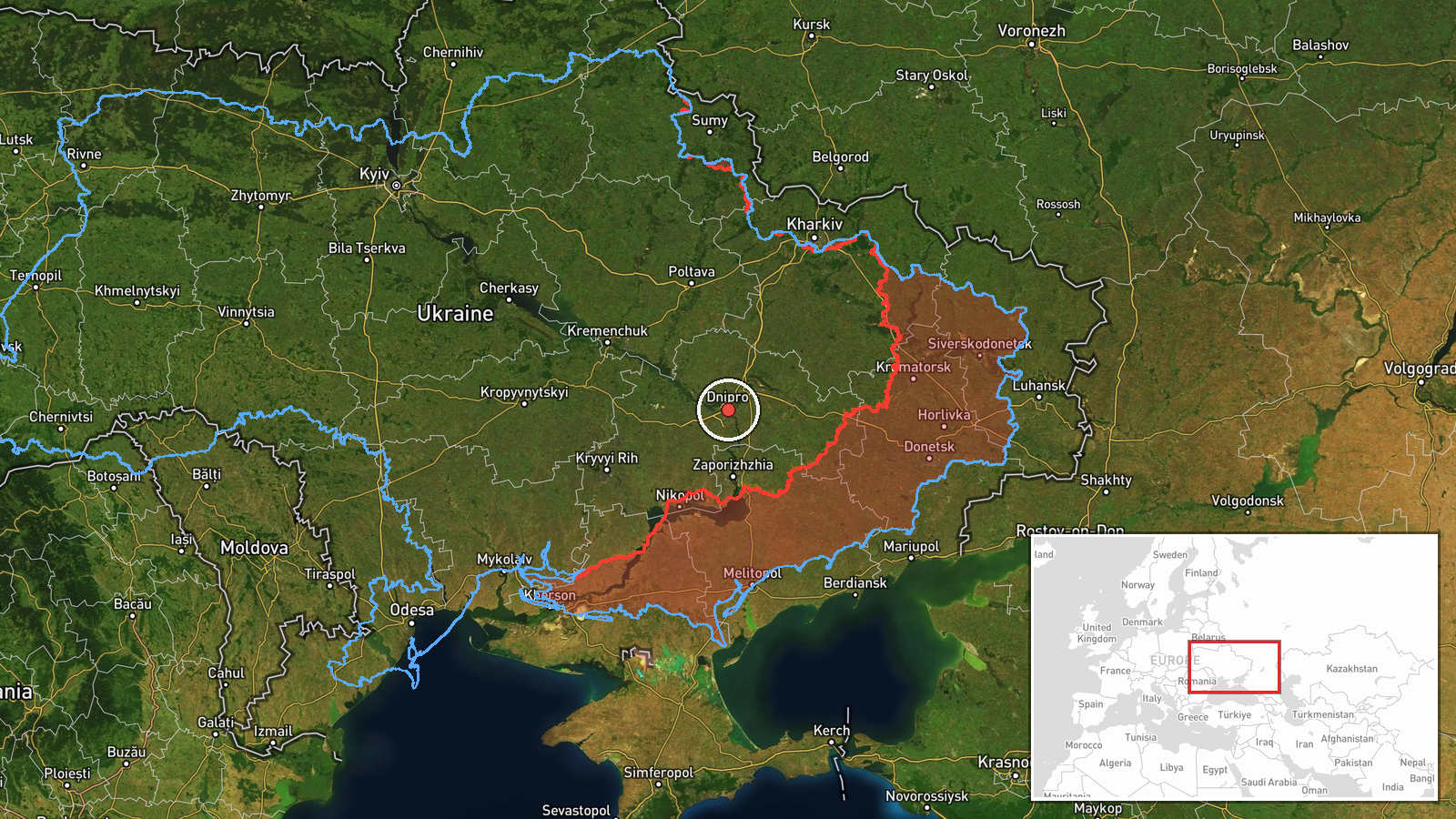
Ukrainian air monitoring reported on 17 October 2026 at 14:28 UTC that one Russian Shahed-type attack drone was passing through Dnipropetrovsk Oblast on a westward heading. The alert, posted on the Telegram channel @kpszsu, places the drone near Slavhorod, a settlement in the oblast. The original Ukrainian wording describes it as a strike UAV, and the post reports only its position and direction. It does not describe impact, damage, casualties, or interception. Because the report comes from a single channel and gives no precise coordinates, the event is recorded as a regional-level transit rather than a confirmed strike on a specific site.
Context and assessment
Dnipropetrovsk Oblast has been under repeated pressure on this day. Earlier alerts include a Shahed-type drone heading northwest at 06:32 UTC, a guided glide bomb (KAB) heading toward the oblast at 08:11, a KAB heading toward Dnipro city at 13:13, and a jet-powered Shahed (Geran-3) passing the oblast westward at 13:22. A further KAB alert toward the oblast followed at 13:31. Dnipro is a major industrial and logistics hub on the Dnipro River, so repeated tracks through its surroundings fit a pattern of sustained activity against the region rather than an isolated flight. The mix of drone transits and glide bombs suggests several strike modes operating in the same airspace within hours. The westward heading may indicate drones routed past defended areas toward targets farther west, though the tracks alone cannot confirm a destination. Transit reports of this kind usually signal movement rather than intent to hit a particular site.
Sources and confidence
The only source is the Telegram channel @kpszsu, which is the official channel of the Ukrainian Air Force and is generally regarded as a primary source for routine air alerts. No second channel, outlet, or official regional statement has corroborated the track in the available data. The confidence score of 8.0 reflects that official origin and the routine nature of the alert, offset by the lack of independent confirmation. Confidence would rise with corroboration from regional military administrations or further reports of interception or impact. It would fall if the alert were updated, withdrawn, or not matched by later reporting.
Location
The map point at 48.46 N, 35.05 E is a regional approximation and is marked as low location confidence, so it should not be read as the position of Slavhorod or of the drone at any moment. Dnipropetrovsk Oblast lies in central-eastern Ukraine and is crossed by the Dnipro River, with largely open steppe terrain and the large city of Dnipro as its principal urban center. The river valley and urban areas are the most likely features shaping drone routing and air defence coverage in the area.
Related events nearby
- Ukrainian air monitoring: 1 Russian Banderol mini cruise missile heading toward Dnipro.2026-10-17 14:38 UTC · Cruise Missile · Dnipro, Ukraine
- Ukrainian air monitoring: 1 Russian guided glide bomb (KAB) heading toward Dnipropetrovsk Oblast.2026-10-17 13:31 UTC · Airstrike · Dnipropetrovsk Oblast, Ukraine
- Ukrainian air monitoring: 1 Russian jet-powered Shahed (Geran-3) drone passing Dnipropetrovsk Oblast, heading 2026-10-17 13:22 UTC · Drone Transit · Dnipropetrovsk Oblast, Ukraine
- Ukrainian air monitoring: 1 Russian guided glide bomb (KAB) heading toward Dnipro.2026-10-17 13:13 UTC · Airstrike · Dnipro, Ukraine
- Ukrainian air monitoring: 1 Russian guided glide bomb (KAB) heading toward Dnipropetrovsk Oblast.2026-10-17 08:11 UTC · Airstrike · Dnipropetrovsk Oblast, Ukraine
▶ View this event on the live map

Intel Mapper aggregates open-source reports from monitored Telegram and X channels, geolocates them, cross-checks duplicates across sources and assigns a confidence score. Entries are updated as new confirmations arrive. Read how we verify events.