Single Shahed-type drone reported heading toward Zaporizhzhia from the south, per Ukrainian air monitoring
What happened
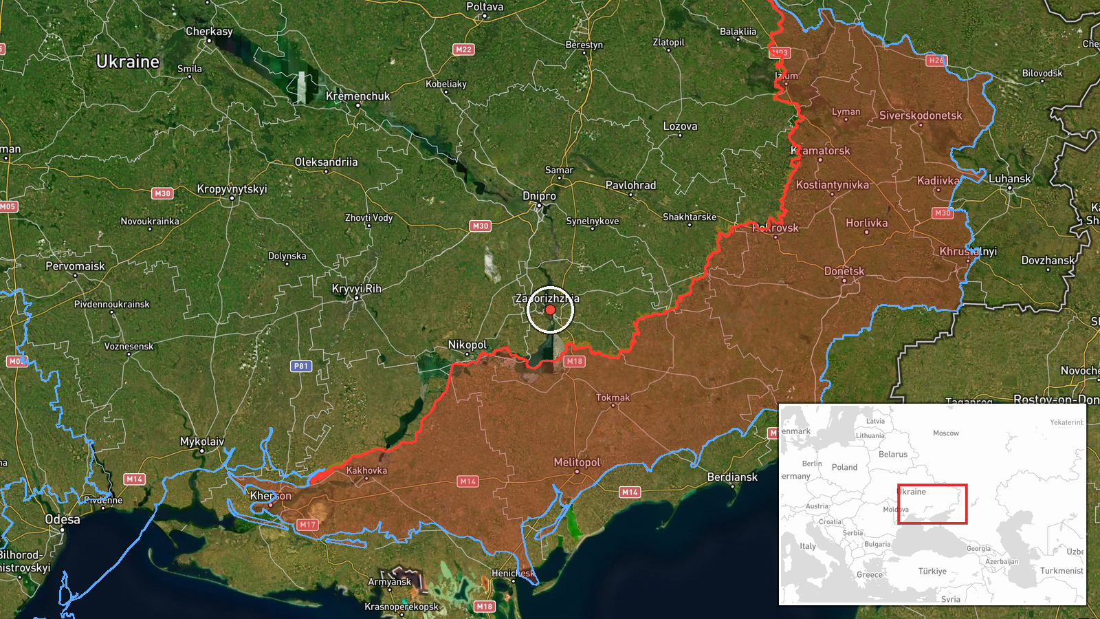
On 18 October 2026 at about 02:02 UTC, the Ukrainian air monitoring channel Telegram (@kpszsu) reported one Russian Shahed-type drone (UAV) moving toward Zaporizhzhia from the south. The original Ukrainian-language post reads roughly as "UAV toward the city from the south," a brief transit alert that does not describe impact, damage, or casualties. The alert is a warning of an aerial threat in progress rather than a confirmed strike. The report is attributed to Russia as the launching side based on the drone type and the monitoring channel's framing. No independent outlet in the event record confirmed the drone's path, interception, or any detonation, so the outcome remains unknown from the available data.
Context and assessment
Zaporizhzhia city, on the Dnipro River in southeastern Ukraine, has been a recurring target of Russian long-range and tactical strikes throughout the war, and it sits close to the front lines in the Zaporizhzhia Oblast. The related events show a dense sequence of Russian air activity in the same area over the preceding day. On 17 October 2026, monitoring reported guided glide bombs (KAB) heading toward Zaporizhzhia at 06:37 UTC and toward Zaporizhzhya Oblast at 08:55 UTC, with a further glide bomb alert toward Vilnyansk at 08:35 UTC and another toward Komyshuvakha at 03:01 UTC. A tactical aircraft alert for the oblast followed at 02:05 UTC on 18 October, a few minutes after this drone report. Taken together, the pattern suggests a sustained, multi-platform effort against the city and surrounding settlements rather than an isolated drone launch. A single slow-moving drone may serve as reconnaissance, a decoy to draw air defence fire, or part of a broader saturation attempt; the data alone cannot distinguish these purposes.
Sources and confidence
The event rests on a single Telegram channel, Telegram (@kpszsu), which is the official Ukrainian air monitoring account for the southern region and is generally timely on aerial threat warnings. The report has not been cross-confirmed by a second independent source, which keeps the confidence score at 8.0 out of 10 rather than higher. Confidence would rise with corroboration from regional military administration statements, local emergency services, or visible wreckage and impact reporting. It would fall if the alert were later retracted, if the drone were identified as a different platform, or if the warning were shown to refer to a different direction or area.
Location
The location is recorded at settlement precision for Zaporizhzhia city, at approximately 47.84 N, 35.14 E, and location confidence is rated high because the alert names the city directly. The coordinates reflect the city centre rather than any specific facility or target, and the precise point of interest for the drone is not stated. Zaporizhzhia lies on the left bank of the Dnipro, near the Kakhovka reservoir and the large Zaporizhzhia Nuclear Power Plant to the southwest, which has been a focus of international concern during the war. The surrounding oblast is largely flat steppe, with agricultural land and industrial zones on the city's edges.
Related events nearby
- Ukrainian air monitoring: 1 Russian guided glide bomb (KAB) heading toward Zaporizhzhia.2026-10-17 06:37 UTC · Airstrike · Zaporizhzhia, Ukraine
- Ukrainian air monitoring: Russian tactical aircraft (tac. aviation) heading toward Zaporizhzhya Oblast.2026-10-18 02:05 UTC · Combat Aircraft · Zaporizhzhya Oblast, Ukraine
- Ukrainian air monitoring: 1 Russian guided glide bomb (KAB) heading toward Zaporizhzhya Oblast.2026-10-17 08:55 UTC · Airstrike · Zaporizhzhya Oblast, Ukraine
- Ukrainian air monitoring: 1 Russian guided glide bomb (KAB) heading toward Vilnyansk.2026-10-17 08:35 UTC · Airstrike · Vilnyansk, Ukraine
- Ukrainian air monitoring: a group of Russian Shahed-type drones in Synelnykove district, Dnipropetrovsk Oblast2026-10-17 06:35 UTC · Drone Transit · Synelnykove, Dnipropetrovsk Oblast, Ukraine
▶ View this event on the live map

Intel Mapper aggregates open-source reports from monitored Telegram and X channels, geolocates them, cross-checks duplicates across sources and assigns a confidence score. Entries are updated as new confirmations arrive. Read how we verify events.