Ukrainian air monitoring reports one jet-powered Shahed (Geran-3) drone heading toward Rivne
What happened
Ukrainian air monitoring, relayed through the Telegram channel @kpszsu, reported at 03:30 UTC on 18 October 2026 that one Russian jet-powered Shahed, identified as a Geran-3, was heading toward Rivne from the east. The original post, written in Ukrainian, describes a jet-type unmanned aerial vehicle on a course for Rivne. The report is a transit warning rather than a confirmed impact. It does not mention an explosion, damage, or casualties. The alert is one of several similar single-drone warnings logged over the previous day across Rivne Oblast, several of which were tracked on westward or southwestward headings. The location is recorded at settlement level for the city of Rivne, and attribution to Russia rests on the Shahed design family and the Ukrainian source's framing.
Context and assessment
Rivne is the administrative centre of a northwestern Ukrainian oblast that sits well west of the front line, so repeated drone tracks through its airspace indicate that long-range Shahed-type aircraft are being routed deep into the country's northwest rather than only along the eastern and southern approaches. The related events show a cluster of at least five transit alerts on 17 and 18 October 2026, several passing Horodnytsia or moving across northern Rivne Oblast before turning west or southwest. The jet-powered Geran-3 variant is generally faster than the older piston-engined Shahed, which shortens the warning window for air defence and makes interception by slower systems harder. Operationally, a run of single-drone transits along a similar corridor could reflect routing toward targets further west, a deliberate probing pattern to map radar and interceptor coverage, or decoy activity that stretches defenders. Each of these readings is tentative, and a single transit alert does not establish the purpose of the flight.
Sources and confidence
The event rests on a single Telegram channel, @kpszsu, which is the official channel associated with Ukraine's air monitoring reporting and therefore carries institutional weight. No independent outlet, official statement, or second channel has been identified confirming the track in the data provided. The confidence score of 8.0 reflects a credible primary source and high location precision offset by the absence of cross-confirmation. Confidence would rise with corroboration from additional Ukrainian military or regional authorities, or from independent flight-tracking or radar-derived reporting. It would fall if the channel corrected or withdrew the alert, or if later reporting indicated the track referred to a different aircraft.
Location
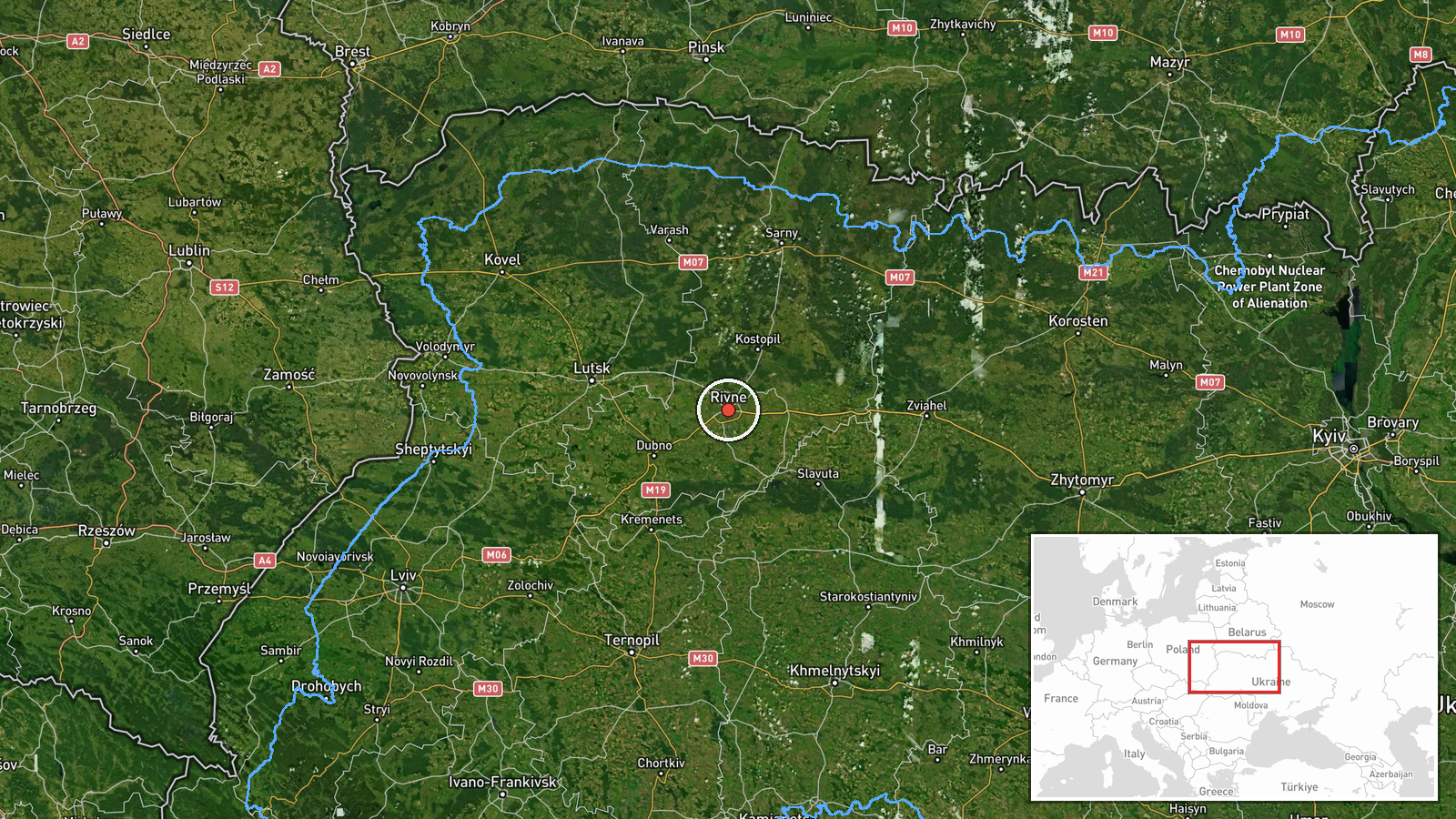
The point is placed at the centre of Rivne city, a settlement-level location recorded with high confidence at approximately 50.62 north and 26.25 east. The city lies in the Polissia region of northwestern Ukraine, on the Ustia River. Surrounding terrain is largely flat, with forest, farmland and wetland belts typical of the lowlands toward the Belarusian border to the north. The city is a regional hub for road and rail links, which matters for understanding why the airspace above it is monitored closely. The coordinates reflect the urban centre, not a specific facility.
Related events nearby
- Ukrainian air monitoring: 1 Russian jet-powered Shahed (Geran-3) drone passing Rivne Oblast, heading southwest2026-10-18 02:04 UTC · Drone Transit · Rivne Oblast, Ukraine
- Ukrainian air monitoring: 1 Russian jet-powered Shahed (Geran-3) drone heading toward Rivne.2026-10-17 08:18 UTC · Drone Transit · Rivne, Ukraine
- Ukrainian air monitoring: 1 Russian jet-powered Shahed (Geran-3) drone passing Horodnytsia, heading toward Riv2026-10-17 08:14 UTC · Drone Transit · Rivne Oblast, Ukraine
- Ukrainian air monitoring: 1 Russian Shahed-type drone passing Rivne Oblast, heading west.2026-10-17 06:29 UTC · Drone Transit · Rivne Oblast, Ukraine
- Ukrainian air monitoring: 1 Russian jet-powered Shahed (Geran-3) drone passing northern Rivne Oblast, heading 2026-10-17 10:12 UTC · Drone Transit · northern Rivne Oblast, Ukraine
▶ View this event on the live map

Intel Mapper aggregates open-source reports from monitored Telegram and X channels, geolocates them, cross-checks duplicates across sources and assigns a confidence score. Entries are updated as new confirmations arrive. Read how we verify events.