Ukrainian air monitoring reports jet-powered Shahed drone crossing northern Rivne Oblast westward
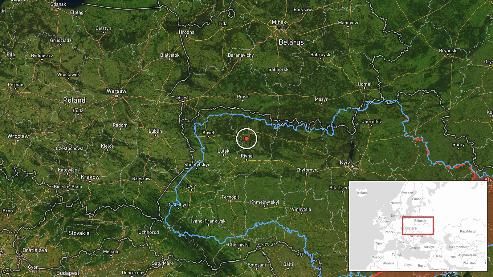
What happened
Ukrainian air monitoring, relayed on the Telegram channel @kpszsu, reports one Russian jet-powered Shahed-type drone, identified as a Geran-3, passing through northern Rivne Oblast on a westward heading. The post is dated 17 October 2026 at 10:12 UTC. The original Ukrainian wording describes a reactive UAV in the northern part of the Rivne region moving on a western course, which refers to flight direction rather than any impact. The source reports no strike, damage, or casualties. The item is logged as a drone transit, not an attack, and the location is recorded only at regional level.
Context and assessment
Northern Rivne Oblast sits in the Polissia belt, a region of forests, wetlands, and rail and road links that runs between Belarus and the Ukrainian heartland. Several towns referenced in the related reports, including Sarny, Kostopil, and Rivne itself, are along or near that corridor. Between roughly 17:00 UTC on 16 October and 08:30 UTC on 17 October, the monitoring feed logged at least five further transit reports: one toward Sarny, one toward Kostopil, one over Dubrovytsya with others heading toward Korosten from Zhytomyr Oblast, one toward Rivne, and one from northern Zhytomyr Oblast toward northern Rivne. Taken together, the sequence suggests a sustained flow of drones moving west and northwest through Zhytomyr and Rivne oblasts over about fifteen hours. Jet-powered variants are faster and harder to intercept than older propeller models, which makes repeated tracks along one corridor noteworthy. The data does not show the final destination of these drones, and some entries may describe the same aircraft reported at different points. Any operational reading should therefore remain provisional.
Sources and confidence
The report rests on a single Telegram channel, @kpszsu, which is widely associated with Ukraine's air force monitoring. The dataset contains no independent confirmation from other outlets, radar summaries, or official alert records. The confidence score of 8.0 reflects the channel's role and the specific airframe detail, but it is still a single-source report with no impact or wreckage evidence. Confidence would rise with corroboration from additional monitoring channels or official air alert logs, or with a clear track confirmation. It would fall if the track were revised, the type were reclassified, or the related entries were found to describe the same drone.
Location
The location is recorded at region level, not as a settlement or facility. The coordinates, roughly 51.17 north and 26.25 east, are an approximate centroid for northern Rivne Oblast, so the point should not be read as a precise position. The area is flat to gently rolling Polissian terrain with extensive forest, marsh, and rivers, and it borders Belarus to the north. Sarny and Kostopil, named in related reports, lie within the northern part of the oblast, and Rivne city lies to the south.
Related events nearby
- Ukrainian air monitoring: 1 Russian Shahed-type drone from northern Zhytomyr Oblast toward northern Rivne Obla2026-10-17 08:32 UTC · Drone Transit · northern Rivne Oblast, Ukraine
- Ukrainian air monitoring: 1 Russian jet-powered Shahed (Geran-3) drone heading toward Sarny.2026-10-16 17:26 UTC · Drone Transit · Sarny, Ukraine
- Ukrainian air monitoring: 1 Russian Shahed-type drone heading toward Kostopil.2026-10-16 21:31 UTC · Drone Transit · Kostopil, Ukraine
- Ukrainian air monitoring: 1 Russian Shahed-type drone heading toward Dubrovytsya; 1 Russian Shahed-type drone 2026-10-17 05:53 UTC · Drone Transit · Dubrovytsya, Ukraine
- Ukrainian air monitoring: 1 Russian jet-powered Shahed (Geran-3) drone heading toward Rivne.2026-10-17 08:18 UTC · Drone Transit · Rivne, Ukraine
▶ View this event on the live map

Intel Mapper aggregates open-source reports from monitored Telegram and X channels, geolocates them, cross-checks duplicates across sources and assigns a confidence score. Entries are updated as new confirmations arrive. Read how we verify events.