Russian Geran-3 jet drone reported heading toward Sarny, Rivne Oblast, on 16 October 2026
What happened
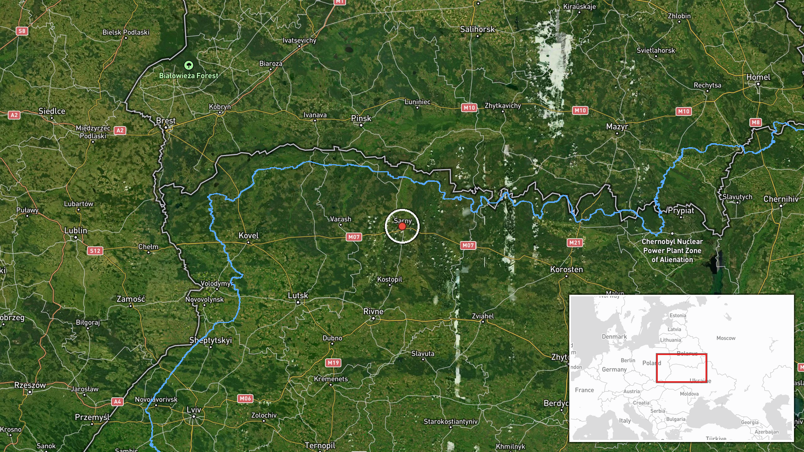
Ukrainian air monitoring reported one Russian jet-powered Shahed drone, described as a Geran-3, heading toward Sarny, a town in northern Rivne Oblast. The alert was logged at 17:26 UTC on 16 October 2026. The original Ukrainian-language post, published on the Telegram channel @kpszsu, describes a jet drone approaching Sarny from the east. That wording indicates direction of travel rather than a confirmed impact. The report does not mention explosions, damage, casualties, or interception. Because it describes an aerial track rather than a strike, the entry is classified as a drone transit, and the coordinates are placed on Sarny itself.
Context and assessment
Sarny sits in the Polesia lowlands near the Belarusian border, which makes it a plausible point on drones tracked through the northern corridor of western Ukraine. Its relevance to a flight path rests mainly on geography rather than on any named facility. The related events from the same day show a sequence of Geran-3 tracks across the region: one from Zhytomyr Oblast toward eastern Berezne shortly after 01:00 UTC, another passing south of Rokytne at 01:42, a track passing north of Berezne heading west at 04:12, a track from western Rivne Oblast toward Tsuman at 04:18, and a track from Zhytomyr Oblast toward Rivne at 16:17. Taken together, these entries may reflect several separate aircraft or repeated passes rather than one long flight. Routes inferred from alert patterns do not confirm an operator's intended target. Operationally, the pattern may suggest that air monitoring is following multiple drones moving through Rivne and neighbouring Zhytomyr Oblast, with Sarny named as one direction of travel among several that day. Any strike outcome would need to be reported separately.
Sources and confidence
The report comes from a single Telegram channel, @kpszsu, associated with Ukrainian air monitoring. The supplied data contains no independent outlet, official statement, or second channel covering this track, so cross-confirmation is absent. The confidence score of 8.0 reflects the channel's use in this feed and the specificity of the report, but it stops short of the top range because only one source is involved and the post contains no independent detail. Confidence would rise if a second monitoring channel or regional military administration corroborated the track, or if later reports confirmed arrival or interception near Sarny. It would fall if updates contradicted the direction of travel or the named settlement.
Location
The location is recorded at settlement precision, with coordinates placed on Sarny, a town in northern Rivne Oblast in northwestern Ukraine. Location confidence is rated high because the report names Sarny directly rather than a facility or street. Sarny lies in the Polesia region, a largely flat, forested and marshy lowland close to the Belarusian border. The town sits on a rail line, and its surroundings include open terrain, wetlands and woodland.
Related events nearby
- Ukrainian air monitoring: 1 Russian jet-powered Shahed (Geran-3) drone passing north of Berezne, heading west.2026-10-16 04:12 UTC · Drone Transit · north of Berezne, Ukraine
- Ukrainian air monitoring: 1 Russian jet-powered Shahed (Geran-3) drone from Zhytomyr Oblast toward eastern Ber2026-10-16 01:05 UTC · Drone Transit · eastern Berezne, Ukraine
- Ukrainian air monitoring: 1 Russian jet-powered Shahed (Geran-3) drone passing south of Rokytne, heading west.2026-10-16 01:42 UTC · Drone Transit · south of Rokytne, Ukraine
- Ukrainian air monitoring: 1 Russian jet-powered Shahed (Geran-3) drone from western Rivne Oblast toward Tsuman2026-10-16 04:18 UTC · Drone Transit · Tsuman, Ukraine
- Ukrainian air monitoring: 1 Russian jet-powered Shahed (Geran-3) drone from Zhytomyr Oblast toward Rivne.2026-10-16 16:17 UTC · Drone Transit · Rivne, Ukraine
▶ View this event on the live map

Intel Mapper aggregates open-source reports from monitored Telegram and X channels, geolocates them, cross-checks duplicates across sources and assigns a confidence score. Entries are updated as new confirmations arrive. Read how we verify events.