Ukrainian air monitoring tracks one jet-powered Shahed drone from Zhytomyr Oblast toward Rivne
What happened
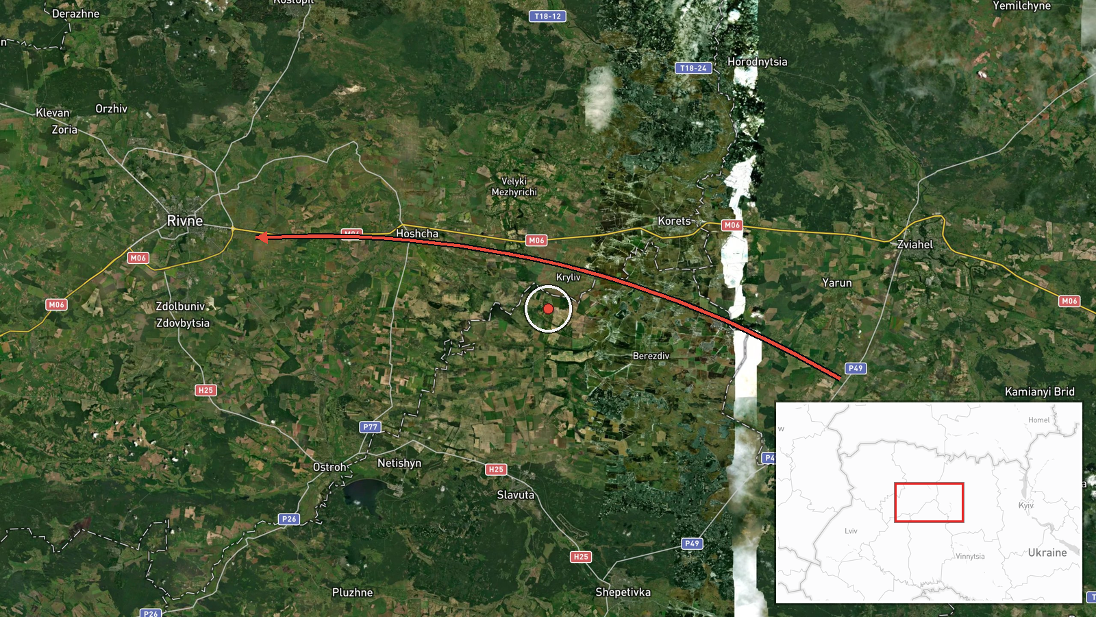
Ukrainian air monitoring reported one Russian jet-powered Shahed-type drone, identified in the channel's wording as a Geran-3, moving from Zhytomyr Oblast in the direction of Rivne. The report was posted on Telegram at 16:17 UTC on 16 October 2026 and is tagged as a drone transit rather than a confirmed strike. The original Ukrainian text is brief, giving only the origin region and destination city, with no description of impact, debris, or casualties. No follow-up report in the record confirms a detonation or damage at the destination. The entry is best read as an airspace warning about an aircraft in transit toward the city.
Context and assessment
Rivne sits in northwestern Ukraine, a region that has repeatedly appeared in air alerts as Russian long-range drones cross from the east and south toward western Ukrainian territory. The same-day record shows five drone transit reports tied to Rivne or Rivne Oblast between 11:45 and 16:17 UTC. Two of the earlier entries describe Geran-3 jet-powered drones, while others use the generic Shahed-type label. Origins vary between Zhytomyr and Khmelnytskyi Oblasts, which suggests that several aircraft may have followed similar corridors toward the same area over a window of roughly four and a half hours. Operationally, this pattern may indicate successive launches along a common route, sequential tracking of individual drones, or a mix of attack and decoy aircraft. The data does not establish which explanation applies, and the repetition of a single destination makes it more likely that the reports reflect continuous monitoring of one approach rather than separate, unrelated incidents.
Sources and confidence
The entry rests on a single Telegram channel, @kpszsu, which is widely associated with the Ukrainian Air Force's air monitoring alerts. The dataset shows no cross-confirmation from other outlets, regional administrations, or independent trackers. The confidence score of 8.0 reflects the official-style origin of the channel, the specific aircraft type, and the consistency with other same-day alerts. It would be raised by corroboration from regional military administration statements, additional monitoring feeds, or a documented impact at the destination. It would be lowered by a correction, a retraction, or a lack of any later alert for the area.
Location
The location is recorded at settlement precision, with coordinates placed at the centre of Rivne city (50.62 N, 26.25 E), and location confidence is rated high because the report names the city directly. Rivne lies in the Polesia lowlands of northwestern Ukraine, a region of flat terrain, forests, and wetlands. The Ustia River, a tributary of the Horyn, runs near the city. The coordinates describe the urban centre rather than any specific facility or the aircraft's track.
Related events nearby
- Ukrainian air monitoring: 1 Russian Shahed-type drone heading toward Rivne Oblast.2026-10-16 15:05 UTC · Drone Transit · Rivne Oblast, Ukraine
- Ukrainian air monitoring: 1 Russian jet-powered Shahed (Geran-3) drone from Khmelnytskyi Oblast toward Rivne O2026-10-16 14:40 UTC · Drone Transit · Rivne Oblast, Ukraine
- Ukrainian air monitoring: 1 Russian Shahed-type drone heading toward Rivne.2026-10-16 14:33 UTC · Drone Transit · Rivne, Ukraine
- Ukrainian air monitoring: 1 Russian Shahed-type drone from Zhytomyr Oblast toward Rivne Oblast.2026-10-16 11:52 UTC · Drone Transit · Rivne Oblast, Ukraine
- Ukrainian air monitoring: 1 Russian jet-powered Shahed (Geran-3) drone heading toward Rivne.2026-10-16 11:45 UTC · Drone Transit · Rivne, Ukraine
▶ View this event on the live map

Intel Mapper aggregates open-source reports from monitored Telegram and X channels, geolocates them, cross-checks duplicates across sources and assigns a confidence score. Entries are updated as new confirmations arrive. Read how we verify events.