Jet-powered Geran-3 drone reported over Rivne Oblast after launch from Khmelnytskyi Oblast
What happened
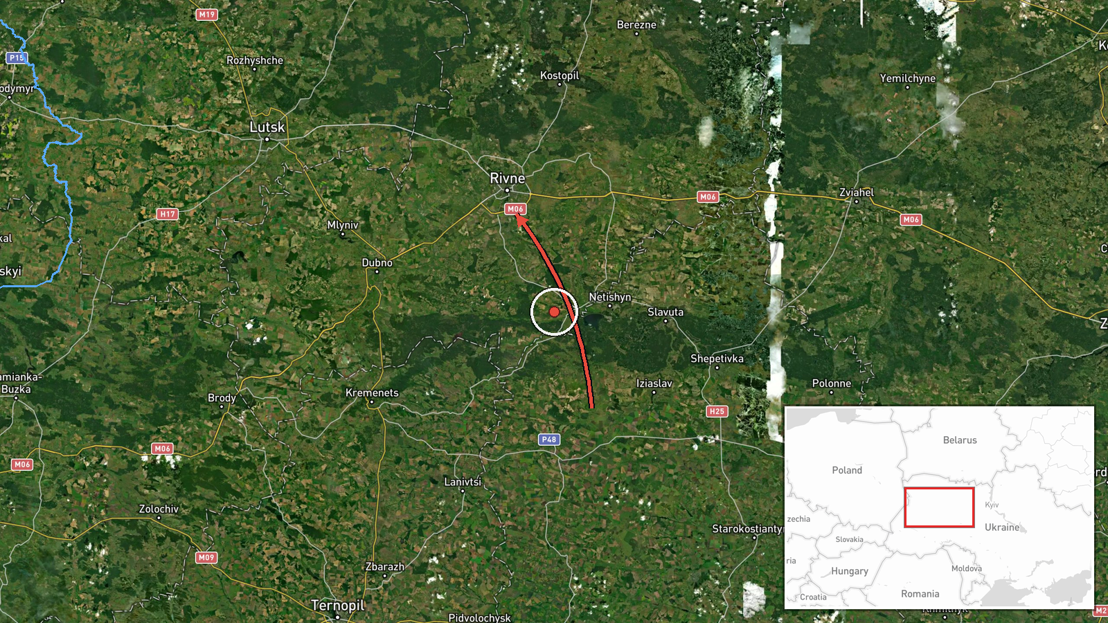
Ukrainian air monitoring reported on Telegram via @kpszsu on 16 October 2026 at 14:40 UTC that one Russian jet-powered Shahed-type drone, described in the original Ukrainian post as a reactive unmanned aerial vehicle, was moving from Khmelnytskyi Oblast through northern Ternopil Oblast toward Rivne Oblast. The notice is brief and does not describe any impact, altitude, speed, or intended target. It is logged as a drone transit, meaning a track through airspace rather than a confirmed strike. Because the report describes a route rather than a fixed point, the map places the event at Rivne Oblast as a whole.
Context and assessment
Rivne Oblast lies in northwestern Ukraine near the Belarusian border, and it sits along one of the corridors that drones have used to cross the country from the south and east toward western regions. Its position makes it a plausible transit zone for long-range strike drones, whose routes often run through several oblasts before reaching a target. The related reports from the same day show a sustained pattern: five earlier monitoring notices between 05:37 and 14:33 UTC mention drones heading toward Rivne or Rivne Oblast, three of them describing jet-powered Geran-3 variants and at least one originating in Zhytomyr Oblast. The repetition suggests either multiple separate launches or repeated tracking of the same flight paths as drones moved westward. Operationally, this may indicate that Russian operators were targeting western Ukraine across a long window rather than a single point, or that air defense and monitoring were following drones through the area. Such reporting does not by itself identify the intended target, and the limited detail in each notice makes firm conclusions premature.
Sources and confidence
The report comes from a single Telegram channel, @kpszsu, which is widely understood to be associated with Ukraine's air force monitoring communications. No second outlet in the provided data independently confirms the track, so the confidence score of 8.0 reflects a credible official-style source without cross-confirmation. Related notices from the same day share the same monitoring format, which supports consistency but not independent verification. The score would rise with corroboration from another monitoring channel, a regional military administration, or local reports of sound or debris, and it would fall if the track were later corrected or retracted. The record is currently uncorrected.
Location
The event is recorded at a region-level point rather than a settlement or facility. The coordinates, 50.62 N and 26.25 E, fall near Rivne city, but the system classifies precision as regional and location confidence as low, so the marker should be read as an approximation of Rivne Oblast. The oblast is largely flat to gently rolling terrain with extensive forest, wetland, and river systems, including Polissia lowlands in the north.
Related events nearby
- Ukrainian air monitoring: 1 Russian jet-powered Shahed (Geran-3) drone from Zhytomyr Oblast toward Rivne.2026-10-16 16:17 UTC · Drone Transit · Rivne, Ukraine
- Ukrainian air monitoring: 1 Russian Shahed-type drone heading toward Rivne Oblast.2026-10-16 15:05 UTC · Drone Transit · Rivne Oblast, Ukraine
- Ukrainian air monitoring: 1 Russian Shahed-type drone heading toward Rivne.2026-10-16 14:33 UTC · Drone Transit · Rivne, Ukraine
- Ukrainian air monitoring: 1 Russian Shahed-type drone from Zhytomyr Oblast toward Rivne Oblast.2026-10-16 11:52 UTC · Drone Transit · Rivne Oblast, Ukraine
- Ukrainian air monitoring: 1 Russian jet-powered Shahed (Geran-3) drone heading toward Rivne.2026-10-16 11:45 UTC · Drone Transit · Rivne, Ukraine
▶ View this event on the live map

Intel Mapper aggregates open-source reports from monitored Telegram and X channels, geolocates them, cross-checks duplicates across sources and assigns a confidence score. Entries are updated as new confirmations arrive. Read how we verify events.