Jet-powered Geran-3 drone reported over Dnipropetrovsk Oblast, heading toward Krynychky
What happened
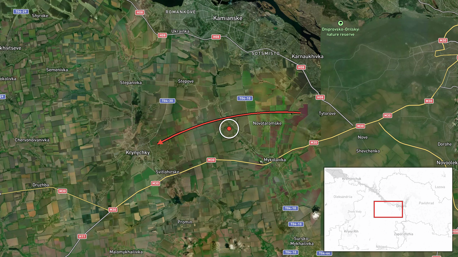
Ukrainian air monitoring reported one Russian jet-powered Shahed-type drone, identified as a Geran-3, moving from Dnipropetrovsk Oblast in the direction of the settlement of Krynychky at about 04:42 UTC on 18 October 2026. The original Ukrainian-language post, carried by the Telegram channel @kpszsu, describes it as a jet-powered UAV in the Dnipropetrovsk region heading toward the village of Krynychky. The post does not report an impact, casualties, or damage. The event is recorded as a drone transit, meaning the aircraft was tracked on a path rather than confirmed to have struck a target. The Geran-3 designation and its jet propulsion come from the event summary rather than from the original post.
Context and assessment
Krynychky sits in Dnipropetrovsk Oblast, a region that has absorbed repeated Russian long-range strikes throughout the war, and the city of Dnipro lies to the east. The preceding day shows a dense sequence in the same area. Between 13:31 and 15:52 UTC on 17 October, monitoring reports logged a guided glide bomb heading toward the oblast, a Shahed-type drone passing west through the oblast, and several Banderol mini cruise missiles moving toward Kamyanske and Dnipro, with one group of four reported over Dnipro itself. That sequence mixes glide bombs, cruise missiles, and drones, which suggests coordinated, multi-axis pressure rather than an isolated launch. A jet-powered Geran-3 is generally understood to be faster and harder to intercept than the piston-engined Shahed variants, so its appearance in the same corridor may indicate an effort to test or stretch air defenses. The reported heading alone does not establish the intended target, and transit tracks often change or end without impact.
Sources and confidence
The report comes from a single Telegram channel, @kpszsu, and no second source is listed in the data. The alert is consistent in form with other Ukrainian air-monitoring posts in the related events, which adds some internal coherence, but it does not independently confirm the aircraft type, route, or endpoint. The confidence score of 8.0 reflects the channel's established role in issuing air alerts and the specific, time-stamped nature of the post, offset by the absence of cross-confirmation and the lack of any impact report. Confidence would rise with corroboration from a second monitoring source, radar-based tracking, or a local report of sightings or debris. It would fall if later updates revised the aircraft type or showed the track ending well outside the settlement.
Location
The coordinates place the event at the settlement level for Krynychky, which the data records with high location confidence. The point is an approximate settlement centroid, not a precise impact site, and it reflects the direction stated in the post rather than a confirmed end point. Krynychky lies in Dnipropetrovsk Oblast, roughly several tens of kilometers west of the city of Dnipro, in a largely agricultural landscape of steppe and river valleys. The Dnipro River and its reservoirs run through the wider region and form notable reference features for air tracks in the area.
Related events nearby
- Ukrainian air monitoring: 2+ Russian Banderol mini cruise missiles heading toward Kamyanske.2026-10-17 15:40 UTC · Cruise Missile · Kamyanske, Ukraine
- Ukrainian air monitoring: 4 Russian Banderol mini cruise missiles over Dnipro.2026-10-17 15:52 UTC · Cruise Missile · Dnipro, Ukraine
- Ukrainian air monitoring: 1 Russian Banderol mini cruise missile heading toward Dnipro.2026-10-17 14:38 UTC · Cruise Missile · Dnipro, Ukraine
- Ukrainian air monitoring: 1 Russian Shahed-type drone passing Dnipropetrovsk Oblast, heading west.2026-10-17 14:28 UTC · Drone Transit · Dnipropetrovsk Oblast, Ukraine
- Ukrainian air monitoring: 1 Russian guided glide bomb (KAB) heading toward Dnipropetrovsk Oblast.2026-10-17 13:31 UTC · Airstrike · Dnipropetrovsk Oblast, Ukraine
▶ View this event on the live map

Intel Mapper aggregates open-source reports from monitored Telegram and X channels, geolocates them, cross-checks duplicates across sources and assigns a confidence score. Entries are updated as new confirmations arrive. Read how we verify events.