Ukrainian air monitoring reports one Shahed-type drone heading toward Zaporizhzhia
What happened
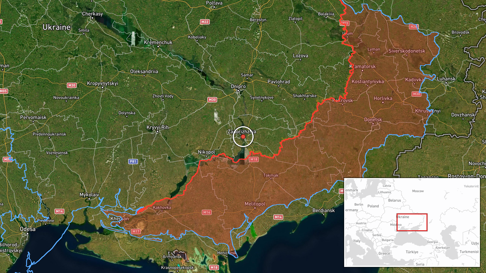
Ukrainian air monitoring reported at 06:17 UTC on 18 October 2026 that one Russian Shahed-type drone was heading toward the city of Zaporizhzhia. The alert was posted on the Telegram channel @kpszsu. Its original Ukrainian wording, a moped icon followed by the phrase 'БпЛА на Запоріжжя з півдня' (UAV toward Zaporizhzhia from the south), indicates the drone was approaching from the south. The post is a transit warning, not a confirmation of impact. It does not describe any detonation, damage, casualties or interception. Only one channel has carried the report so far, and no origin point is specified for the drone.
Context and assessment
Zaporizhzhia is a major industrial and logistics city on the Dnipro River in southeastern Ukraine, and it lies within reach of the front line in the south, which makes it a recurring target area. The related events in the feed show a dense sequence over about 24 hours. On 17 October, a guided glide bomb was reported heading toward Vilnyansk at 08:35 UTC, another toward Zaporizhzhya Oblast at 08:55 UTC, and one toward Zaporizhzhia city at 06:37 UTC. Early on 18 October, a Shahed-type drone transit toward Zaporizhzhia was logged at 02:02 UTC, and Russian tactical aviation was reported heading toward the oblast at 02:05 UTC. Taken together, the pattern suggests sustained pressure on the city and its surroundings that combines long-range drones, manned aircraft and standoff glide munitions. Repeated drone transits toward the same city within hours may reflect successive waves or surveillance flights, though single-channel warnings cannot establish which. Alerts of this kind are issued mainly to prompt air-defence response and public warning, so their value lies in indicating activity rather than measuring damage.
Sources and confidence
The report rests on one channel, Telegram @kpszsu, which is the only outlet listed for this event. The confidence score of 8.0 reflects the channel's role as an established air-monitoring source and the high location confidence, offset by the lack of independent confirmation. Confidence would rise if other monitoring accounts, regional military administration statements or local officials reported the same track, or if a follow-up describes an intercept or impact. It would fall if the warning were retracted, if no corroboration emerged, or if later reports indicated the track was directed elsewhere.
Location
The coordinates place the event at settlement-level precision in the centre of Zaporizhzhia city, and location confidence is high because the report names the city directly. The city lies along the Dnipro River in southeastern Ukraine, with the Dnipro reservoir system downstream to its south. Open steppe surrounds the urban area, and the river and its islands are notable features that shape approach routes and urban layout.
Related events nearby
- Ukrainian air monitoring: 1 Russian guided glide bomb (KAB) heading toward Zaporizhzhia.2026-10-18 07:18 UTC · Airstrike · Zaporizhzhia, Ukraine
- Ukrainian air monitoring: 1 Russian Shahed-type drone heading toward Zaporizhzhia.2026-10-18 02:02 UTC · Drone Transit · Zaporizhzhia, Ukraine
- Ukrainian air monitoring: Russian tactical aircraft (tac. aviation) heading toward Zaporizhzhya Oblast.2026-10-18 02:05 UTC · Combat Aircraft · Zaporizhzhya Oblast, Ukraine
- Ukrainian air monitoring: 1 Russian guided glide bomb (KAB) heading toward Zaporizhzhya Oblast.2026-10-17 08:55 UTC · Airstrike · Zaporizhzhya Oblast, Ukraine
- Ukrainian air monitoring: 1 Russian guided glide bomb (KAB) heading toward Vilnyansk.2026-10-17 08:35 UTC · Airstrike · Vilnyansk, Ukraine
▶ View this event on the live map

Intel Mapper aggregates open-source reports from monitored Telegram and X channels, geolocates them, cross-checks duplicates across sources and assigns a confidence score. Entries are updated as new confirmations arrive. Read how we verify events.