Ukrainian air monitoring reports one drone transit over Izyum, Kharkiv Oblast
What happened
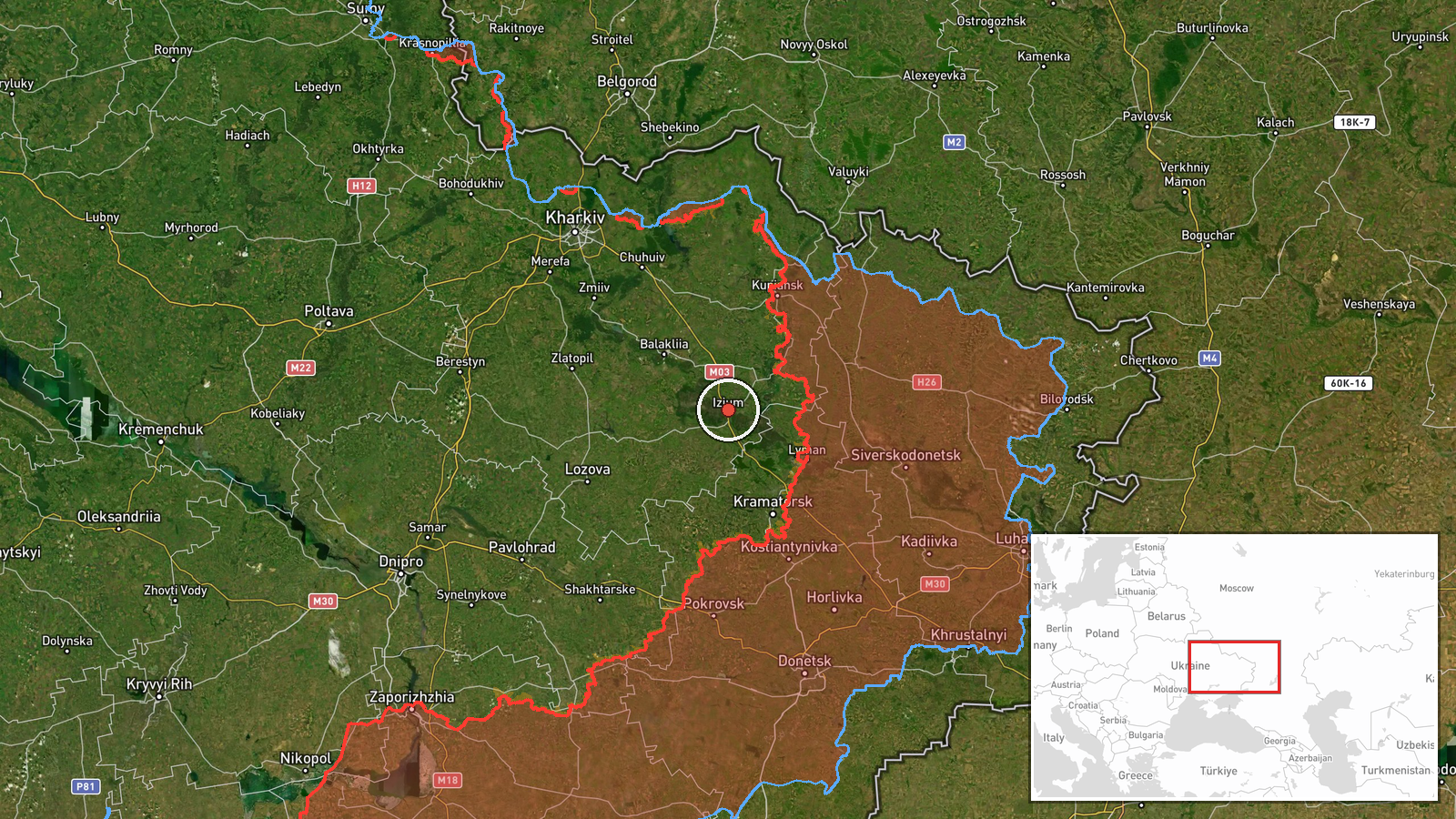
A Ukrainian air monitoring report posted on the Telegram channel @kpszsu described one unmanned aerial vehicle in the area of the settlement of Izyum, Kharkiv Oblast, at 06:59 UTC on 18 October 2026. The original Ukrainian wording, 'БпЛА в районі н.п. Ізюм', is brief and does not name a drone type. The event summary classifies the object as a Russian Shahed-type drone, an attribution that appears to come from the monitoring framing rather than from the post's own text. No impact, damage, casualties or debris recovery are described. The record is tagged as a drone transit, meaning the object was observed passing through the area rather than striking a target. The report is a single post from one channel and had not been independently confirmed at the time of writing.
Context and assessment
Izyum sits on the Donets River in northeastern Kharkiv Oblast, a town that was occupied in 2022 and recovered later that year, and it remains a symbolically and logistically significant point in the northeastern front. Its location means that aerial activity over it can reflect movement toward the Donetsk and Kharkiv border zones, or toward rear areas further inside Ukrainian territory. The related events from the preceding day show a broader pattern of activity across this belt. At 08:44 UTC on 17 October, a Shahed-type drone was reported passing Kupiansk district heading southwest. Shortly after 02:49 UTC on 18 October, a jet-powered Geran-3 was reported moving from Donetsk Oblast toward Blyzniuky. Ground reporting in the same window included ten assault attempts on the Kupiansk axis toward Novoosynove and Radkivka, according to the Ukrainian General Staff. Taken together, these reports may indicate a sustained drone corridor supporting ground pressure, reconnaissance or strikes in depth. That reading remains tentative. The Yampil interceptor video and the Shandryholove Telegram post are unverified and fragmentary, so they should not be treated as confirmed parts of the same operational picture.
Sources and confidence
Only one channel, Telegram @kpszsu, reported this event, and no second outlet, official statement or imagery has been linked to it. The confidence score of 8.0 reflects the channel's role as an established Ukrainian air monitoring source with a clear location and a short, direct post, but it is capped by the single-source status and by the absence of any independent detail. The drone-type label is an editorial attribution not present in the original text. Confidence would rise with corroboration from additional Ukrainian air or regional military channels, radar or track data, photographs of wreckage, or a later impact report. It would fall if the attribution were revised, the location were corrected, or the post were withdrawn.
Location
The location is recorded at settlement level, with coordinates of approximately 49.207 N and 37.277 E, marking the centre of Izyum rather than any specific facility, and the location confidence is rated high. Izyum lies in northeastern Kharkiv Oblast in a landscape of open farmland, river valleys and wooded patches typical of the region. The Donets River runs through the town, and its rail and road links make the settlement an important transit point in the area.
Related events nearby
- Unverified Telegram post claims results against German soldiers near Shandryholove, Lyman direction; the text 2026-10-17 14:24 UTC · Report · Shandryholove, Lyman Direction, Donetsk Oblast, Uk
- Video reportedly shows Ukrainian jet-powered interceptor drones hunting and hitting a Russian attack helicopte2026-10-17 13:08 UTC · Aircraft Shootdown · Near Yampil', Donetsk, Ukraine (front line, estima
- Ukrainian General Staff: as of 22:00, Russia made ten assault attempts on the Kupiansk axis toward Novoosynove2026-10-17 19:04 UTC · Combat · Novoosynove, Kharkiv Oblast, Ukraine
- Ukrainian air monitoring: 1 Russian guided glide bomb (KAB) heading toward Kramatorsk.2026-10-18 07:00 UTC · Airstrike · Kramatorsk, Ukraine
- Ukrainian air monitoring: 1 Russian Shahed-type drone passing Kupiansk district, heading southwest.2026-10-17 08:44 UTC · Drone Transit · Kupiansk district, Ukraine
▶ View this event on the live map

Intel Mapper aggregates open-source reports from monitored Telegram and X channels, geolocates them, cross-checks duplicates across sources and assigns a confidence score. Entries are updated as new confirmations arrive. Read how we verify events.