Ukrainian air monitoring reports one Russian guided glide bomb heading toward Kramatorsk
What happened
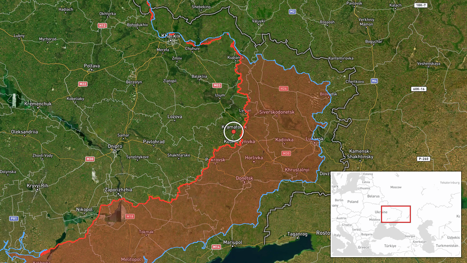
Ukrainian air monitoring, relayed through the Telegram channel @kpszsu, reported on 18 October 2026 at about 07:00 UTC that a Russian guided glide bomb (KAB) was heading toward Kramatorsk in Donetsk Oblast, eastern Ukraine. The channel's own wording is plural, 'КАБи на Донеччину (Краматорськ)', which reads as glide bombs toward Donetchyna with Kramatorsk named, while the summary specifies a single munition. No impact, casualties, or damage are described in the report. The alert is a warning of an inbound weapon, not confirmation that it struck. Russia is named as the actor on the basis of the attribution in the channel's monitoring output.
Context and assessment
Kramatorsk is one of the largest remaining Ukrainian-held urban centers in Donetsk Oblast and a major administrative and logistics hub for the region, which is why it has repeatedly been within reach of Russian long-range fire. Glide bombs are unpowered or lightly powered munitions released from aircraft at standoff distance, so their appearance in air-monitoring alerts often indicates Russian aviation operating near the front and striking towns within tactical range of the line. This event sits in a cluster of activity that day. A separate KAB alert toward Donetsk Oblast was logged at 06:28 UTC, about half an hour earlier, which may represent the same wider salvo or a separate launch. A Shahed-type drone was reported over Izyum at 06:59 UTC, indicating that aerial threats were being tracked across several axes in the same window. To the south, the General Staff reported on 17 October that Ukrainian forces repelled 15 Russian assaults near Kostiantynivka, suggesting continued pressure on the Donetsk front. Other items from the previous day, including an unverified claim of a helicopter shootdown and a fragmentary Telegram post about Shandryholove, cannot be tied to this event. Operationally, the pattern points to sustained Russian use of aircraft-delivered glide bombs against population centers near the front, though one alert alone does not establish intent or frequency.
Sources and confidence
Only one source reported this event: the Telegram channel @kpszsu, which posts Ukrainian air-monitoring alerts. No independent outlet, official statement, or second channel was found in the data to corroborate the alert. The confidence score of 8.0 reflects that the alert is specific in time, munition type, and target city, and comes from a channel that regularly publishes such warnings. It is held below the top of the scale because it is single-sourced, does not confirm impact, and includes a plural/singular discrepancy in wording. Confidence would rise with corroboration from additional monitoring channels, regional military administration statements, or reports of impact in Kramatorsk. It would fall if later updates showed no munition detected or a different target.
Location
The location is recorded at settlement level for Kramatorsk, Ukraine, at approximately 48.731 N, 37.568 E, with high location confidence. The coordinates appear to mark the city rather than a specific facility or street, which is consistent with how air-monitoring alerts are usually geolocated. Kramatorsk lies in the Donbas region of Donetsk Oblast, in gently rolling steppe terrain traversed by small rivers, including the Kazennyi Torets. The surrounding area is largely open country with industrial and residential districts, and the city sits within range of the front to its south and east.
Related events nearby
- Ukrainian General Staff: Ukrainian forces repelled 15 Russian assaults near Kostiantynivka and toward Novoseli2026-10-17 19:03 UTC · Combat · Kostiantynivka, Donetsk, Ukraine
- Ukrainian air monitoring: 1 Russian guided glide bomb (KAB) heading toward Donetsk Oblast.2026-10-18 06:28 UTC · Airstrike · Donetsk Oblast, Ukraine
- Ukrainian air monitoring: 1 Russian Banderol mini cruise missile passing Sharivka, heading toward Pivdennyi.2026-10-18 08:14 UTC · Cruise Missile · Pivdennyi, Ukraine
- Video reportedly shows Ukrainian jet-powered interceptor drones hunting and hitting a Russian attack helicopte2026-10-17 13:08 UTC · Aircraft Shootdown · Near Yampil', Donetsk, Ukraine (front line, estima
- Unverified Telegram post claims results against German soldiers near Shandryholove, Lyman direction; the text 2026-10-17 14:24 UTC · Report · Shandryholove, Lyman Direction, Donetsk Oblast, Uk
▶ View this event on the live map

Intel Mapper aggregates open-source reports from monitored Telegram and X channels, geolocates them, cross-checks duplicates across sources and assigns a confidence score. Entries are updated as new confirmations arrive. Read how we verify events.