Ukrainian Air Force reports one Russian guided glide bomb heading toward Donetsk Oblast
What happened
Ukraine's Air Force Telegram channel, @kpszsu, reported at 06:28 UTC on 18 October 2026 that one Russian guided glide bomb, known as a KAB, was heading toward Donetsk Oblast. The original Ukrainian post was broader, referring to KABs aimed at Donetsk Oblast and the northeast of Kharkiv Oblast, while the structured record narrows the alert to a single munition over Donetsk. The report names no specific settlement, target, or impact, and it describes no casualties or damage. It is a movement warning from air monitoring rather than a confirmed strike, so the outcome remains unknown from this source alone.
Context and assessment
Donetsk Oblast is one of the most active front-line areas in the Russia-Ukraine war, and glide bombs are a common weapon there because launch aircraft can release them at a distance from Ukrainian air defences. They are typically used against troop concentrations, fortified positions, and logistics near the front. The related events suggest the same sector was under heavy ground pressure at the time. The General Staff reported on the evening of 17 October that Ukrainian forces repelled 15 Russian assaults near Kostiantynivka and surrounding villages, and air-delivered munitions often accompany such attacks. A reportedly unverified video of an aircraft shootdown near Yampil' points to contested airspace nearby, while a fragmentary Telegram claim from the Lyman direction adds little certainty. A Shahed-type drone transit toward Blyzniuky that same night reflects a separate deep-strike flow. Taken together, the cluster may indicate sustained Russian air support for ground operations in the Donetsk axis, but a single glide bomb alert is an incomplete signal and should not be read as a confirmed trend.
Sources and confidence
The alert comes from a single channel, @kpszsu, which is linked to Ukraine's Air Force, and no independent outlet had cross-confirmed it when the record was made. The confidence score of 8.0 reflects the official-channel origin and a precise timestamp. It is held back by the single source, the undefined target, and the movement-style wording that announces a munition in flight rather than an impact. Confidence would rise with corroboration from Donetsk regional authorities, reports of impact, geolocated imagery, or a Russian acknowledgement. It would fall if the report were retracted or if later reporting contradicted the trajectory.
Location
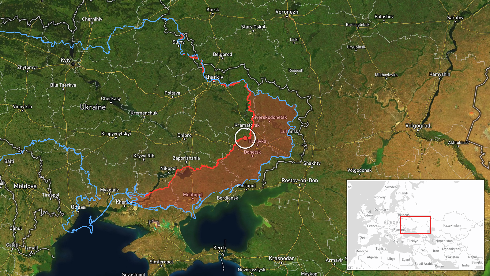
The point is placed at a regional centroid, latitude 48.5 and longitude 37.5, because the report names only Donetsk Oblast, so location confidence is low. The oblast is in eastern Ukraine, borders Russia, and is largely steppe and industrial terrain shaped by mining. Donetsk city and Kostiantynivka are among the nearby urban centres. The actual point of any relevant event could lie many kilometres from the marker.
Related events nearby
- Ukrainian General Staff: Ukrainian forces repelled 15 Russian assaults near Kostiantynivka and toward Novoseli2026-10-17 19:03 UTC · Combat · Kostiantynivka, Donetsk, Ukraine
- Ukrainian air monitoring: 1 Russian guided glide bomb (KAB) heading toward Kramatorsk.2026-10-18 07:00 UTC · Airstrike · Kramatorsk, Ukraine
- Video reportedly shows Ukrainian jet-powered interceptor drones hunting and hitting a Russian attack helicopte2026-10-17 13:08 UTC · Aircraft Shootdown · Near Yampil', Donetsk, Ukraine (front line, estima
- Unverified Telegram post claims results against German soldiers near Shandryholove, Lyman direction; the text 2026-10-17 14:24 UTC · Report · Shandryholove, Lyman Direction, Donetsk Oblast, Uk
- Ukrainian air monitoring: 1 Russian jet-powered Shahed (Geran-3) drone from Donetsk Oblast toward Blyzniuky.2026-10-18 02:49 UTC · Drone Transit · Blyzniuky, Ukraine
▶ View this event on the live map

Intel Mapper aggregates open-source reports from monitored Telegram and X channels, geolocates them, cross-checks duplicates across sources and assigns a confidence score. Entries are updated as new confirmations arrive. Read how we verify events.