Jet-powered Geran-3 drone reported moving from Zhytomyr toward eastern Rivne Oblast, Ukraine
What happened
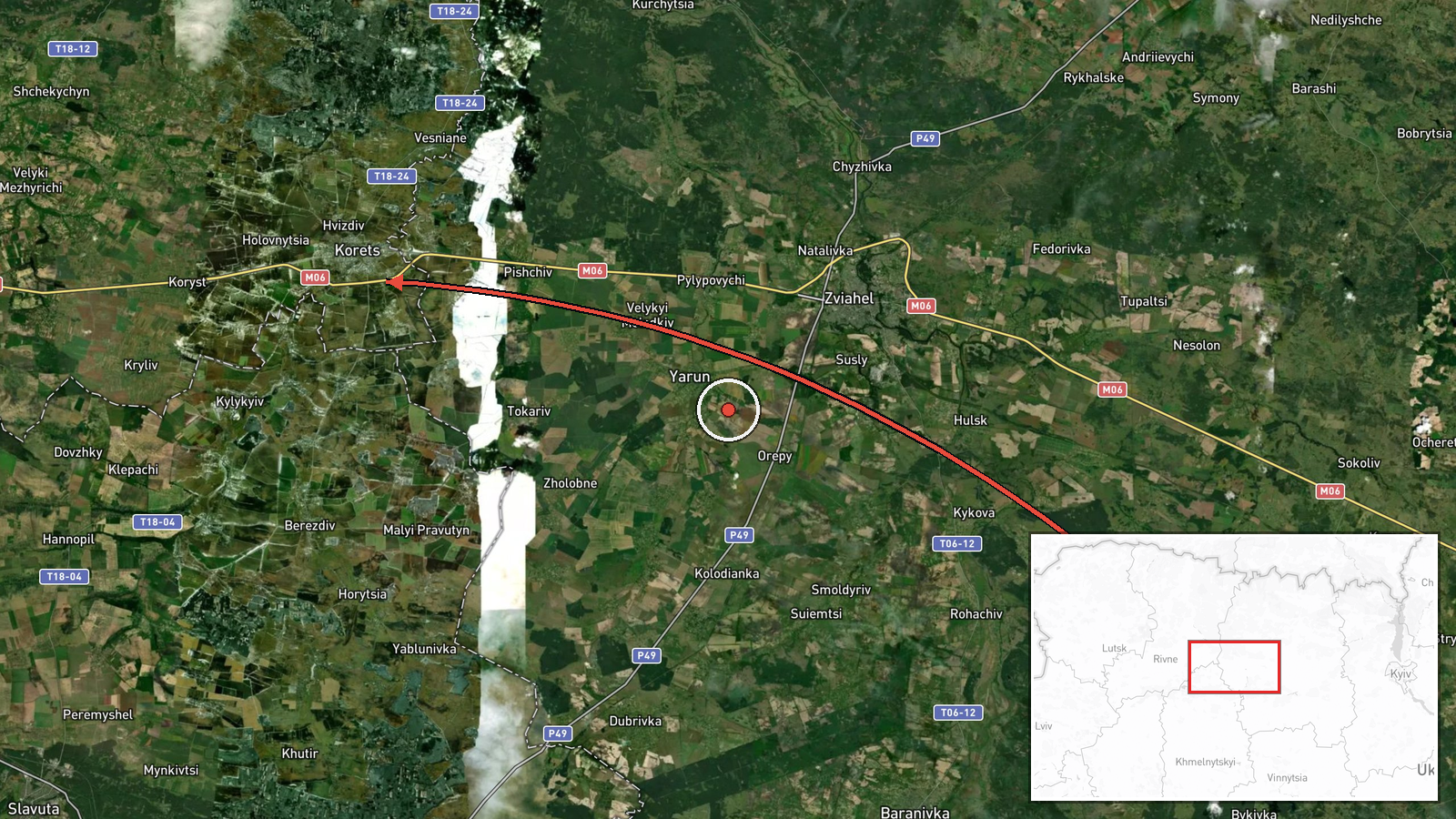
Ukrainian air monitoring reported one Russian jet-powered Shahed, designated Geran-3, moving from Zhytomyr Oblast toward eastern Rivne Oblast in northwestern Ukraine. The report was posted at 02:57 UTC on 19 October 2026 on the Telegram channel @kpszsu, an account associated with Ukraine's air force monitoring messages. The original Ukrainian wording, "Реактивний БпЛА на схід Рівненщини з Житомирщини," describes a jet-type unmanned aerial vehicle heading east across Rivne region from Zhytomyr region. The message names no impact point, target, or damage, and it is categorised as a drone transit rather than a strike. Nothing in the single post confirms where the drone was at the time of posting or where it ended its flight.
Context and assessment
The drone sits within a cluster of Geran-3 transit reports across northwestern Ukraine over roughly 24 hours. Earlier reports on 18 October place single drones heading toward and over Iziaslav in Khmelnytskyi Oblast, and over Rivne city at 08:40 UTC. Early on 19 October, further reports describe a drone heading toward Rivne at 02:44 UTC and another passing south of Berezne, heading west, at 02:41 UTC. The repeated appearance of single jet-powered drones over the same corridor suggests routing through this area rather than isolated launches. Rivne and Iziaslav are road and rail nodes, and the region hosts energy and logistics infrastructure, so transits here may reflect targeting of western-Ukrainian sites or simply the geography of flight paths from the east and south. Because the reports describe movement in different directions, including the westward track near Berezne, the pattern may indicate drones being steered around air defence zones or redirected mid-flight rather than a single planned objective. The available data does not establish intent, and no related event in the set records a completed strike. The most cautious reading is that the sequence shows sustained drone traffic through northwestern Ukraine, with the purpose of individual flights unknown.
Sources and confidence
The event rests on one Telegram post from @kpszsu, with no second channel, official statement, or local media report in the data. Because the account is an established Ukrainian air monitoring source, its reports of drone type and heading are generally treated as reliable for transit tracking, but the single-source status limits certainty about the route and the drone's location. The confidence score of 8.0 reflects the credible channel and specific airframe identification, offset by the lack of cross-confirmation and the absence of timestamps for position. Confidence would rise with corroboration from additional monitoring channels, regional military administrations, or a later report of impact or interception. It would fall if follow-up reports contradicted the stated direction or if the drone was later identified as a different platform.
Location
The location is recorded at region level for eastern Rivne Oblast, not at a named settlement, and the location confidence is low. The coordinates are a broad approximation of the eastern part of the oblast rather than a confirmed point of flight. Rivne Oblast sits in northwestern Ukraine, bordering Belarus to the north and the Volyn and Zhytomyr oblasts nearby, with a landscape of forest and Polissia wetlands in the north. Rivne city and Berezne are nearby reference points mentioned in related reports.
Related events nearby
- Ukrainian air monitoring: 1 Russian jet-powered Shahed (Geran-3) drone passing south of Berezne, heading west.2026-10-19 02:41 UTC · Drone Transit · south of Berezne, Ukraine
- Ukrainian air monitoring: 1 Russian jet-powered Shahed (Geran-3) drone over Iziaslav.2026-10-18 06:47 UTC · Drone Transit · Iziaslav, Ukraine
- Ukrainian air monitoring: 1 Russian jet-powered Shahed (Geran-3) drone heading toward Iziaslav.2026-10-18 05:43 UTC · Drone Transit · Iziaslav, Ukraine
- Ukrainian air monitoring: 1 Russian jet-powered Shahed (Geran-3) drone heading toward Rivne.2026-10-19 03:06 UTC · Drone Transit · Rivne, Ukraine
- Ukrainian air monitoring: 1 Russian jet-powered Shahed (Geran-3) drone heading toward Rivne.2026-10-19 02:44 UTC · Drone Transit · Rivne, Ukraine
▶ View this event on the live map

Intel Mapper aggregates open-source reports from monitored Telegram and X channels, geolocates them, cross-checks duplicates across sources and assigns a confidence score. Entries are updated as new confirmations arrive. Read how we verify events.