Jet-powered Shahed (Geran-3) drone reported transiting eastern Rivne Oblast, heading west
What happened
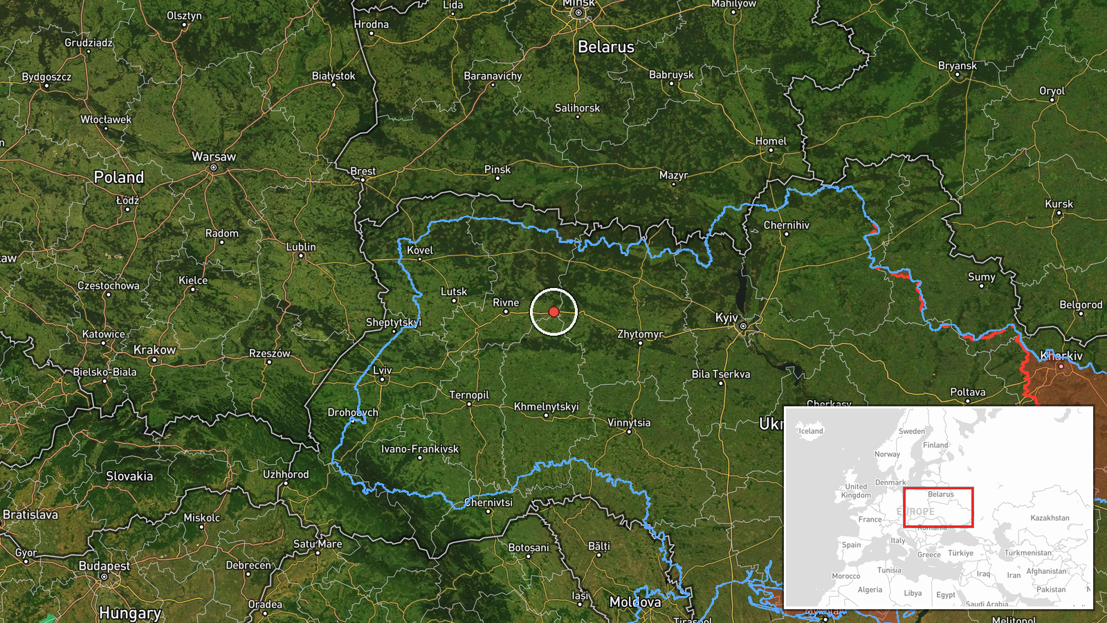
Ukrainian air monitoring, relayed on Telegram by the channel @kpszsu, reported one Russian jet-powered Shahed, designated Geran-3, passing through eastern Rivne Oblast on a westward heading. The report is timestamped 19 October 2026 at 03:33 UTC. The original Ukrainian wording describes a jet-type unmanned aerial vehicle in the east of the Rivne region moving west. It names no settlement, altitude, or impact. The event is logged as a drone transit rather than a strike, and the source describes no casualties, damage, or interception. The Geran-3 designation and the attribution to Russia appear in the event summary rather than in the original post, so they rest on the desk's classification. Because the report gives only a regional position, the track and timing should be read as approximate.
Context and assessment
Rivne Oblast lies in northwestern Ukraine, close to the Belarusian border, and its eastern parts sit in the forested and marshy Polissia lowlands. Monitoring of drones moving across this belt matters because routes through the northwest can carry long-range strike systems toward western Ukraine. The related records show a sequence of Geran-3 reports over roughly 26 hours. Two reports on 18 October place a drone heading toward or over Iziaslav, a town in neighbouring Khmelnytskyi Oblast. A drone was reported south of Berezne at 02:41 on 19 October, and another was reported moving from Zhytomyr Oblast toward eastern Rivne at 02:57, followed by one heading toward Rivne city at 03:06. The spacing and westward direction could indicate a single airframe reported at successive points, or several drones on similar tracks. The pattern suggests that these are transit corridors rather than isolated incidents. Operationally, the jet-powered variant is generally faster and harder to intercept than older piston-engined Shaheds, which may explain why air monitoring reports are concentrated along these routes. The available data does not show the intended target, so any conclusion about destination would be speculative.
Sources and confidence
The report comes from one channel, @kpszsu, a Telegram account associated with Ukrainian air monitoring. No other outlet in the event record independently reports this specific transit, so cross-confirmation is absent. The related events come from the same channel family and corroborate a pattern rather than this exact track. The confidence score of 8.0 reflects a credible official-style source with a precise timestamp, offset by the single-channel basis and the regional-only location. Confidence would rise with independent reporting, air defence statements naming the area, or verified debris or impact sites. It would fall if later reporting contradicted the heading or identified the object as another type.
Location
The location is recorded at region level, eastern Rivne Oblast, rather than at a settlement or facility. The coordinates, 50.62 N and 27.109 E, are an approximate central point for the eastern part of the oblast, and the location confidence is rated low. The area is part of the Polissia lowlands, with extensive forest, wetland, and river systems, including the Horyn basin. Nearby named places in the related records include Berezne and Rivne city, which give context for the route but do not mark the drone's exact position.
Related events nearby
- Ukrainian air monitoring: 1 Russian jet-powered Shahed (Geran-3) drone from Zhytomyr Oblast toward eastern Riv2026-10-19 02:57 UTC · Drone Transit · eastern Rivne Oblast, Ukraine
- Ukrainian air monitoring: 1 Russian jet-powered Shahed (Geran-3) drone passing south of Berezne, heading west.2026-10-19 02:41 UTC · Drone Transit · south of Berezne, Ukraine
- Ukrainian air monitoring: 1 Russian jet-powered Shahed (Geran-3) drone over Iziaslav.2026-10-18 06:47 UTC · Drone Transit · Iziaslav, Ukraine
- Ukrainian air monitoring: 1 Russian jet-powered Shahed (Geran-3) drone heading toward Iziaslav.2026-10-18 05:43 UTC · Drone Transit · Iziaslav, Ukraine
- Ukrainian air monitoring: 1 Russian jet-powered Shahed (Geran-3) drone heading toward Rivne.2026-10-19 03:06 UTC · Drone Transit · Rivne, Ukraine
▶ View this event on the live map

Intel Mapper aggregates open-source reports from monitored Telegram and X channels, geolocates them, cross-checks duplicates across sources and assigns a confidence score. Entries are updated as new confirmations arrive. Read how we verify events.