Jet-powered Shahed drone reported heading west over northern Mykolaiv Oblast
What happened
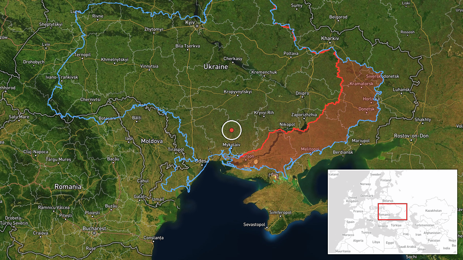
Ukrainian air monitoring reported one jet-powered Shahed drone, identified in the report as a Geran-3, moving toward northern Mykolaiv Oblast in southern Ukraine. The original Ukrainian-language post described a jet-type unmanned aerial vehicle to the north of Mykolaiv region on a westward course. The alert is dated 19 October 2026 at 03:00 UTC. The only source is a single Telegram channel, @kpszsu, which posts Ukrainian air alerts and monitoring updates. The report does not name a target, a point of impact, or any damage, and it gives no precise position for the drone when it was observed. Attribution to Russia rests on the drone type, which Ukrainian officials and independent analysts widely associate with Russian forces.
Context and assessment
Northern Mykolaiv Oblast sits on the route between the Black Sea coast and the industrial and logistics belt around Kryvyi Rih and Dnipro, so drones and missiles passing through it can reach several regions. The related events show a cluster of activity on the previous day. At 04:41 UTC on 18 October, a Geran-3 was tracked from Mykolaiv Oblast toward Novyi Buh. At 04:53, jet-powered Shahed drones were tracked near Khmelove in Kirovohrad Oblast, heading northwest. At 09:12, two or more Banderol mini cruise missiles were reported passing Apostolove, heading toward Kryvyi Rih. Taken together, these reports suggest several strike or transit groups using different air corridors across a band of southern and central Ukraine within roughly a day. Operationally, the westward heading in this report differs from the northwest headings earlier, which may point to routing toward other districts, a diversion, or a single drone changing course. Because each report is a brief monitoring alert, the wider pattern should be read as indicative rather than as a confirmed campaign plan.
Sources and confidence
The event rests on one channel, @kpszsu, and no independent outlet or second monitoring source in the dataset confirms it. The confidence score of 8.0 reflects a channel tied to Ukrainian air monitoring, the consistent drone type in the related events, and a plausible track pattern. It is held below the top of the scale because there is only one report, it contains no radar detail, and no impact or debris report follows. Confidence would rise with corroboration from another monitoring source, a regional military administration statement, or reports of debris or impact in the area. It would fall if the channel corrected or withdrew the alert, or if later reports showed the drone was a different system.
Location
The location is region-level, not a settlement or facility. The coordinates, 47.515 N and 32.000 E, are a generic point within northern Mykolaiv Oblast, and the location is marked low confidence. The area is mostly open steppe and farmland. The Southern Bug river valley lies to the west, and the boundary with Kirovohrad Oblast lies to the north. No specific infrastructure is named in the report.
Related events nearby
- Ukrainian air monitoring: 1 Russian jet-powered Shahed (Geran-3) drone from Mykolaiv Oblast toward Novyi Buh.2026-10-18 04:41 UTC · Drone Transit · Novyi Buh, Ukraine
- Ukrainian air monitoring: 1 Russian jet-powered Shahed (Geran-3) drone passing southern Kirovohrad Oblast, hea2026-10-19 03:13 UTC · Drone Transit · southern Kirovohrad Oblast, Ukraine
- Ukrainian air monitoring: one Russian jet-powered Shahed (Geran-3) drone tracked approaching Kropyvnytskyi fro2026-10-19 03:21 UTC · Drone Transit · Kropyvnytskyi, Kirovohrad Oblast, Ukraine
- Ukrainian air monitoring: 2+ Russian Banderol mini cruise missiles passing Apostolove, heading toward Kryvyi R2026-10-18 09:12 UTC · Cruise Missile · Kryvyi Rih, Ukraine
- Ukrainian air monitoring: 1 Russian jet-powered Shahed (Geran-3) drone passing Kropyvnytskyi, heading toward A2026-10-19 03:19 UTC · Drone Transit · Adzhamka, Ukraine
▶ View this event on the live map

Intel Mapper aggregates open-source reports from monitored Telegram and X channels, geolocates them, cross-checks duplicates across sources and assigns a confidence score. Entries are updated as new confirmations arrive. Read how we verify events.