Ukrainian monitors report one Geran-3 drone approaching Kropyvnytskyi from the east
What happened
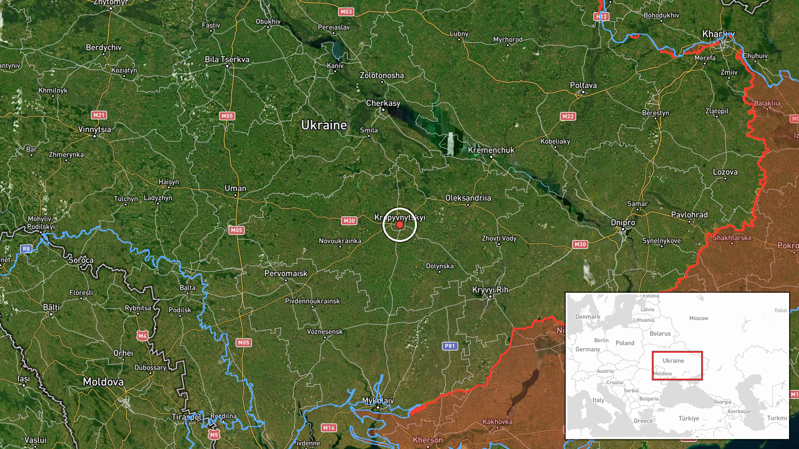
Ukrainian air monitoring reported one Russian jet-powered Shahed-type drone, identified as the Geran-3, tracked approaching Kropyvnytskyi from the east at about 03:21 UTC on 19 October 2026. The report, carried on the Telegram channel @kpszsu, is a short monitoring notice rather than a description of impact, and it does not state whether the drone was shot down, lost from tracking, or reached the city. The original Ukrainian wording is brief: 'На Кропивницький зі сходу,' which translates roughly as 'toward Kropyvnytskyi from the east.' About two minutes earlier, a related alert placed the same type of drone passing Kropyvnytskyi and heading toward Adzhamka, which suggests it was followed through the city's surroundings rather than reported as striking it.
Context and assessment
Kropyvnytskyi is the administrative center of Kirovohrad Oblast in central Ukraine and sits on major road and rail routes, so its appearance in monitoring reports matters for how far into the country these drones are being tracked. It lies well west of the front lines in the east and south, which makes a single drone reaching this area a sign of the range these systems can cover. The event fits a wider pattern in the related reports. On 18 October at 08:30, two or more Geran-3 drones were reported passing Oleksandrivka heading west, and a Ukrainian Air Command West pilot video reportedly showed the destruction of a Geran drone less than an hour later. Overnight on the same date, Russia reportedly launched one Iskander-M ballistic missile and about 180 Shahed-type and decoy drones, with Ukrainian air defense reportedly downing or suppressing 152. Operationally, a lone drone tracked on a westerly path through central oblasts may be a probe, a decoy element, or part of a longer route toward western targets, but the data does not establish which.
Sources and confidence
The event rests on a single Telegram channel, @kpszsu, and no other outlet in the provided data independently reports it. The confidence score of 8.0 reflects the official-looking monitoring origin of the post and its consistency with the surrounding air-monitoring alerts in the same area and hours. It is held below the maximum because only one source is cited, the post does not confirm impact or outcome, and no location confidence value was assigned. Corroboration from independent Ukrainian or international reporting, or an official statement on the drone's fate, would raise confidence. A correction, retraction, or conflicting monitoring report would lower it. The record is currently not marked as corrected.
Location
The location is recorded at settlement precision, with coordinates of roughly 48.5079 N, 32.2623 E placed at the city of Kropyvnytskyi rather than at any specific facility. Kropyvnytskyi is the regional center of Kirovohrad Oblast and lies on the Inhul River in central Ukraine. The adjacent village of Adzhamka, named in a related alert, is in the same general area, so the drone's track passes close to the settlement rather than through a defined site.
Related events nearby
- Ukrainian air monitoring: 1 Russian jet-powered Shahed (Geran-3) drone passing Kropyvnytskyi, heading toward A2026-10-19 03:19 UTC · Drone Transit · Adzhamka, Ukraine
- Ukrainian air monitoring: 2+ Russian jet-powered Shahed (Geran-3) drones passing Oleksandrivka, heading west.2026-10-18 08:30 UTC · Drone Transit · Oleksandrivka, Ukraine
- Ukrainian monitoring issues all-clear, ending the ballistic missile threat alert.2026-10-18 17:02 UTC · Siren · Ukraine (location not reported)
- Ukrainian Air Command West pilot from a tactical aviation brigade video reportedly shows destruction of a Russ2026-10-18 09:08 UTC · Drone Shootdown · Ukraine (location not reported)
- Russia launched one Iskander-M ballistic missile and about 180 Shahed-type and decoy drones overnight. Ukraini2026-10-18 05:01 UTC · UAS Strike · Ukraine
▶ View this event on the live map

Intel Mapper aggregates open-source reports from monitored Telegram and X channels, geolocates them, cross-checks duplicates across sources and assigns a confidence score. Entries are updated as new confirmations arrive. Read how we verify events.