Jet-powered Shahed drones reported transiting Kropyvnytskyi and Voznesensk districts, Ukraine
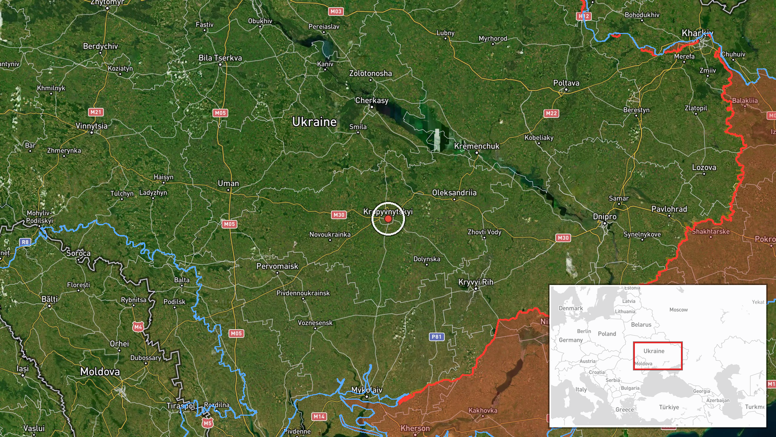
What happened
Ukrainian air monitoring reported on Telegram via the Kropyvnytskyi-based air command channel (@kpszsu) that one Russian jet-powered Shahed, known in Russian designation as Geran-3, was passing through Kropyvnytskyi district heading west. The same post reported a second jet-powered drone of the same type passing through Voznesensk district in Mykolaiv Oblast, heading north. The event is dated 20 October 2026 at 00:53 UTC. The original Ukrainian wording describes the aircraft as 'реактивний БпЛА', meaning jet-powered unmanned aerial vehicle, and uses directional arrows rather than naming any impact point. The report does not describe any strike, detonation, or damage, and it gives no casualty information. It is a single-channel air-monitoring notice.
Context and assessment
Kropyvnytskyi sits on the Ingul and Inhul river corridor in central Ukraine, and the region has been a recurring transit zone for long-range drones aimed at western and central targets. Related events logged on 19 October 2026 show a sequence of transits: a single drone approaching Kropyvnytskyi from the east, multiple drones over Kirovohrad Oblast heading west and northwest, and another single drone heading toward Adzhamka. Taken together, these reports suggest a pattern of repeated drone movements crossing the oblast over a span of roughly one day, with headings shifting between west and northwest. The 20 October report extends that pattern, with a drone moving west over Kropyvnytskyi and a separate drone moving north over Voznesensk. Operationally, such transit reporting is typically used by air defence and civil authorities to warn of flight paths rather than to confirm targets. The headings may indicate routes toward western Ukraine or dispersal across several axes, but the data alone cannot establish the intended destination of any airframe.
Sources and confidence
The only reporting channel is the Telegram account @kpszsu, a Ukrainian air-monitoring source, so the event currently has a source count of one and no independent cross-confirmation. The confidence score of 8.0 reflects that the channel is an official-style military monitoring feed with a consistent format and a clear track record in the related events, which all come from the same type of reporting. It is not higher because no second outlet, radar-based summary, or official statement has corroborated the specific sightings. Confidence would rise with confirmation from a second Ukrainian air-command source or regional administration, or with independent flight tracking data. It would fall if later corrections revised the drone type, count, or district boundaries.
Location
The coordinates correspond to the settlement level for Kropyvnytskyi district, placed at roughly 48.508 N and 32.266 E, and the location is marked as high confidence because the district is named explicitly in the source. The Voznesensk reference is not separately geolocated in this record, so the point represents the Kropyvnytskyi district center rather than the full track. The district lies in Kirovohrad Oblast on the Dnipro-Ingul lowlands, an area of open agricultural land with rivers, reservoirs, and scattered rail and road links to the city.
Related events nearby
- Ukrainian air monitoring: one Russian jet-powered Shahed (Geran-3) drone tracked approaching Kropyvnytskyi fro2026-10-19 03:21 UTC · Drone Transit · Kropyvnytskyi, Kirovohrad Oblast, Ukraine
- Ukrainian air monitoring: 1 Russian jet-powered Shahed (Geran-3) drone from Odesa Oblast toward Kirovohrad Obl2026-10-20 01:08 UTC · Drone Transit · Kirovohrad Oblast, Ukraine
- Ukrainian air monitoring: 2+ Russian jet-powered Shahed (Geran-3) drones passing Kirovohrad Oblast, heading we2026-10-19 07:11 UTC · Drone Transit · Kirovohrad Oblast, Ukraine
- Ukrainian air monitoring: jet-powered Shahed (Geran-3) drones tracked over central Kirovohrad Oblast, heading 2026-10-19 04:43 UTC · Drone Transit · Central Kirovohrad Oblast, Ukraine
- Ukrainian air monitoring: 1 Russian jet-powered Shahed (Geran-3) drone passing Kropyvnytskyi, heading toward A2026-10-19 03:19 UTC · Drone Transit · Adzhamka, Ukraine
▶ View this event on the live map

Intel Mapper aggregates open-source reports from monitored Telegram and X channels, geolocates them, cross-checks duplicates across sources and assigns a confidence score. Entries are updated as new confirmations arrive. Read how we verify events.