Jet-powered Shahed (Geran-3) drones reported over central Kirovohrad Oblast, heading northwest
What happened
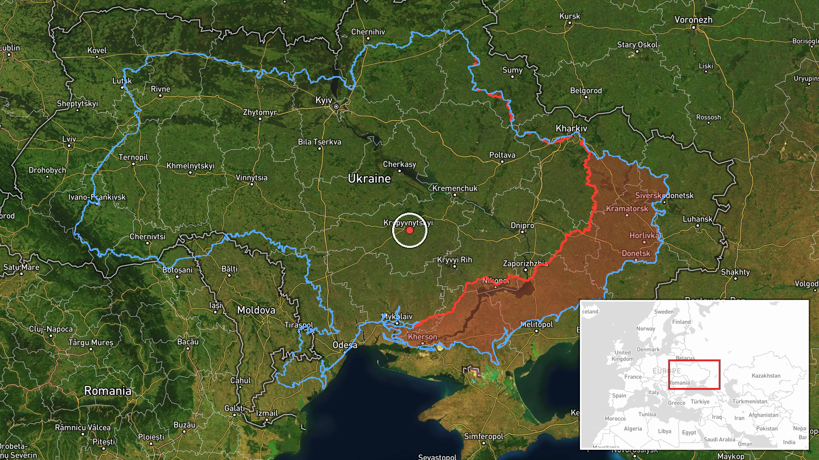
Ukrainian air monitoring reported through the Telegram channel @kpszsu that jet-powered Shahed (Geran-3) drones were tracked over central Kirovohrad Oblast in Ukraine on 19 October 2026, with the entry logged at 04:43 UTC, moving in a northwestern direction. The original Ukrainian wording describes jet-type UAVs in the center of Kirovohrad region, heading northwest. The report gives no drone count, no precise track, and no information about impact or damage. It describes transit rather than a strike. Attribution to Russia rests on the monitoring channel's identification of the drones as Russian Geran-3 type, and the event is recorded as a drone transit with the location held only at regional level.
Context and assessment
Kirovohrad Oblast sits on the central Ukrainian steppe, and its administrative centre, Kropyvnytskyi, is a road and rail junction that frequently appears in air-monitoring reports. Related entries from the same morning place drones in the area in sequence. At 03:13 UTC one drone was reported passing southern Kirovohrad Oblast heading north. At 03:19 and 03:21 a single Geran-3 was tracked passing Kropyvnytskyi toward Adzhamka and then approaching the city from the east. At 04:36 two or more drones were reported passing south of Kropyvnytskyi heading west, with a further drone reported in the same entry. The previous day, on 18 October, two or more drones were reported passing Oleksandrivka heading west. Taken together, the pattern suggests drones moving across the oblast on several routes over several hours rather than a single isolated flight. Operationally, such sequences are often read as transit or route-testing traffic, but the reports alone cannot show whether the drones were headed for a particular target, were being diverted, or were simply crossing the region. Any sustained reporting of this kind would be consistent with a broader campaign against regional infrastructure, though that link is not established by these entries.
Sources and confidence
The event rests on a single Telegram channel, @kpszsu, which is the sole listed source. The related entries from the same morning also appear to come from air-monitoring reporting, but they are presented as separate reports and do not independently confirm the 04:43 UTC drone position. The confidence score of 8.0 reflects a credible monitoring channel with a consistent reporting style and corroborating nearby entries, but it is held down by the single-source basis, the absence of an exact track, and the lack of any official or second-channel confirmation. Confidence would rise with confirmation from another monitoring source, an official air-force statement, or a time-stamped track that fixes the drones' route. It would fall if the nearby entries were found to repeat the same drones or if the type identification were disputed.
Location
The location is recorded at regional level, not at a settlement or facility, so the coordinates of 48.5 and 32.3 are an approximate central point for Kirovohrad Oblast rather than a tracked position. The oblast is largely flat, open steppe with agricultural land. The Inhul River runs through the region, and Kropyvnytskyi, the regional centre, lies close to the coordinates. Because the drones were reported as moving across the central area, the point should be read as a general area marker.
Related events nearby
- Ukrainian air monitoring: one Russian jet-powered Shahed (Geran-3) drone tracked approaching Kropyvnytskyi fro2026-10-19 03:21 UTC · Drone Transit · Kropyvnytskyi, Kirovohrad Oblast, Ukraine
- Ukrainian air monitoring: 1 Russian jet-powered Shahed (Geran-3) drone passing Kropyvnytskyi, heading toward A2026-10-19 03:19 UTC · Drone Transit · Adzhamka, Ukraine
- Ukrainian air monitoring: 2+ Russian jet-powered Shahed (Geran-3) drones passing south of Kropyvnytskyi, headi2026-10-19 04:36 UTC · Drone Transit · south of Kropyvnytskyi, Ukraine
- Ukrainian air monitoring: 2+ Russian jet-powered Shahed (Geran-3) drones passing Oleksandrivka, heading west.2026-10-18 08:30 UTC · Drone Transit · Oleksandrivka, Ukraine
- Ukrainian air monitoring: 1 Russian jet-powered Shahed (Geran-3) drone passing southern Kirovohrad Oblast, hea2026-10-19 03:13 UTC · Drone Transit · southern Kirovohrad Oblast, Ukraine
▶ View this event on the live map

Intel Mapper aggregates open-source reports from monitored Telegram and X channels, geolocates them, cross-checks duplicates across sources and assigns a confidence score. Entries are updated as new confirmations arrive. Read how we verify events.