Ukrainian monitors report 2+ jet-powered Shahed drones moving west over Kirovohrad Oblast
What happened
On 19 October 2026 at about 07:11 UTC, the Telegram channel @kpszsu, which carries Ukrainian air monitoring reports, posted that jet-powered Shahed drones, identified as Geran-3 type, were passing near the settlement of Haidamatske in Kirovohrad Oblast, heading on a western course. The original post is in Ukrainian and describes the aircraft as reaktyvni BpLA, or jet-powered unmanned aerial vehicles. The post gives a count of two or more drones and does not state any impact, target or damage. The report is a transit notice only, and the wording reflects what observers tracked in the air, not what happened on the ground.
Context and assessment
Kirovohrad Oblast sits in central Ukraine, and the data shows it was crossed by several tracks over roughly a day. Earlier on 19 October, a single Geran-3 was tracked approaching Kropyvnytskyi, the oblast centre, from the east at about 03:21 UTC, and another was reported passing the city toward Adzhamka at 03:19. Around 04:36 two or more drones were reported south of Kropyvnytskyi heading west, and at 04:43 drones were reported over central parts of the oblast heading northwest. A further group was logged passing Oleksandrivka on 18 October at 08:30 heading west. The pattern suggests multiple small groups moving through the oblast on differing headings rather than a single formation. Operationally, such transit tracks may reflect routes toward western Ukraine, decoy or saturation tactics, or shifts in flight paths, but the data does not identify intended targets, and no strike outcome is recorded here.
Sources and confidence
This event rests on a single channel, @kpszsu, with a source count of one and no independent cross-confirmation in the data. The confidence score of 8.0 is relatively high because the channel has posted consistent track reports for the same oblast across several related events, and the aircraft type is specified. It is still held below the maximum because no second monitoring source, official air force statement or regional administration report is attached. Confidence would rise with confirmation from another monitoring channel or an official Ukrainian air force notice naming the same time window. It would fall if later updates contradicted the track direction or if the drone count were revised.
Location
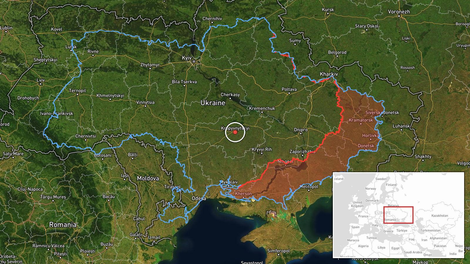
The location is recorded at regional level, not at settlement level, with a low location confidence rating. The post names the village of Haidamatske, but the map pin reflects an approximate point for Kirovohrad Oblast at about 48.51 N, 32.26 E rather than a precise village position. The oblast is a largely flat steppe area of central-southern Ukraine, with river valleys and agricultural land, and Kropyvnytskyi, the regional capital, lies to the west of the pin's general area in the related reports. The area is a corridor between eastern and western Ukraine.
Related events nearby
- Ukrainian air monitoring: one Russian jet-powered Shahed (Geran-3) drone tracked approaching Kropyvnytskyi fro2026-10-19 03:21 UTC · Drone Transit · Kropyvnytskyi, Kirovohrad Oblast, Ukraine
- Ukrainian air monitoring: jet-powered Shahed (Geran-3) drones tracked over central Kirovohrad Oblast, heading 2026-10-19 04:43 UTC · Drone Transit · Central Kirovohrad Oblast, Ukraine
- Ukrainian air monitoring: 1 Russian jet-powered Shahed (Geran-3) drone passing Kropyvnytskyi, heading toward A2026-10-19 03:19 UTC · Drone Transit · Adzhamka, Ukraine
- Ukrainian air monitoring: 2+ Russian jet-powered Shahed (Geran-3) drones passing south of Kropyvnytskyi, headi2026-10-19 04:36 UTC · Drone Transit · south of Kropyvnytskyi, Ukraine
- Ukrainian air monitoring: 2+ Russian jet-powered Shahed (Geran-3) drones passing Oleksandrivka, heading west.2026-10-18 08:30 UTC · Drone Transit · Oleksandrivka, Ukraine
▶ View this event on the live map

Intel Mapper aggregates open-source reports from monitored Telegram and X channels, geolocates them, cross-checks duplicates across sources and assigns a confidence score. Entries are updated as new confirmations arrive. Read how we verify events.