Russian jet-powered Shahed drones reportedly transit Kirovohrad Oblast, heading northwest
What happened
A single Ukrainian source, the Telegram channel @kpszsu, reported on 20 October 2026 at about 05:22 UTC that jet-powered Shahed (Geran-3) drones were passing near Holovanivsk in Kirovohrad Oblast, central Ukraine, moving in a northwest direction. The original post uses the phrase 'Реактивні БпЛА' (jet-powered unmanned aerial vehicles) and names Holovanivsk as the reference point, while the English summary gives a count of two or more drones. The report describes transit only. It does not mention impacts, casualties, or damage, and the source wording does not state how many drones were involved beyond 'two or more.' Attribution to Russia reflects the Shahed/Geran designation used in the Ukrainian report.
Context and assessment
This report fits a pattern of repeated Shahed transits over the same region within roughly 24 hours. Related reports from the same monitoring stream describe a drone heading toward Kirovohrad Oblast from Odesa Oblast at about 01:08 UTC on 20 October, single drones passing Kropyvnytskyi district at 00:53 and 02:09 UTC, and another group of two or more drones heading west through Kirovohrad Oblast on 19 October. Taken together, these reports suggest that the central Ukrainian corridor is being used repeatedly, with routes that move between east, west and northwest headings rather than a single fixed track. Operationally, repeated transits like these are often read as drones moving through airspace toward targets further west or north, or as air-defence engagement and monitoring activity along the route. The reports alone do not establish which of these explanations applies, and no target is named in the data. The steady cadence does show that the region is part of an active drone flight path, which is why the monitoring channel is issuing repeated updates.
Sources and confidence
All of the event's information comes from one Telegram channel, @kpszsu, so cross-confirmation is currently absent for this specific report. The confidence score of 8.0 is high for a single-channel report, which reflects that the channel is an established Ukrainian air-monitoring source and that the related reports from the same stream are internally consistent in time, place and drone type. The score is still tempered by the lack of independent corroboration and by the vagueness of the count. Confidence would rise with confirmation from other Ukrainian air-force or regional military administration channels, or from open-source tracking of the same flight path. It would fall if the channel later corrected or withdrew the report, or if independent monitoring placed the drones elsewhere.
Location
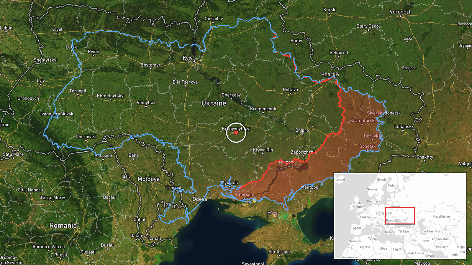
The event is geolocated at the regional level for Kirovohrad Oblast, with coordinates of 48.51 N, 32.26 E, and is marked with low location confidence. The source's reference to Holovanivsk does not translate into an exact point, so the pin should be read as approximate and as representing the oblast rather than a specific settlement or facility. Kirovohrad Oblast lies in central Ukraine, a largely agricultural steppe landscape with river valleys and a dense network of rural roads and small towns. Its open terrain is one reason drone transits across it are commonly reported by regional monitoring.
Related events nearby
- Ukrainian air monitoring: 1 Russian jet-powered Shahed (Geran-3) drone passing Kirovohrad Oblast, heading nort2026-10-20 02:54 UTC · Drone Transit · Kirovohrad Oblast, Ukraine
- Ukrainian air monitoring: 1 Russian jet-powered Shahed (Geran-3) drone from Odesa Oblast toward Kirovohrad Obl2026-10-20 01:08 UTC · Drone Transit · Kirovohrad Oblast, Ukraine
- Ukrainian air monitoring: 2+ Russian jet-powered Shahed (Geran-3) drones passing Kirovohrad Oblast, heading we2026-10-19 07:11 UTC · Drone Transit · Kirovohrad Oblast, Ukraine
- Ukrainian air monitoring: 2+ Russian jet-powered Shahed (Geran-3) drones passing Kropyvnytskyi district, headi2026-10-20 02:09 UTC · Drone Transit · Kropyvnytskyi district, Ukraine
- Ukrainian air monitoring: 1 Russian jet-powered Shahed (Geran-3) drone passing Kropyvnytskyi district, heading2026-10-20 00:53 UTC · Drone Transit · Kropyvnytskyi district, Ukraine
▶ View this event on the live map

Intel Mapper aggregates open-source reports from monitored Telegram and X channels, geolocates them, cross-checks duplicates across sources and assigns a confidence score. Entries are updated as new confirmations arrive. Read how we verify events.