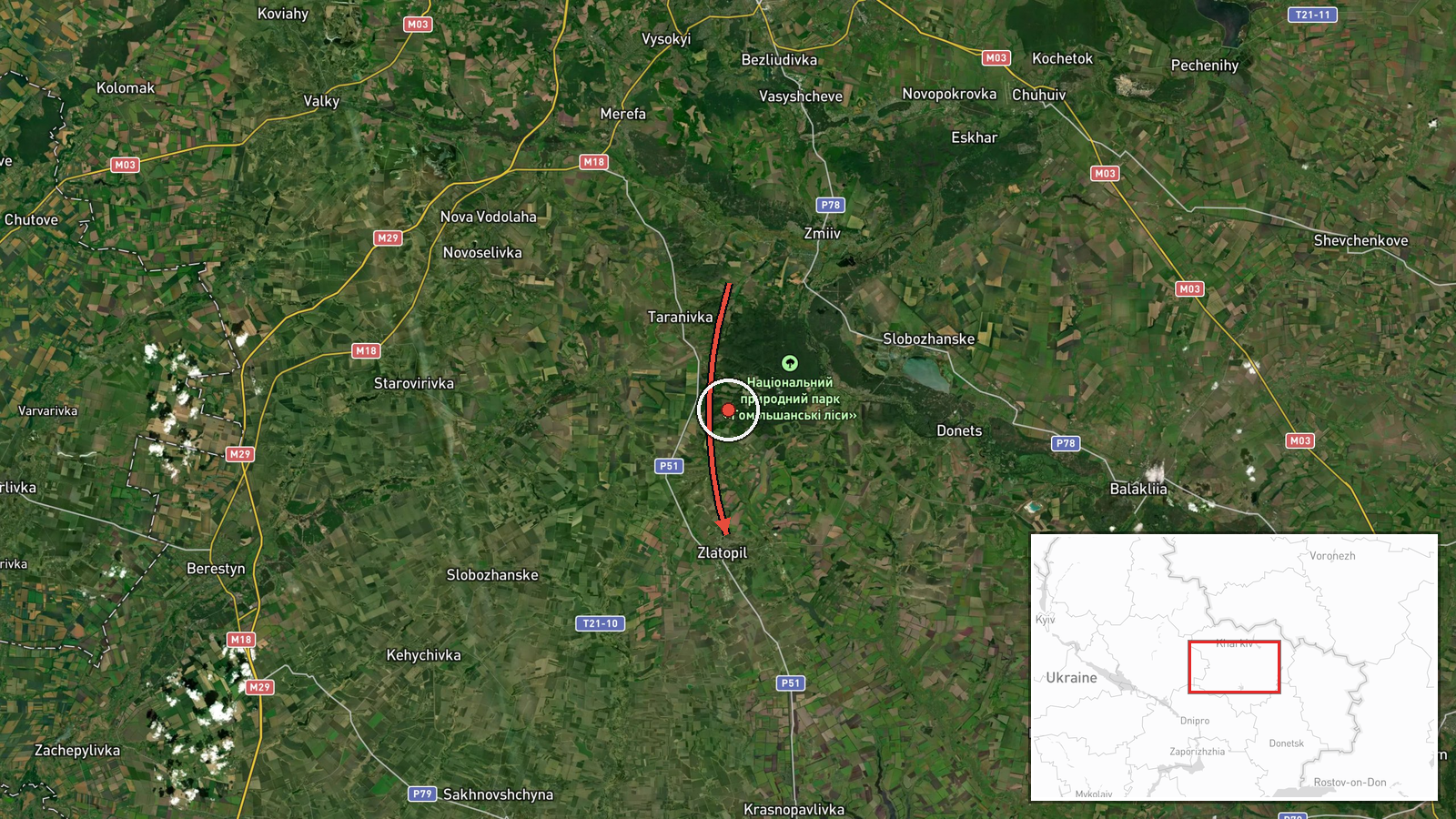
Russian Geran-3 drone reported in transit toward Zlatopil, Kharkiv Oblast, on 19 October 2026
What happened
Ukraine's air monitoring channel on Telegram, @kpszsu, reported one Russian jet-powered Shahed, designated Geran-3, moving toward the settlement of Zlatopil in Kharkiv Oblast. The post, written in Ukrainian, described a jet-powered UAV approaching from the north in the Kharkiv region. The report was timestamped 03:23 UTC on 19 October 2026 and recorded a drone transit rather than a confirmed impact, so no damage, casualties or interception outcome is stated. The original wording names the target settlement and direction but gives no altitude, speed or intended aim point. Reportedly, the event was logged as a single aerial track, and the summary's reference to Kharkiv Oblast reflects the origin area given in the channel's framing rather than a separately confirmed launch site.
Context and assessment
Zlatopil sits in the Kharkiv Oblast countryside, where Russian long-range drone activity has been recurring in recent days. The related events form a clear sequence: a Geran-3 was logged over Lozova and another heading toward Valky on 18 October, a further track was reported toward Kharkiv city that evening, and two more were flagged toward Kharkiv and Donets on 19 October. The pattern places Zlatopil within a corridor of tracks moving through the northeastern part of the oblast, a region that lies between the Russian border and the regional capital. Repeated single-drone reports along this axis may suggest route-testing, multiple aim points, or drones being steered toward different targets as they approach. Because each record is a transit alert, the data alone cannot show whether these airframes struck their intended targets or were downed. Operationally, a settlement-level alert of this kind usually signals that air defence units and local authorities are being warned, not that a strike has occurred. Analysts would want follow-up reports of impacts or interceptions before drawing firm conclusions about intent.
Sources and confidence
This is a single-source report from the Telegram channel @kpszsu, the Ukrainian air monitoring account. No second outlet in the dataset independently reports this track, so cross-confirmation is absent. The confidence score of 8.0 is high relative to single-channel reporting because the channel is an official-style air monitoring source and the timing and direction are specific. It is held below the maximum because there is no corroboration, no impact confirmation, and the origin is not independently verified. Confidence would rise with confirmation from additional monitoring channels, regional military administration statements, or radar-based tracking, and would fall if the alert were revised, withdrawn, or contradicted by later reporting.
Location
Location is settlement-level: Zlatopil was placed at the settlement's coordinates with high location confidence, and the record gives no facility or street. The area is agricultural steppe in northeastern Kharkiv Oblast, with rural roads, rail lines and small villages dispersed across open farmland. Kharkiv city lies well to the north, and the Russian border is some distance further north still.
Related events nearby
- Ukrainian air monitoring: 1 Russian jet-powered Shahed (Geran-3) drone from Kharkiv Oblast toward Donets.2026-10-19 02:53 UTC · Drone Transit · Donets, Ukraine
- Ukrainian air monitoring: 1 Russian jet-powered Shahed (Geran-3) drone over Lozova.2026-10-18 07:52 UTC · Drone Transit · Lozova, Ukraine
- Ukrainian air monitoring: 1 Russian jet-powered Shahed (Geran-3) drone heading toward Valky.2026-10-18 07:50 UTC · Drone Transit · Valky, Ukraine
- Ukrainian air monitoring: 1 Russian jet-powered Shahed (Geran-3) drone heading toward Kharkiv.2026-10-19 03:12 UTC · Drone Transit · Kharkiv, Ukraine
- Ukrainian air monitoring: 1 Russian Shahed-type drone over Izyum.2026-10-18 06:59 UTC · Drone Transit · Izyum, Ukraine
▶ View this event on the live map

Intel Mapper aggregates open-source reports from monitored Telegram and X channels, geolocates them, cross-checks duplicates across sources and assigns a confidence score. Entries are updated as new confirmations arrive. Read how we verify events.