Ukrainian monitors track one jet-powered Geran-3 drone toward Krasnopavlivka
What happened
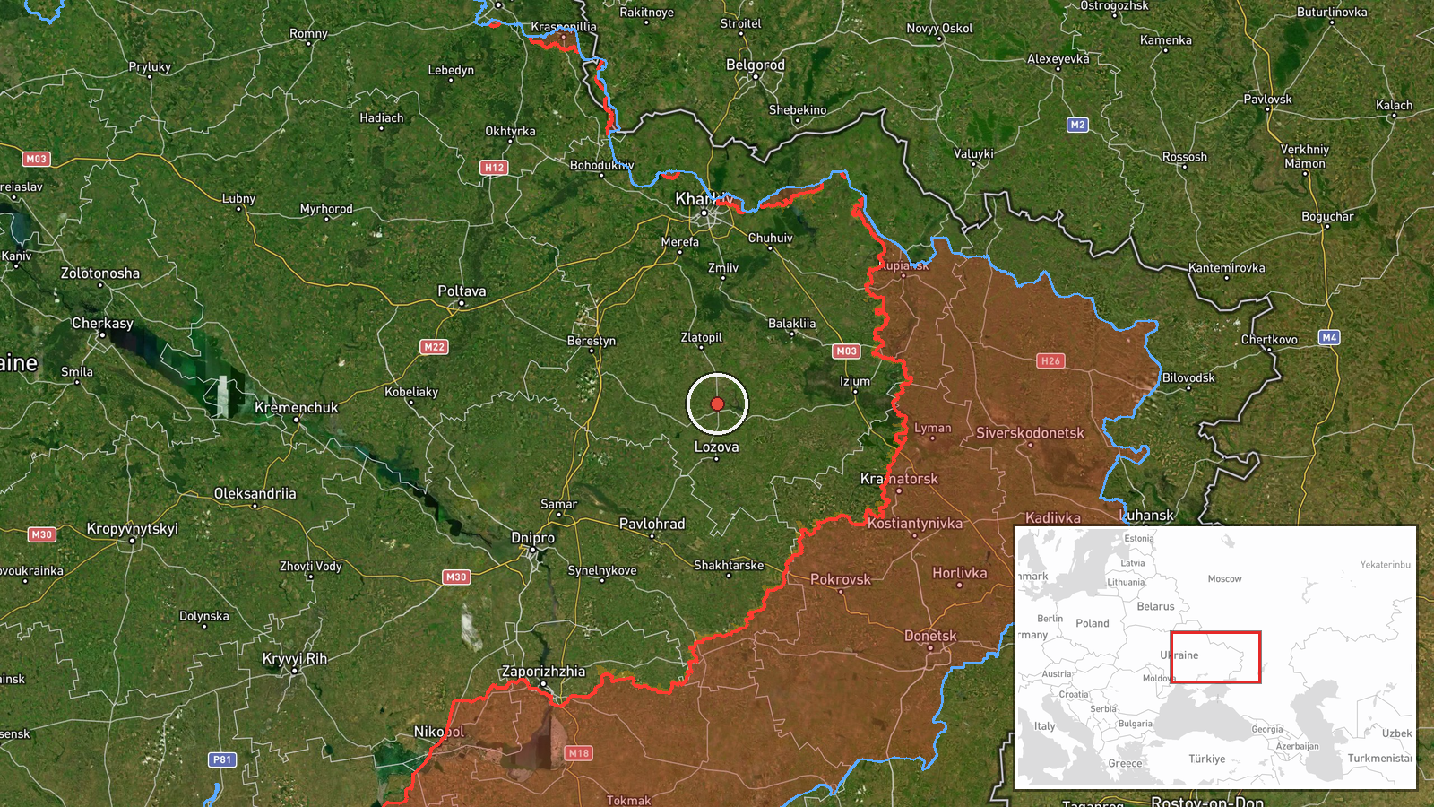
Ukrainian air monitoring reported on Telegram that one Russian jet-powered Shahed, designated Geran-3, was heading toward Krasnopavlivka, with the post noting it was moving from the south of Kharkiv region. The report is timestamped 19 October 2026 at 07:52 UTC and was published by the monitoring channel @kpszsu. The original Ukrainian wording uses the phrase 'Реактивний БпЛА' (jet UAV) and names the settlement directly, without describing any impact, casualties or damage. The event is classified as a drone transit rather than a strike, meaning the feed records a track toward a settlement rather than a confirmed detonation. No independent confirmation of the track or any outcome appears in the provided data.
Context and assessment
Krasnopavlivka sits in a part of northeastern Ukraine where the recent feed shows repeated Russian drone movements. Earlier that morning, Geran-3 tracks were logged from Kharkiv Oblast toward Donets at 02:53 and toward Zlatopil at 03:23, and a separate track was reported heading toward Kharkiv city at 03:12. The pattern suggests a sequence of jet-powered drones moving through the Kharkiv area in quick succession, which is consistent with waves of long-range launches being routed across several axes rather than aimed at one point. Further south, a guided glide bomb (KAB) was reported heading toward Pavlohrad at 02:44, and another toward eastern Dnipropetrovsk Oblast on 18 October, indicating that glide-bomb strikes continue along the broader front as well. Operationally, a single track toward a small settlement could reflect routing, a decoy, or an intended target, and the data alone cannot distinguish these. The event is best read as one data point in a wider overnight and morning pattern of drone movement across the region.
Sources and confidence
The event rests on a single Telegram channel, @kpszsu, which is recorded as the only source and was not cross-posted by any other monitor in the data. Its confidence score of 8.0 reflects that the channel is an established Ukrainian air-monitoring feed with a consistent record of track reporting, while the lack of corroboration keeps it below the top of the scale. Confidence would rise if other Ukrainian monitoring channels, regional military administrations, or the Ukrainian Air Force independently reported the same track. It would fall if later updates showed the drone was redirected, lost, or misidentified, or if no impact reporting followed a track that was expected to reach its target.
Location
The location is recorded at settlement precision with high location confidence, placing the point at approximately 49.137 N, 36.320 E, which is the settlement's approximate centre rather than any specific facility. Krasnopavlivka lies in an area of open agricultural steppe in northeastern Ukraine, where terrain is largely flat and settlements are spaced across farmland and river valleys. The data gives no evidence of a specific facility or infrastructure at the coordinates, so the point should be treated as the settlement as a whole.
Related events nearby
- Ukrainian air monitoring: 1 Russian jet-powered Shahed (Geran-3) drone from Kharkiv Oblast toward Zlatopil.2026-10-19 03:23 UTC · Drone Transit · Zlatopil, Ukraine
- Ukrainian air monitoring: 1 Russian jet-powered Shahed (Geran-3) drone from Kharkiv Oblast toward Donets.2026-10-19 02:53 UTC · Drone Transit · Donets, Ukraine
- Ukrainian air monitoring: 1 Russian guided glide bomb (KAB) heading toward Pavlohrad.2026-10-19 02:44 UTC · Airstrike · Pavlohrad, Ukraine
- Ukrainian air monitoring: 1 Russian jet-powered Shahed (Geran-3) drone heading toward Kharkiv.2026-10-19 03:12 UTC · Drone Transit · Kharkiv, Ukraine
- Ukrainian forces report repelling Russian assaults on Dobropillia and destroying infiltration attempts; Comman2026-10-18 14:58 UTC · Combat · Dobropillia, Donetsk Oblast, Ukraine
▶ View this event on the live map

Intel Mapper aggregates open-source reports from monitored Telegram and X channels, geolocates them, cross-checks duplicates across sources and assigns a confidence score. Entries are updated as new confirmations arrive. Read how we verify events.