Ukraine reports jet-powered Geran-3 drones south of Kropyvnytskyi heading west
What happened
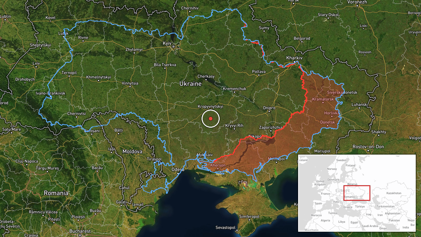
On 19 October 2026 at about 04:36 UTC, a Ukrainian air monitoring report published on the Telegram channel @kpszsu described two or more Russian jet-powered Shahed (Geran-3) drones passing south of Kropyvnytskyi in Kirovohrad Oblast, heading west. The same post separately noted one similar jet-powered drone passing southern Zhytomyr Oblast, heading north. The original Ukrainian wording refers to jet-powered UAVs to the south of Kropyvnytskyi on a westerly course, and to a single jet-powered drone in southern Zhytomyr region on a northerly course. The report does not mention impacts, casualties, or damage, and it does not state the intended target. It is a transit notice, meaning the drones were tracked in flight rather than observed striking anything.
Context and assessment
Kropyvnytskyi is the administrative centre of Kirovohrad Oblast in central Ukraine, on road and rail routes linking the south and west with the centre of the country. Drones tracked there may be moving through the area toward western or northern regions rather than toward the city itself. The related events show a sustained pattern of jet-powered Geran-3 transits across the same oblast over roughly 24 hours. On 18 October a group was tracked near Khmelove heading northwest. On 19 October, a single drone was reported passing southern Kirovohrad Oblast heading north at 03:13 UTC, another was tracked passing Kropyvnytskyi toward Adzhamka at 03:19, and one approached the city from the east at 03:21. A further sighting over central Kirovohrad Oblast followed at 04:43, heading northwest. Taken together, the sequence suggests repeated use of a central-southern corridor rather than an isolated flight. Jet-powered variants are generally understood to be faster than the older piston-engined design, which may shorten warning times. Recurring transits on similar headings could reflect route probing, decoy activity, or drones moving toward targets farther west or north. Transit reports describe tracks, not intent, so none of this establishes what the drones were meant to hit.
Sources and confidence
The report rests on a single Telegram channel, @kpszsu, and no independent corroboration appears in the supplied data. The system assigns a confidence score of 8.0, which reflects a consistent monitoring format and internal agreement with related entries. However, the single-source basis and the low location confidence keep the score from being higher. Related entries carry similar wording, which supports internal consistency but is not independent verification. Confidence would rise with a second monitoring source, regional military administration statements, or reports of wreckage or impacts. It would fall if later corrections altered the tracks or if the channel's reports could not be matched with other observations.
Location
The coordinates are a regional approximation at about 48.24 N, 32.27 E, placed south of Kropyvnytskyi because the report gives direction relative to the city rather than a precise point. Geographic precision is recorded as region, so the marker indicates an area, not a flight path or facility. The surrounding terrain of Kirovohrad Oblast is largely flat agricultural land cut by river valleys, including the Inhul and Ingul systems. Zhytomyr Oblast, referenced in the second line, lies well to the northwest.
Related events nearby
- Ukrainian air monitoring: jet-powered Shahed (Geran-3) drones tracked over central Kirovohrad Oblast, heading 2026-10-19 04:43 UTC · Drone Transit · Central Kirovohrad Oblast, Ukraine
- Ukrainian air monitoring: one Russian jet-powered Shahed (Geran-3) drone tracked approaching Kropyvnytskyi fro2026-10-19 03:21 UTC · Drone Transit · Kropyvnytskyi, Kirovohrad Oblast, Ukraine
- Ukrainian air monitoring: 1 Russian jet-powered Shahed (Geran-3) drone passing southern Kirovohrad Oblast, hea2026-10-19 03:13 UTC · Drone Transit · southern Kirovohrad Oblast, Ukraine
- Ukrainian air monitoring: 1 Russian jet-powered Shahed (Geran-3) drone passing Kropyvnytskyi, heading toward A2026-10-19 03:19 UTC · Drone Transit · Adzhamka, Ukraine
- Ukrainian air monitoring: 2+ Russian jet-powered Shahed (Geran-3) drones passing Oleksandrivka, heading west.2026-10-18 08:30 UTC · Drone Transit · Oleksandrivka, Ukraine
▶ View this event on the live map

Intel Mapper aggregates open-source reports from monitored Telegram and X channels, geolocates them, cross-checks duplicates across sources and assigns a confidence score. Entries are updated as new confirmations arrive. Read how we verify events.