Jet-powered Geran-3 drone reported moving from Volyn toward northern Lviv Oblast
What happened
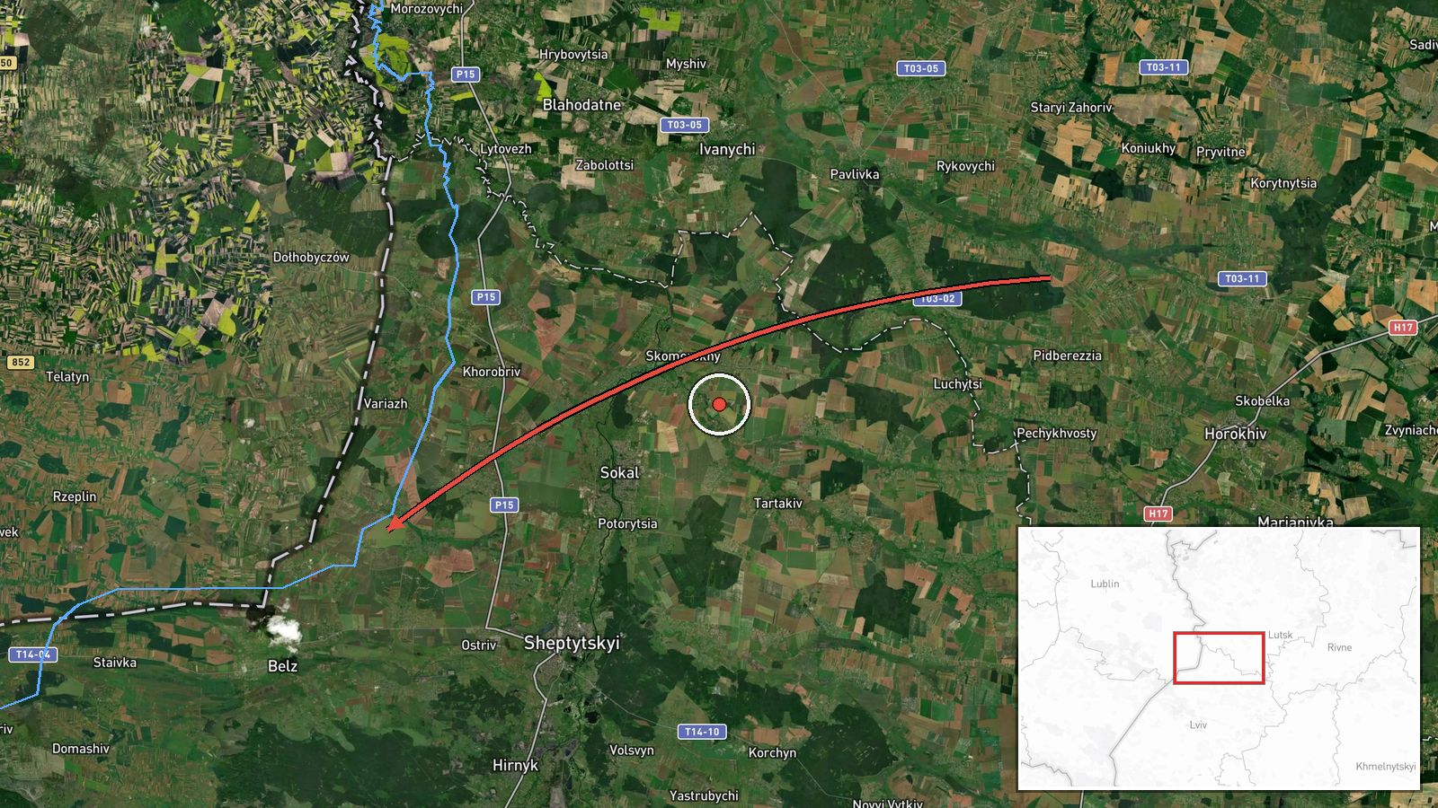
Ukrainian air monitoring reported at 04:39 UTC on 19 October 2026 that one Russian jet-powered Shahed-type drone, identified as a Geran-3, was moving from Volyn Oblast toward northern Lviv Oblast. The original Ukrainian-language post describes it simply as a jet-powered drone heading north over Lviv region from Volyn. The report names no impact site, no casualties and no damage, and describes only an aerial track. The event is classed as a drone transit rather than a strike. It was published on Telegram by the channel @kpszsu, which is associated with Ukraine's Air Force, and no other outlet is listed as carrying it at the time of data collection.
Context and assessment
The track matters because northern Lviv Oblast sits on the main air corridor that Russian long-range drones have used to approach western Ukraine, and the city of Lviv is a major logistics, rail and government hub near the Polish border. The event fits a visible sequence. On 18 October 2026, several Shahed-type drones were logged moving through northern Lviv Oblast toward Sosnivka, Zhovkva, Kulykiv and Dobrotvir, with later tracks heading toward Lviv itself. The Hirnyk track logged on 19 October at 04:42 UTC, about three minutes after this report, suggests the same or a related drone continued along the northern approach. Taken together, the pattern points to repeated drone movements across the region over roughly two days rather than a single isolated flight. Operationally, jet-powered variants are faster and harder to intercept than older piston-engine Shaheds, so such tracks may indicate an effort to test air defence response or to position drones for later strikes. The available reporting does not establish intent, and transit tracks often do not end in impacts.
Sources and confidence
The event rests on a single Telegram channel, @kpszsu, so cross-confirmation is absent in the data provided. The post is a brief tactical alert without coordinates, timestamps for each waypoint or independent imagery, which limits verification. The score of 8.0 reflects a credible official-type source and a coherent pattern with nearby events, but it is held down by single-source reporting and a low location confidence. Confidence would rise with corroboration from a second Ukrainian air command or regional military administration, or with wreckage or interception reports. It would fall if later updates contradicted the origin in Volyn, since the post's wording and the related Lviv-origin tracks differ slightly.
Location
The location is recorded at region level only, so the coordinates represent an approximate point within northern Lviv Oblast rather than a named settlement or facility. No specific town was named in the original post. The area is mainly lowland and agricultural, with forest and wetland belts stretching north toward the Volyn and Rivne border zone. The Lviv-Volyn border area and the rail and road routes leading toward Lviv city are notable features nearby.
Related events nearby
- Ukrainian air monitoring: 1 Russian jet-powered Shahed (Geran-3) drone from Lviv Oblast toward Hirnyk.2026-10-19 04:42 UTC · Drone Transit · Hirnyk, Ukraine
- Ukrainian air monitoring: 1 Russian Shahed-type drone from northern Lviv Oblast toward Sosnivka.2026-10-18 07:09 UTC · Drone Transit · Sosnivka, Ukraine
- Ukrainian air monitoring: 1 Russian Shahed-type drone heading toward Zhovkva.2026-10-18 07:18 UTC · Drone Transit · Zhovkva, Ukraine
- Ukrainian air monitoring: 1 Russian Shahed-type drone passing Kulykiv, heading toward Lviv.2026-10-18 08:14 UTC · Drone Transit · Lviv, Ukraine
- Ukrainian air monitoring: 1 Russian Shahed-type drone passing Dobrotvir, heading toward Lviv.2026-10-18 08:08 UTC · Drone Transit · Lviv, Ukraine
▶ View this event on the live map

Intel Mapper aggregates open-source reports from monitored Telegram and X channels, geolocates them, cross-checks duplicates across sources and assigns a confidence score. Entries are updated as new confirmations arrive. Read how we verify events.