Two or more Russian jet-powered Shahed drones reported heading toward Kovel in Volyn Oblast
What happened
Ukrainian air monitoring channel @kpszsu reported on Telegram on 19 October 2026 at about 14:00 UTC that two or more Russian jet-powered Shahed (Geran-3) drones were heading toward Kovel in Volyn Oblast, in western Ukraine. The original Ukrainian-language post, which reads roughly as 'Volyn: jet-powered UAVs on course for Kovel,' gives no altitude, impact, or damage information. The report describes the drones as in transit, not as having struck anything. Kovel was the stated destination, and the post does not say whether the drones were tracked to that point or only directed toward it. The event is recorded as a single-source report.
Context and assessment
Kovel is a railway junction and regional centre in northern Volyn, close to the Polish and Belarusian borders, and it sits on routes that Russian long-range drones have crossed repeatedly toward western Ukraine. The same morning's related reports show a sustained pattern in the same airspace. Between about 02:42 and 07:08 UTC, monitoring posts tracked single drones from eastern Rivne Oblast into Volyn, then toward Lutsk twice and Kivertsi, and at least one report noted two or more drones passing Volyn heading west. The sequence suggests a multi-drone raid moving through the region in waves rather than a single isolated launch. The shift from Lutsk and Kivertsi toward Kovel may reflect drones being routed along different corridors or simply the monitoring post's changing tracking. Operationally, such transits are often used to stretch air defence coverage, to probe western approaches, or to pin mobile fire groups in place. Nothing in the data confirms which purpose applies here.
Sources and confidence
The event rests on one Telegram channel, @kpszsu, which relays Ukrainian air monitoring alerts. The related events come from the same channel type, so they reflect a single reporting stream rather than independent confirmation. No second outlet, official statement, or visual evidence appears in the data. The confidence score of 8.0 out of 10 reflects a credible official-linked channel with consistent wording across a series of alerts, but it is not higher because the report is unconfirmed by any independent source and does not describe impact. Confidence would rise if regional military administrations, air force statements, or independent trackers corroborated the track toward Kovel. It would fall if later updates showed the drones diverted or were shot down with no clear track.
Location
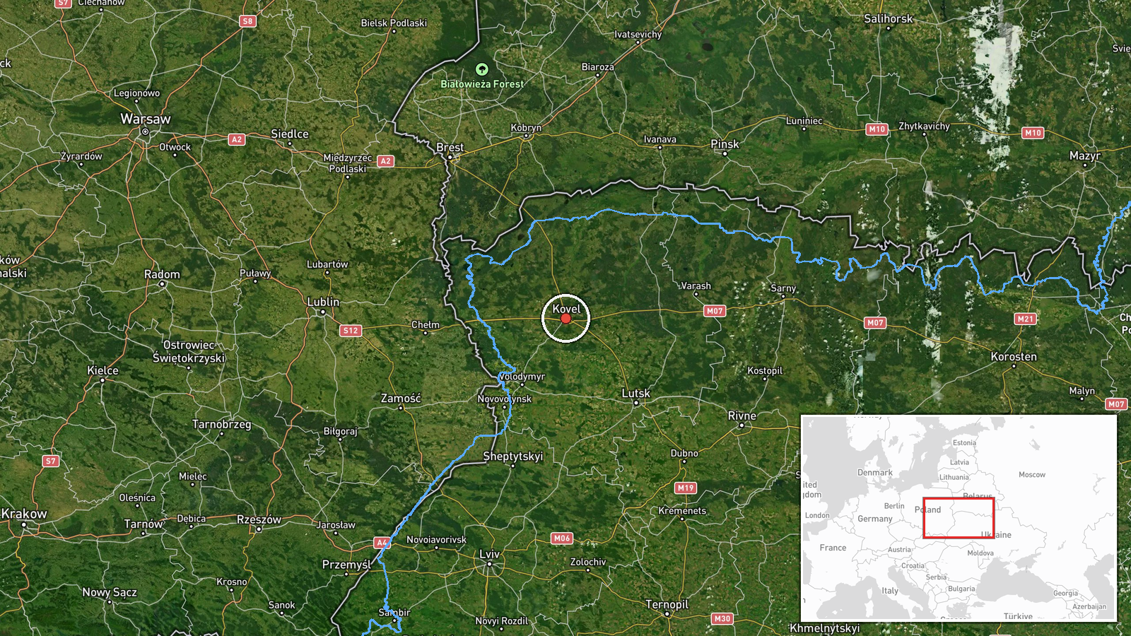
The location is recorded at settlement level for Kovel, a town in Volyn Oblast, with coordinates of roughly 51.215 N, 24.701 E. The alert names the city as the destination, so the point marks the settlement centre rather than a specific facility. Kovel lies in the flat, forested Polesian lowlands of northwestern Ukraine, with the Turiya River system and extensive wetlands to the north and rail lines running east to west. Lutsk, Kivertsi, and the Rivne border area named in the related reports are all within a short distance to the east and northeast.
Related events nearby
- Ukrainian air monitoring: 1 Russian jet-powered Shahed (Geran-3) drone heading toward Kivertsi.2026-10-19 07:08 UTC · Drone Transit · Kivertsi, Ukraine
- Ukrainian air monitoring: 1 Russian jet-powered Shahed (Geran-3) drone heading toward Lutsk.2026-10-19 04:34 UTC · Drone Transit · Lutsk, Ukraine
- Ukrainian air monitoring: 1 Russian jet-powered Shahed (Geran-3) drone heading toward Lutsk.2026-10-19 03:17 UTC · Drone Transit · Lutsk, Ukraine
- Ukrainian air monitoring: 1 Russian jet-powered Shahed (Geran-3) drone passing Volyn Oblast, heading west; 2+ 2026-10-19 02:42 UTC · Drone Transit · Volyn Oblast, Ukraine
- Ukrainian air monitoring: 1 Russian jet-powered Shahed (Geran-3) drone from eastern Rivne Oblast toward Volyn 2026-10-19 02:42 UTC · Drone Transit · Volyn Oblast, Ukraine
▶ View this event on the live map

Intel Mapper aggregates open-source reports from monitored Telegram and X channels, geolocates them, cross-checks duplicates across sources and assigns a confidence score. Entries are updated as new confirmations arrive. Read how we verify events.