Ukrainian air monitoring reports one drone heading toward Zaporizhzhia from the south
What happened
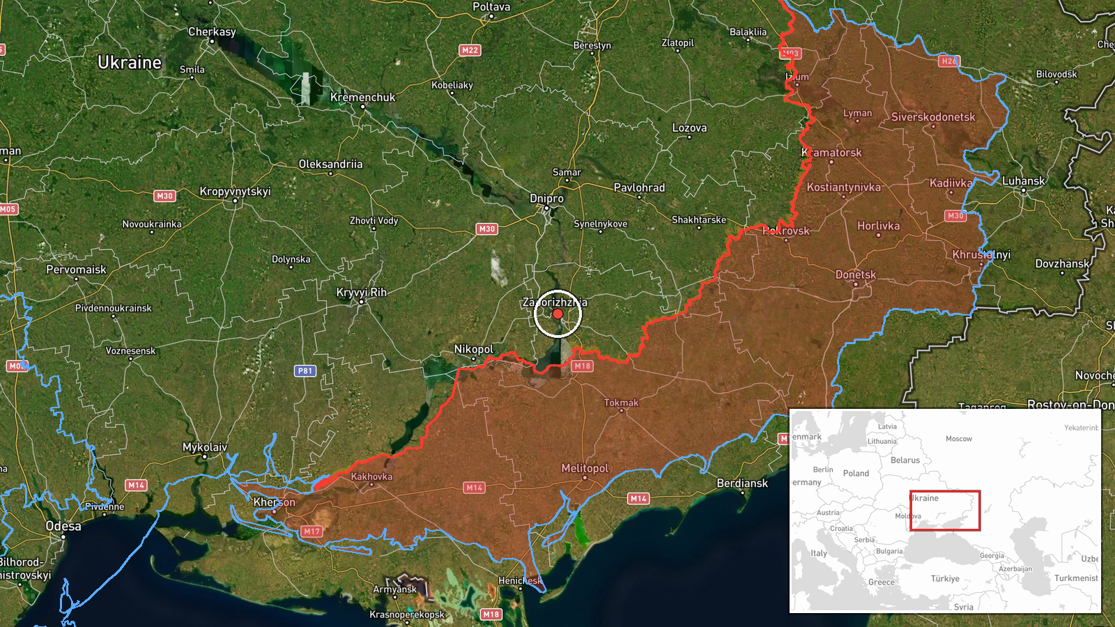
Ukraine's air monitoring channel, cited in the event record as @kpszsu on Telegram, reported at 16:08 UTC on 19 October 2026 a single unmanned aerial vehicle heading toward Zaporizhzhia. The original Ukrainian post reads 'БпЛА на Запоріжжя з півдня', meaning a UAV toward Zaporizhzhia from the south, marked with a scooter-style icon commonly used for drone alerts. The summary describes the object as a Russian Shahed-type drone, but the original wording names no type or operator, so that attribution rests on the summary rather than the post itself. The report is a transit warning, not a confirmed impact. No damage, casualties or interception are described in the source. The alert followed about two hours after a report of two or more jet-powered drones on the same axis.
Context and assessment
Zaporizhzhia city has been a recurring target in this period, and the related events show a dense sequence on 19 October. Earlier that night, a ballistic missile was reported heading toward the city, and guided glide bombs were reported heading toward Zaporizhzhia Oblast at 02:42, 02:46 and 03:22, with another glide bomb reported toward southern Dnipropetrovsk Oblast at 02:42. Mid-afternoon, two or more jet-powered Geran-3 drones were reported on the same approach. Taken together, the pattern suggests several weapon types being used against the city and its surrounding oblast within a single day. A single drone reported later may be part of a follow-on wave, a probing element, or an independent launch, and the record alone does not show which. Glide bombs typically target areas nearer the front line than the city itself, so the oblast reports may reflect strikes on different districts. Repeated alerts for the same target area are also common because monitoring channels issue several updates as tracked objects move. The duplicate 02:46 timestamps in the record may reflect separate entries rather than separate events.
Sources and confidence
Only one channel, the Telegram account @kpszsu, is listed as the source, and no independent outlet has been recorded as confirming the drone's track. The confidence score of 8.0 is high for a single-source record, reflecting the official nature of the air monitoring feed and the consistency of the alert with other same-day reports in the area. It is held below the maximum because the post is a brief warning without a type designation, and the Shahed-type label appears only in the summary. Confidence would rise with corroboration from a second monitoring source, a subsequent official statement, or local reports of impacts or interceptions. It would fall if the track were revised or withdrawn.
Location
The location is recorded at settlement precision, placed at the city of Zaporizhzhia at approximately 47.84 N, 35.14 E. The coordinates reflect the city center rather than a specific facility, and the alert names only the city. Zaporizhzhia sits on the Dnipro River, where the reservoir system forms a broad water corridor through the city. The Zaporizhzhia Nuclear Power Plant lies to the southwest, on the Kakhovka reservoir near Enerhodar, roughly fifty kilometers from the city.
Related events nearby
- Ukrainian air monitoring: 1 Russian Shahed-type drone heading toward Zaporizhzhia.2026-10-19 17:55 UTC · Drone Transit · Zaporizhzhia, Ukraine
- Ukrainian air monitoring: 2+ Russian jet-powered Shahed (Geran-3) drones heading toward Zaporizhzhia.2026-10-19 14:02 UTC · Drone Transit · Zaporizhzhia, Ukraine
- Ukrainian air monitoring: 1 Russian ballistic missile heading toward Zaporizhzhia.2026-10-19 02:46 UTC · Ballistic Missile · Zaporizhzhia, Ukraine
- Ukrainian air monitoring: 1 Russian guided glide bomb (KAB) heading toward Zaporizhzhya Oblast.2026-10-19 03:22 UTC · Airstrike · Zaporizhzhya Oblast, Ukraine
- Ukrainian air monitoring: 1 Russian guided glide bomb (KAB) heading toward Zaporizhzhya Oblast.2026-10-19 02:46 UTC · Airstrike · Zaporizhzhya Oblast, Ukraine
▶ View this event on the live map

Intel Mapper aggregates open-source reports from monitored Telegram and X channels, geolocates them, cross-checks duplicates across sources and assigns a confidence score. Entries are updated as new confirmations arrive. Read how we verify events.