Ukrainian air monitoring reports one Russian drone heading toward Zaporizhzhia from the north
What happened
Ukraine's air monitoring channel on Telegram, @kpszsu, posted on 20 October 2026 at 07:53 UTC that one unmanned aerial vehicle was heading toward Zaporizhzhia from the north. The original Ukrainian post is brief: a motorcycle-style emoji followed by the phrase 'UAV on course to Zaporizhzhia from the north.' The post does not name the drone type. The summary labels it a Russian Shahed-type drone, which is an interpretation drawn from the wider pattern of similar alerts rather than from the post's wording. The report describes a tracked trajectory only. It records no impact, damage, or casualties, and it should not be read as confirmation of a strike. The event is classified as a Drone Transit and attributed to Russia.
Context and assessment
The city of Zaporizhzhia is the administrative center of Zaporizhzhia Oblast and a major industrial hub on the Dnipro River, so repeated alerts toward it carry weight for the wider region. The related events show a sequence over roughly sixteen hours. On 19 October at 14:02 UTC, the monitoring channel reported two or more jet-powered Geran-3 drones heading toward the city. Single Shahed-type drones followed at 16:08 and 17:55. Early on 20 October, two guided glide bomb (KAB) alerts were issued for Zaporizhzhya Oblast, at 06:59 and 07:53, the latter matching this report's timestamp. Glide bombs are usually launched from aircraft near the front line, so their presence points to pressure across the oblast as well as on the city. Operationally, a steady stream of single drones may be intended to sustain alert conditions, probe air defense, or gather information, though the reports do not establish intent. The combination with glide bomb alerts may indicate coordinated activity across the region, but that link remains an inference from timing.
Sources and confidence
This record rests on a single channel, @kpszsu, which is the Ukrainian Air Force's official monitoring account and has a generally consistent record for alerts. Confidence is scored at 8.0 because of that official origin and the clear, time-stamped wording. It is not higher because no independent outlet or second channel had cross-confirmed the alert when the record was made, the original text is very short, and no impact reporting exists. Confidence would rise with corroboration from regional military administration statements, independent flight-tracking or monitoring accounts, or reports of debris or impact. It would fall if the alert were cancelled, the drone were reported as diverted or downed without consequence, or no follow-up reporting appeared.
Location
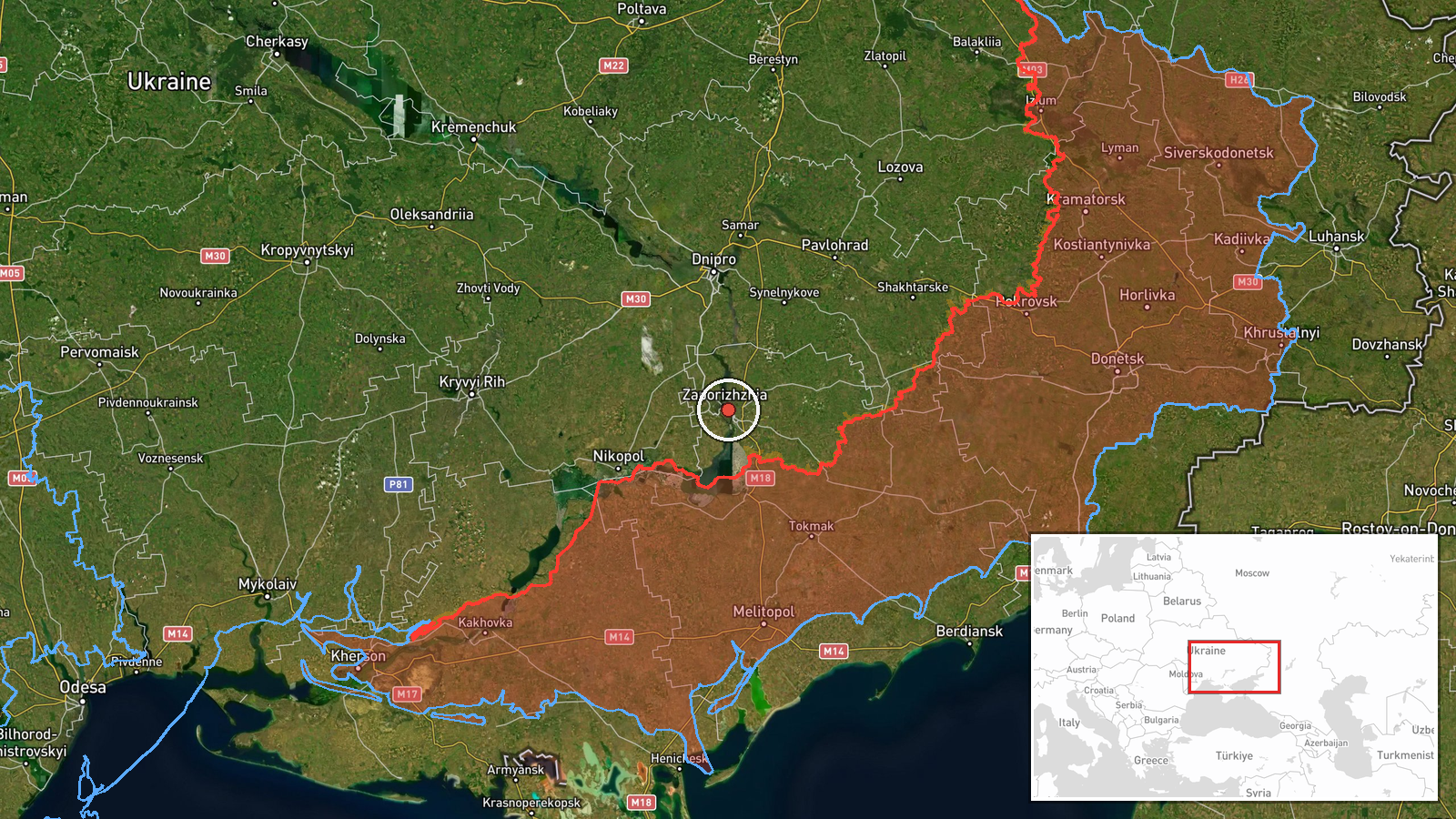
The coordinates, 47.84 N and 35.14 E, correspond to the center of Zaporizhzhia city. The location is recorded at settlement precision with high location confidence, because the alert names the city directly rather than a specific facility. Zaporizhzhia sits on the Dnipro River in southeastern Ukraine, on the edge of the steppe, with the large Kakhovka reservoir and its industrial districts to the south. The Zaporizhzhia nuclear power plant lies farther southwest, near Enerhodar, and is separate from this point.
Related events nearby
- Ukrainian air monitoring: 1 Russian Shahed-type drone heading toward Zaporizhzhia.2026-10-19 17:55 UTC · Drone Transit · Zaporizhzhia, Ukraine
- Ukrainian air monitoring: 1 Russian Shahed-type drone heading toward Zaporizhzhia.2026-10-19 16:08 UTC · Drone Transit · Zaporizhzhia, Ukraine
- Ukrainian air monitoring: 2+ Russian jet-powered Shahed (Geran-3) drones heading toward Zaporizhzhia.2026-10-19 14:02 UTC · Drone Transit · Zaporizhzhia, Ukraine
- Ukrainian air monitoring: 1 Russian guided glide bomb (KAB) heading toward Zaporizhzhya Oblast.2026-10-20 07:53 UTC · Airstrike · Zaporizhzhya Oblast, Ukraine
- Ukrainian air monitoring: 1 Russian guided glide bomb (KAB) heading toward Zaporizhzhya Oblast.2026-10-20 06:59 UTC · Airstrike · Zaporizhzhya Oblast, Ukraine
▶ View this event on the live map

Intel Mapper aggregates open-source reports from monitored Telegram and X channels, geolocates them, cross-checks duplicates across sources and assigns a confidence score. Entries are updated as new confirmations arrive. Read how we verify events.