Ukrainian air monitoring reports jet-powered Shahed drones heading toward Zaporizhzhia
What happened
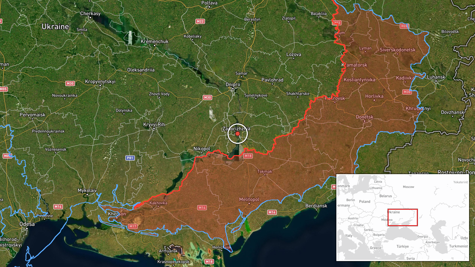
Ukrainian air monitoring reported at 14:02 UTC on 19 October 2026 that two or more jet-powered Shahed drones, identified in the summary as Geran-3 type, were heading toward the city of Zaporizhzhia from the north. The original Ukrainian-language post describes the objects as jet-powered UAVs moving toward the city from the north. It does not report impacts, damage, or casualties. The only listed source is a Telegram channel, @kpszsu, which is widely understood to be the official Ukrainian Air Force account. The entry is a transit warning, meaning it describes aerial movement rather than a confirmed strike on a specific target. The attack type is recorded as Drone Transit and the actor as Russia, a launch attribution consistent with the Geran family being Russian-operated.
Context and assessment
Zaporizhzhia is a major industrial city on the Dnipro River and a regional administrative center, and it has been struck repeatedly since the full-scale invasion. The same early-morning period logged a sequence of related warnings across the wider region. At 02:42 UTC a guided glide bomb was reported heading toward southern Dnipropetrovsk Oblast. At 02:44 a jet-powered Geran-3 was reported passing northern Zaporizhzhia heading west, and at 02:46 a ballistic missile and a glide bomb were reported toward Zaporizhzhia and its oblast. A further glide bomb warning followed at 03:22. Together these entries suggest a multi-axis effort combining standoff munitions and long-range drones across several oblasts within a few hours. Jet-powered Shaheds are generally assessed as faster and harder to intercept with older gun systems than piston-engine variants, so a later wave may be intended to saturate air defenses. That is an inference rather than something the report states. The afternoon approach from the north, roughly eleven hours after the early activity, could indicate a separate tasking rather than a continuation.
Sources and confidence
The report appears on a single channel, Telegram @kpszsu, which is widely understood to be the official Ukrainian Air Force account used for real-time air alerts. No independent outlet or second channel is listed, so cross-confirmation is absent. The confidence score of 8.0 reflects the official status of the channel and a specific, clearly worded description, offset by single-source reliance and the fact that the report describes a moving threat rather than a confirmed impact. Confidence would rise if a later air-force update, local military administration statement, or independent geolocated imagery confirmed drones in flight over the city. It would fall if subsequent updates revised the track or reported the drones heading elsewhere.
Location
The location is recorded at settlement precision, with coordinates placing the point at the city of Zaporizhzhia. The high confidence rating is supported because the city name appears directly in the original post. The city lies on the Dnipro River in southeastern Ukraine, in a flat steppe landscape. Nearby features include the river and the Kakhovka reservoir system to the south and west, and the Zaporizhzhia nuclear power plant near Enerhodar lies some distance to the southwest.
Related events nearby
- Ukrainian air monitoring: 1 Russian Shahed-type drone heading toward Zaporizhzhia.2026-10-19 17:55 UTC · Drone Transit · Zaporizhzhia, Ukraine
- Ukrainian air monitoring: 1 Russian Shahed-type drone heading toward Zaporizhzhia.2026-10-19 16:08 UTC · Drone Transit · Zaporizhzhia, Ukraine
- Ukrainian air monitoring: 1 Russian ballistic missile heading toward Zaporizhzhia.2026-10-19 02:46 UTC · Ballistic Missile · Zaporizhzhia, Ukraine
- Ukrainian air monitoring: 1 Russian guided glide bomb (KAB) heading toward Zaporizhzhya Oblast.2026-10-19 03:22 UTC · Airstrike · Zaporizhzhya Oblast, Ukraine
- Ukrainian air monitoring: 1 Russian guided glide bomb (KAB) heading toward Zaporizhzhya Oblast.2026-10-19 02:46 UTC · Airstrike · Zaporizhzhya Oblast, Ukraine
▶ View this event on the live map

Intel Mapper aggregates open-source reports from monitored Telegram and X channels, geolocates them, cross-checks duplicates across sources and assigns a confidence score. Entries are updated as new confirmations arrive. Read how we verify events.