Ukrainian air monitoring reports one Russian Shahed-type drone heading toward Zaporizhzhia
What happened
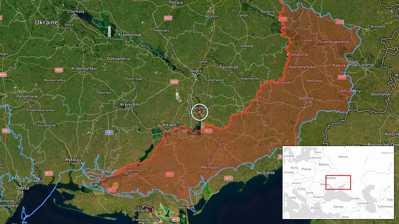
Ukraine's air monitoring channel on Telegram, @kpszsu, reported at 17:55 UTC on 19 October 2026 that one Russian Shahed-type attack drone was heading toward Zaporizhzhia from the south. The original Ukrainian wording describes a strike UAV approaching the city from the south, and the summary frames the event as a transit warning rather than a confirmed impact. The report does not state whether the drone was shot down, lost, or struck anything, and no damage, casualty, or outcome details appear in the post. The event is logged as a Drone Transit attributed to Russia, with the target recorded as the city of Zaporizhzhia in southeastern Ukraine.
Context and assessment
Zaporizhzhia is a major industrial city on the Dnipro River and a recurring target in the southern sector of the war, within reach of front-line areas and of the drone and glide-bomb routes used against the wider oblast. Its position makes it a logical objective for repeated long-range strikes aimed at infrastructure, logistics, and industrial sites, although the reports themselves name no specific target. The related events show a dense sequence on the same date. At 02:46 a ballistic missile was reported heading toward Zaporizhzhia, and a guided glide bomb was logged toward the surrounding oblast at 03:22. Later, at 14:02, two or more jet-powered Geran-3 drones were reported on the same approach, followed at 16:08 by a single Shahed-type drone and then by this 17:55 report. The pattern suggests layered activity across the day, combining missiles, glide bombs, and drones in separate waves rather than one large salvo. Operationally, staggered drone transits of this kind may be intended to sustain pressure, probe air defence coverage, or stretch interceptor stocks, but the data alone cannot establish which purpose applies. A single drone in a late-day report may also be a trailing element of an earlier group.
Sources and confidence
Only one channel, the Telegram account @kpszsu, carries this report, so there is no cross-confirmation. The channel is an official Ukrainian air monitoring feed that routinely posts early warnings, which supports its relevance, but it reports a heading rather than an outcome. The confidence score of 8.0 reflects a credible official origin and a clear target location, offset by the absence of independent corroboration. Confidence would rise with confirmation from another monitoring feed, regional military administration statements, or reports of impact. It would fall if later updates contradicted the heading or indicated the drone was never in the area.
Location
The location is recorded at settlement level, placed on the city of Zaporizhzhia itself, and location confidence is rated high because the report names a city rather than an ambiguous area. The city lies on the Dnipro River in southeastern Ukraine. The surrounding landscape is flat steppe with agricultural land, and the city's industrial zones and river crossings are notable features. The approach from the south means the drone's track crosses open country before reaching the urban area.
Related events nearby
- Ukrainian air monitoring: 1 Russian Shahed-type drone heading toward Zaporizhzhia.2026-10-19 16:08 UTC · Drone Transit · Zaporizhzhia, Ukraine
- Ukrainian air monitoring: 2+ Russian jet-powered Shahed (Geran-3) drones heading toward Zaporizhzhia.2026-10-19 14:02 UTC · Drone Transit · Zaporizhzhia, Ukraine
- Ukrainian air monitoring: 1 Russian ballistic missile heading toward Zaporizhzhia.2026-10-19 02:46 UTC · Ballistic Missile · Zaporizhzhia, Ukraine
- Ukrainian air monitoring: 1 Russian guided glide bomb (KAB) heading toward Zaporizhzhya Oblast.2026-10-19 03:22 UTC · Airstrike · Zaporizhzhya Oblast, Ukraine
- Ukrainian air monitoring: 1 Russian guided glide bomb (KAB) heading toward Zaporizhzhya Oblast.2026-10-19 02:46 UTC · Airstrike · Zaporizhzhya Oblast, Ukraine
▶ View this event on the live map

Intel Mapper aggregates open-source reports from monitored Telegram and X channels, geolocates them, cross-checks duplicates across sources and assigns a confidence score. Entries are updated as new confirmations arrive. Read how we verify events.