Ukraine reports one Russian guided glide bomb heading toward Zaporizhzhya Oblast
What happened
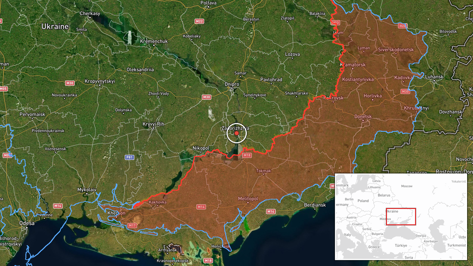
Ukrainian air monitoring reports that one Russian guided glide bomb, known as a KAB, was heading toward Zaporizhzhya Oblast in southeastern Ukraine. The alert was posted at 00:39 UTC on 20 October 2026 on the Telegram channel @kpszsu, which carries Ukrainian air alerts. The coordinates place the report at the city of Zaporizhzhia, although the source names only the oblast, so the exact point of impact is not stated. The original Ukrainian post is more general, describing repeated KAB launches toward Zaporizhzhya and Donetsk regions, but it gives no count, target, or result. No casualties or damage are described in the data, and the report has not been independently confirmed.
Context and assessment
Zaporizhzhia city sits on the Dnipro River, has repeatedly been within reach of Russian strikes, and lies within range of the front line to the south and east. Glide bombs are typically released by aircraft at a distance from their targets, so an alert of this kind indicates that aircraft are active in the area and launching munitions, not necessarily that a specific target has been chosen. The related events fit a recurring pattern. On 19 October, two separate KAB alerts toward Zaporizhzhya Oblast were logged at 02:46 and 03:22 UTC. During the afternoon and evening, three drone transits toward Zaporizhzhia were recorded, including one group of two or more jet-powered Shahed-type drones described as Geran-3. Taken together, the sequence suggests sustained pressure on the city over a short window, combining guided bombs and drones. Operationally, repeated glide bomb and drone activity may be intended to stretch air defenses, strike infrastructure or logistics nodes, or pressure populated areas, but the data alone does not show which purpose applies here.
Sources and confidence
The report rests on a single channel, the Telegram account @kpszsu, and no other source in the data confirms it. The confidence score of 8.0 reflects that the alert is specific about weapon type and direction and that the channel is a long-running source for air monitoring. It is held below the top of the scale because nothing independently verifies it and no impact is described. Confidence would rise with corroboration from other official Ukrainian channels, regional administration statements, or reported impacts, and would fall if the alert were withdrawn or contradicted by later updates. The record is not marked as corrected.
Location
The location is settlement-level with high confidence. The coordinates, roughly 47.84 N and 35.14 E, correspond to the city of Zaporizhzhia, which the record uses as its reference point, while the alert itself names the wider oblast, so the precise target area is approximate. The city lies on the Dnipro River in southeastern Ukraine, with industrial districts and the Dnipro reservoir system downstream to the south.
Related events nearby
- Ukrainian air monitoring: 1 Russian guided glide bomb (KAB) heading toward Zaporizhzhya Oblast.2026-10-19 03:22 UTC · Airstrike · Zaporizhzhya Oblast, Ukraine
- Ukrainian air monitoring: 1 Russian guided glide bomb (KAB) heading toward Zaporizhzhya Oblast.2026-10-19 02:46 UTC · Airstrike · Zaporizhzhya Oblast, Ukraine
- Ukrainian air monitoring: 1 Russian Shahed-type drone heading toward Zaporizhzhia.2026-10-19 17:55 UTC · Drone Transit · Zaporizhzhia, Ukraine
- Ukrainian air monitoring: 1 Russian Shahed-type drone heading toward Zaporizhzhia.2026-10-19 16:08 UTC · Drone Transit · Zaporizhzhia, Ukraine
- Ukrainian air monitoring: 2+ Russian jet-powered Shahed (Geran-3) drones heading toward Zaporizhzhia.2026-10-19 14:02 UTC · Drone Transit · Zaporizhzhia, Ukraine
▶ View this event on the live map

Intel Mapper aggregates open-source reports from monitored Telegram and X channels, geolocates them, cross-checks duplicates across sources and assigns a confidence score. Entries are updated as new confirmations arrive. Read how we verify events.