Ukrainian air monitoring tracks one jet-powered Shahed drone west of Poltava, heading south
What happened
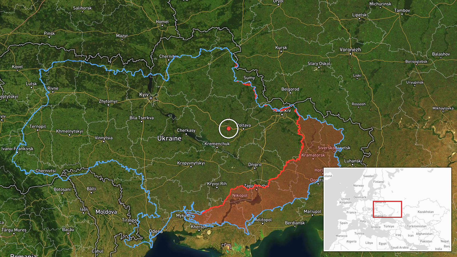
Ukraine's air monitoring channel on Telegram, @kpszsu, reported on 19 October 2026 at 20:59 UTC that one Russian jet-powered Shahed drone, identified in the report as a Geran-3, was tracked west of Poltava on a southern heading. The original Ukrainian wording describes a jet-type UAV on a southern course, a routine monitoring notice rather than a description of impact. The report names no settlement, no target, and no damage or casualties. It is one of several Shahed transit notices issued that day for Poltava Oblast and neighbouring areas, summarised in the related events. Because the notice comes from a single channel and gives only an approximate position, the track should be read as reported rather than independently verified.
Context and assessment
Poltava Oblast sits in central Ukraine on the forest-steppe, and the area around it, including the Kremenchuk industrial zone on the Dnipro to the southwest, has repeatedly appeared in air alerts during long-range drone campaigns. The earlier notices that day show a sequence rather than an isolated sighting. Shortly after 02:41 UTC a Shahed-type drone was reported moving from northern Poltava Oblast toward Pyryatyn. Later, Geran-3 drones were reported near Novi Sanzhary at 15:02, passing Poltava Oblast heading northwest at 17:03, passing Semenivka heading west at 17:56 in a group of two or more, and heading toward Kremenchuk at 18:46. The 20:59 notice places a single jet-powered drone west of Poltava on a southern heading. Taken together, the pattern suggests drones moving through central Ukraine on several headings, with some tracks turning and others continuing. This may reflect multiple launch axes or redirection in flight. Notices of this kind usually indicate that flights are being tracked for air-defence purposes rather than that a specific target has been identified. The southern heading could point toward areas further south, but the data does not confirm a destination, and the reports should not be read as evidence of a particular strike plan.
Sources and confidence
The notice was issued by the Ukrainian Air Force monitoring channel on Telegram, @kpszsu, and it is the only source listed. There is no cross-confirmation from a second channel, wire service, or official statement. The confidence score of 8.0 reflects a credible, routinely used official channel that reports tracks individually, offset by single-source status and the absence of independent corroboration. The score would rise if a second Ukrainian or independent monitoring source reported the same track, or if official air force or regional military administration statements confirmed the sequence. It would fall if later reporting contradicted the heading or reclassified the drone.
Location
The location is approximate. The source gives only west of Poltava within Poltava Oblast, so the coordinates of 49.6 north and 33.9 east mark a regional point west of Poltava city rather than a settlement or facility, and location confidence is low. The setting is flat to gently rolling forest-steppe with river valleys. The Vorskla River runs through Poltava city, and the Dnipro reservoir system lies to the southwest near Kremenchuk. Treat the point as a general area, not a precise track position.
Related events nearby
- Ukrainian air monitoring: 1 Russian jet-powered Shahed (Geran-3) drone from Poltava Oblast toward Novi Sanzhar2026-10-19 15:02 UTC · Drone Transit · Novi Sanzhary, Ukraine
- Ukrainian air monitoring: 1 Russian jet-powered Shahed (Geran-3) drone passing Poltava Oblast, heading northwe2026-10-19 17:03 UTC · Drone Transit · Poltava Oblast, Ukraine
- Ukrainian air monitoring: 2+ Russian jet-powered Shahed (Geran-3) drones passing Semenivka, heading west.2026-10-19 17:56 UTC · Drone Transit · Semenivka, Ukraine
- Ukrainian air monitoring: 1 Russian jet-powered Shahed (Geran-3) drone heading toward Kremenchuk.2026-10-19 18:46 UTC · Drone Transit · Kremenchuk, Ukraine
- Ukrainian air monitoring: 1 Russian Shahed-type drone from northern Poltava Oblast toward Pyryatyn.2026-10-19 02:41 UTC · Drone Transit · Pyryatyn, Ukraine
▶ View this event on the live map

Intel Mapper aggregates open-source reports from monitored Telegram and X channels, geolocates them, cross-checks duplicates across sources and assigns a confidence score. Entries are updated as new confirmations arrive. Read how we verify events.