Geran-3 jet drone reported over Poltava Oblast heading northwest, Ukrainian air monitoring says
What happened
Ukrainian air monitoring, relayed through the Telegram channel @kpszsu, reported on 19 October 2026 at 17:03 UTC that one Russian jet-powered Shahed, designated Geran-3, was passing near Kobeliaky in Poltava Oblast and heading northwest. The original post, written in Ukrainian, describes a jet-powered unmanned aerial vehicle and names Kobeliaky as the point the drone passed. The report describes a transit rather than a strike and does not mention impact, damage, casualties or any ground target. The attribution to Russia and the drone type come from the channel's own identification, not from wreckage or independent imagery. Because the report is a single short notice, its track and timing should be treated as provisional until other monitoring sources or official statements confirm them.
Context and assessment
Poltava Oblast lies in central Ukraine, east of the Dnipro, and contains road and rail corridors, energy infrastructure and industrial sites that have appeared repeatedly in Russian long-range strike campaigns. The same day produced a cluster of related reports. Earlier on 19 October, a Geran-3 was logged moving from Kharkiv Oblast toward Birky at 14:01 UTC, and another from Dnipropetrovsk Oblast toward Samar at 16:52 UTC. A separate Geran-3 was reported from Poltava Oblast toward Novi Sanzhary at 15:02 UTC, placing the Kobeliaky sighting within a sequence of drones moving through the same general area. On 18 October, Banderol mini cruise missiles were reported over Myrhorod, with one passing Okhtyrka en route, suggesting a northeast-to-central approach path was in use the previous day. Taken together, the pattern points to a multi-axis raid or a sustained series of launches in which drones are routed across the region rather than aimed at one site. Operationally, transit reports like this mainly serve air defence units and civilians for alert purposes. They cannot on their own establish intended targets, and a drone reported northwest of Kobeliaky may be headed toward any of several areas further along that bearing.
Sources and confidence
The report rests on a single Telegram channel, @kpszsu, with a source count of one and no corroboration from a second outlet in the supplied data. The confidence score of 8.0 is relatively high for a single source, reflecting the channel's established role in relaying Ukrainian air monitoring and the consistency of its timing with other reports from the same day. It is not higher because no wire service, second monitoring feed or official statement with a matching track has been found. Confidence would rise if another Ukrainian or regional channel reported the same track, or if local authorities confirmed drone activity near Kobeliaky. It would fall if later reporting changed the drone type, direction or location.
Location
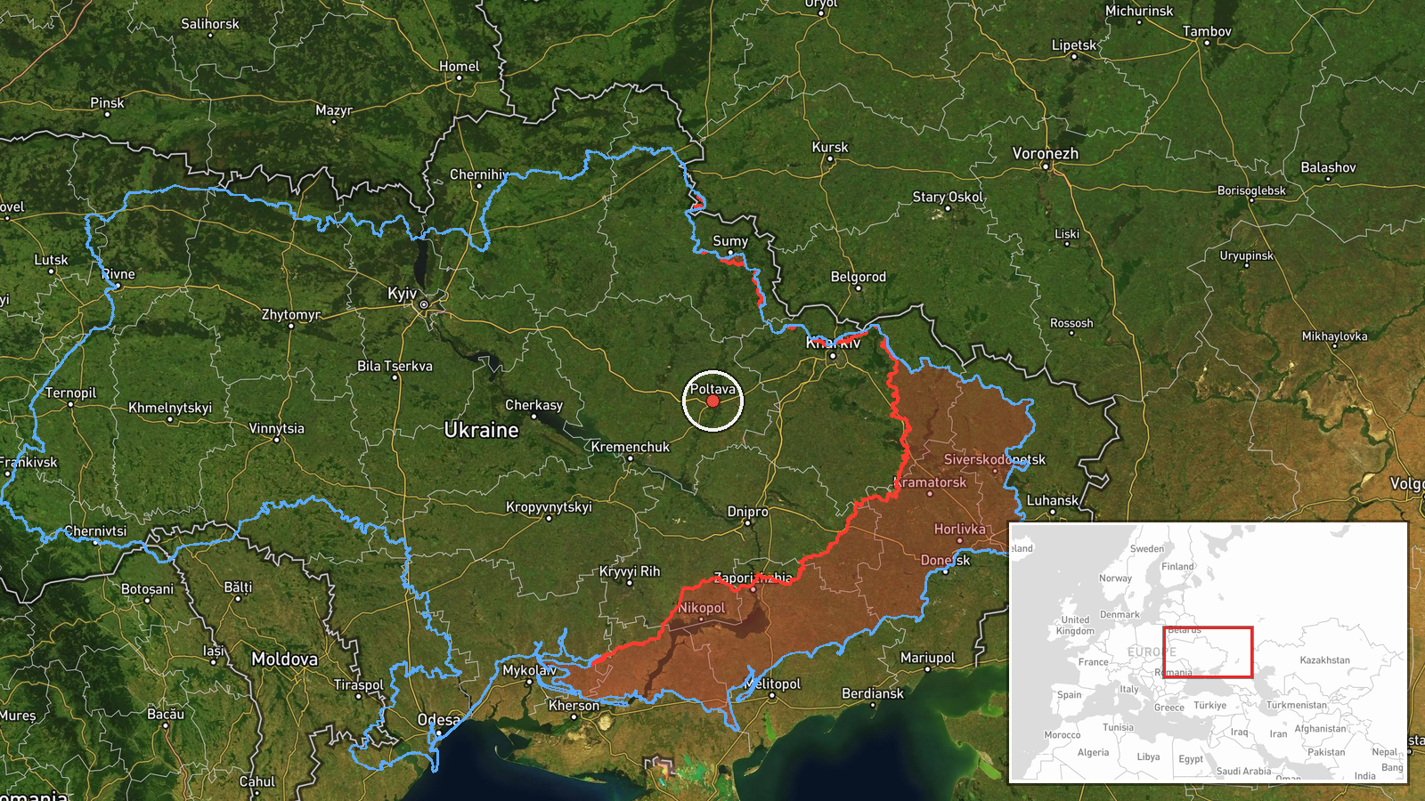
The location is recorded as Poltava Oblast at region level, with low location confidence. The coordinates are an approximate regional point rather than the position of Kobeliaky, so the map marker should not be read as a precise track or target. Kobeliaky, a small town in the oblast, was named in the original post, but the marker does not resolve to it. The oblast is largely flat steppe and farmland, drained by river systems including the Vorskla and Psel, with the Dnipro lying to its west.
Related events nearby
- Ukrainian air monitoring: 1 Russian jet-powered Shahed (Geran-3) drone from Poltava Oblast toward Novi Sanzhar2026-10-19 15:02 UTC · Drone Transit · Novi Sanzhary, Ukraine
- Ukrainian air monitoring: 1 Russian Banderol mini cruise missile passing Okhtyrka, heading toward Myrhorod.2026-10-18 19:14 UTC · Cruise Missile · Myrhorod, Ukraine
- Ukrainian air monitoring: 2+ Russian jet-powered Shahed (Geran-3) drones passing Semenivka, heading west.2026-10-19 17:56 UTC · Drone Transit · Semenivka, Ukraine
- Ukrainian air monitoring: 1 Russian jet-powered Shahed (Geran-3) drone heading toward Kremenchuk.2026-10-19 18:46 UTC · Drone Transit · Kremenchuk, Ukraine
- Ukrainian air monitoring: 1 Russian jet-powered Shahed (Geran-3) drone from Kharkiv Oblast toward Birky.2026-10-19 14:01 UTC · Drone Transit · Birky, Ukraine
▶ View this event on the live map

Intel Mapper aggregates open-source reports from monitored Telegram and X channels, geolocates them, cross-checks duplicates across sources and assigns a confidence score. Entries are updated as new confirmations arrive. Read how we verify events.