Jet-powered Shahed drones reported heading toward Bilyky, Poltava Oblast
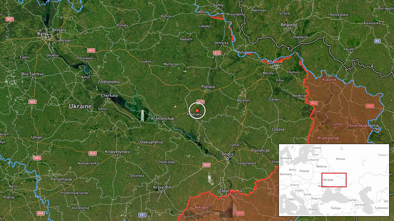
What happened
Ukraine's Air Force Telegram channel (@kpszsu) reported on 20 October 2026 at 13:10 UTC that at least two Russian jet-powered Shahed (Geran-3) drones were on a course toward Bilyky, a settlement in Poltava Oblast in central Ukraine. The original Ukrainian post, opened with a motorcycle emoji, reads "реактивні БпЛА курсом на Білики та Хорол," meaning jet-type unmanned aerial vehicles heading for Bilyky and Khorol. The English summary says "2+" drones, while the Ukrainian text names two destinations, so this is a transit warning rather than a confirmed strike. The report describes no impact, casualties, or damage. It does not say whether the drones were later engaged or lost track of.
Context and assessment
Bilyky sits west of Poltava city, within a region that Russian long-range drones have repeatedly crossed on their way deeper into Ukraine. The related events show a steady pattern in the same oblast over roughly 24 hours. On 19 October, a single Geran-3 was reported from Poltava Oblast toward Novi Sanzhary at 15:02 UTC, and another was tracked west of Poltava heading south at 20:59. On 20 October, further single drones were logged passing Poltava district at 04:02 and Poltava Oblast heading west at 05:40. The 17:03 report on 19 October described a drone heading northwest. The headings vary, which may reflect drones changing course or flying different routes through the same airspace. Operationally, this suggests sustained transit through central Ukraine rather than one isolated raid. A group of two or more drones heading toward a settlement could indicate a deliberate route toward a target further west or north, or simply a corridor being used. Because the monitoring reports only track movement, the intended target cannot be determined from this data.
Sources and confidence
The only source is the official Telegram channel of the Air Force of the Armed Forces of Ukraine, which publishes real-time air-threat tracking. No second outlet or independent confirmation appears in the data, so the report rests on one channel. The confidence score of 8.0 is high because the source is an official military monitoring feed and the related reports form a consistent pattern. It is not higher because the count is uncertain ("2+") and the destination list differs between languages. Confidence would rise with corroboration from Ukrainian regional authorities, impact reports, or wreckage findings. It would fall if later updates revised the drone count or reported that the tracks were false.
Location
The coordinates are at settlement level for Bilyky, a village in western Poltava Oblast in central Ukraine, and the location confidence is rated high. The point is approximate to the settlement centre and does not indicate a specific facility. The area is flat agricultural steppe drained by rivers such as the Vorskla. The location is about 40 km west of Poltava city, and Khorol, the second destination named in the Ukrainian post, lies nearby to the northwest.
Related events nearby
- Ukrainian air monitoring: 1 Russian jet-powered Shahed (Geran-3) drone from Poltava Oblast toward Novi Sanzhar2026-10-19 15:02 UTC · Drone Transit · Novi Sanzhary, Ukraine
- Ukrainian air monitoring: 1 Russian jet-powered Shahed (Geran-3) drone passing Poltava Oblast, heading west.2026-10-20 05:40 UTC · Drone Transit · Poltava Oblast, Ukraine
- Ukrainian air monitoring: 1 Russian jet-powered Shahed (Geran-3) drone passing Poltava Oblast, heading northwe2026-10-19 17:03 UTC · Drone Transit · Poltava Oblast, Ukraine
- Ukrainian air monitoring: 1 Russian jet-powered Shahed (Geran-3) drone passing Poltava district, heading west.2026-10-20 04:02 UTC · Drone Transit · Poltava district, Ukraine
- Ukrainian air monitoring: one Russian jet-powered Shahed (Geran-3) drone tracked west of Poltava, heading sout2026-10-19 20:59 UTC · Drone Transit · West of Poltava, Poltava Oblast, Ukraine
▶ View this event on the live map

Intel Mapper aggregates open-source reports from monitored Telegram and X channels, geolocates them, cross-checks duplicates across sources and assigns a confidence score. Entries are updated as new confirmations arrive. Read how we verify events.