Single jet-powered Geran-3 drone reported transiting Poltava district heading west
What happened
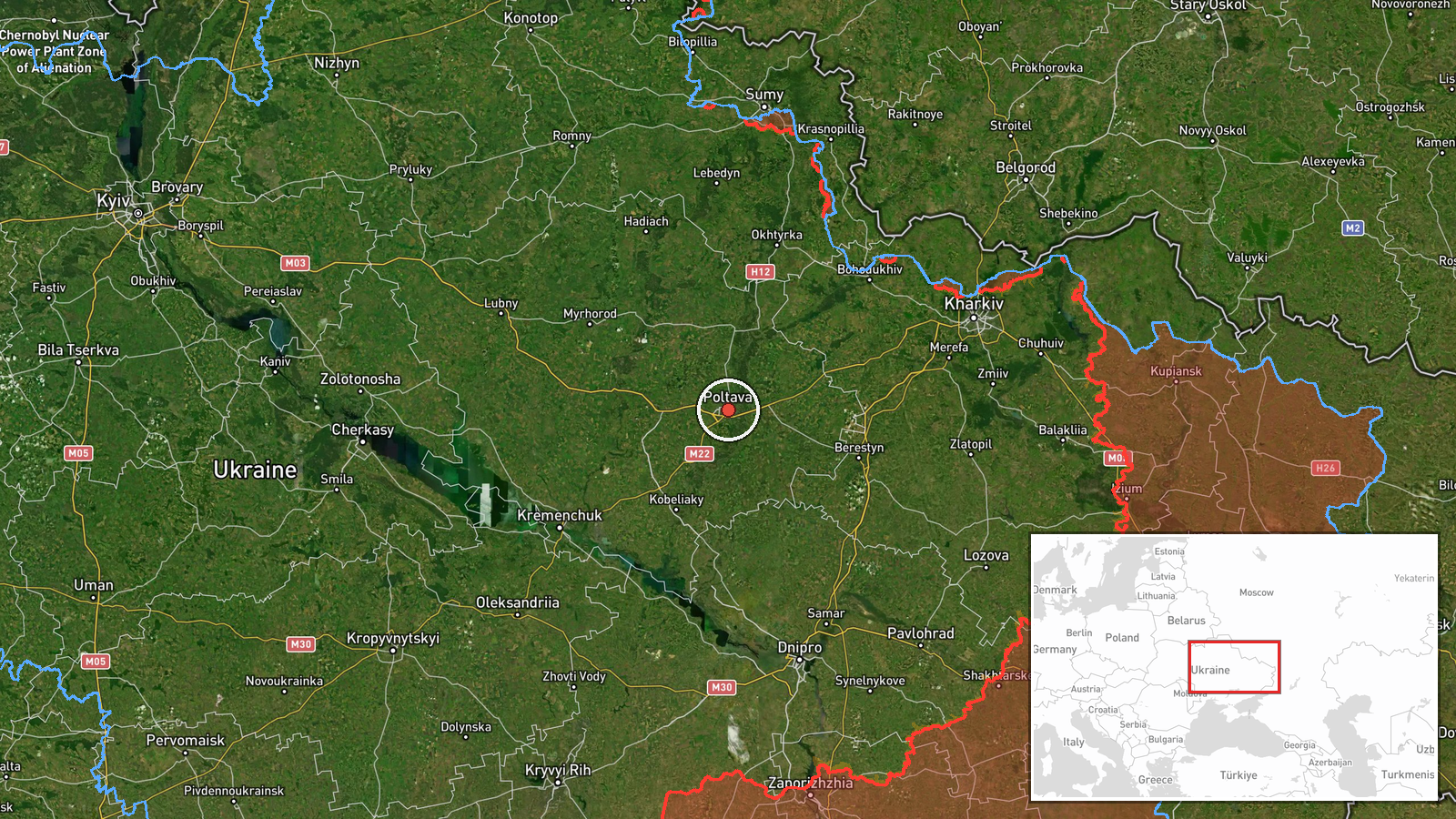
Ukrainian air monitoring channel @kpszsu reported on Telegram that one Russian jet-powered Shahed (Geran-3) drone was passing through Poltava district in central Ukraine, moving in a western direction. The report was timestamped 04:02 UTC on 20 October 2026. The original post, written in Ukrainian, uses the phrase 'Реактивний БпЛА' (jet-powered unmanned aerial vehicle) and an arrow indicating westward travel, without describing any impact, strike, or damage. The wording is brief and records only the track of the object. No casualties, targets, or interceptions are mentioned in the source text, and the event is classed here as a drone transit rather than a strike.
Context and assessment
Poltava sits in central Ukraine, on the routes that Russian long-range drones have repeatedly used to move between the east and the west of the country. Earlier reports on 19 and 20 October 2026 place Geran-3 drones over several points in the same oblast, including Semenivka, Novi Sanzhary, Myrhorod, and the area west of Poltava city. Several tracks moved in different directions, some heading northwest, south, north, and west, which suggests the drones were not all following one simple corridor. The sequence of repeated transits across a single oblast over roughly eleven hours may indicate route probing, navigation through a corridor of Ukrainian air defence coverage, or drones moving toward targets farther west. The reports alone do not reveal which of these explanations applies. The pattern is consistent with a sustained campaign of long-range drone use rather than an isolated flight, but the monitoring data does not show where any drone ultimately went.
Sources and confidence
The event rests on a single Telegram channel, @kpszsu, which relays Ukrainian air monitoring alerts. No independent outlet or second channel is recorded in the data for this specific transit. The confidence score of 8.0 reflects a credible official monitoring source with a clear and specific description, offset by the lack of cross-confirmation and the single-channel basis. Confidence would rise if regional air force or Ukrainian government statements, or a second monitoring channel, confirmed the same track. It would fall if later reporting contradicted the drone type, direction, or location, or if the track proved to be a different aerial object.
Location
The coordinates correspond to the Poltava district at the settlement level, with a high location confidence rating in the data. The point is an approximate district-centre placement rather than a precise facility, since the source names only the district. Poltava district lies in the flat, fertile plains of central Ukraine, drained by several rivers that flow into the Dnipro basin. The area is largely agricultural, with scattered settlements and a dense road and rail network. Poltava city, the regional centre, lies to the southeast of the district, and the nearby towns named in related reports are spread across the oblast.
Related events nearby
- Ukrainian air monitoring: 1 Russian jet-powered Shahed (Geran-3) drone passing Poltava Oblast, heading northwe2026-10-19 17:03 UTC · Drone Transit · Poltava Oblast, Ukraine
- Ukrainian air monitoring: 1 Russian jet-powered Shahed (Geran-3) drone from Poltava Oblast toward Novi Sanzhar2026-10-19 15:02 UTC · Drone Transit · Novi Sanzhary, Ukraine
- Ukrainian air monitoring: one Russian jet-powered Shahed (Geran-3) drone tracked west of Poltava, heading sout2026-10-19 20:59 UTC · Drone Transit · West of Poltava, Poltava Oblast, Ukraine
- Ukrainian air monitoring: 1 Russian Shahed-type drone passing Myrhorod, heading north.2026-10-20 00:37 UTC · Drone Transit · Myrhorod, Ukraine
- Ukrainian air monitoring: 2+ Russian jet-powered Shahed (Geran-3) drones passing Semenivka, heading west.2026-10-19 17:56 UTC · Drone Transit · Semenivka, Ukraine
▶ View this event on the live map

Intel Mapper aggregates open-source reports from monitored Telegram and X channels, geolocates them, cross-checks duplicates across sources and assigns a confidence score. Entries are updated as new confirmations arrive. Read how we verify events.