Single Russian drone reported transiting Myrhorod, Poltava Oblast, heading north, per Ukrainian air monitoring
What happened
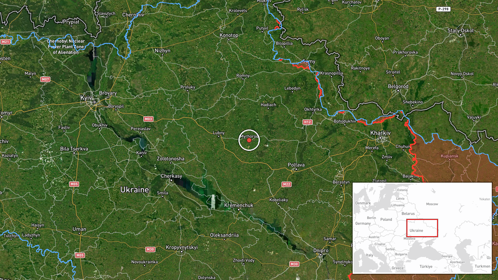
Ukrainian air monitoring reported at 00:37 UTC on 20 October 2026 that one unmanned aerial vehicle was passing Myrhorod in Poltava Oblast and heading north. The original Ukrainian-language message uses the term БпЛА (unmanned aerial vehicle) and does not name a model. The Shahed-type classification appears in the event summary, not in the original wording. The report describes a drone transit rather than a strike, and no impact, casualties, or damage are mentioned. The alert was published on a single Telegram channel, @kpszsu, and had not been independently confirmed by another outlet at the time of writing.
Context and assessment
Myrhorod lies southeast of Poltava city in central-eastern Ukraine, a region that has appeared repeatedly in recent monitoring. Earlier on 19 October, the related events record several drone tracks through the same oblast. A single Shahed-type drone was reported from northern Poltava Oblast toward Pyryatyn in the early hours. Later the same day, a jet-powered Geran-3 was reported from Poltava Oblast toward Novi Sanzhary, two or more Geran-3 drones passed Semenivka heading west, another was reported passing the oblast heading northwest, and one was tracked west of Poltava heading south. The tracks point in several directions across roughly eighteen hours, which suggests drones moving through central Ukraine along varied routes rather than a single fixed corridor. Operationally, such transits may reflect reconnaissance, route testing, or the use of decoys, but the data does not establish a target or intent. The northward heading from Myrhorod is consistent with movement away from the southern part of the oblast, though the track's destination is unknown. The shift from jet-powered Geran-3 labels to a generic Shahed-type label likely reflects differences in reporting detail rather than a confirmed change in aircraft.
Sources and confidence
All information comes from one Telegram channel, @kpszsu, which gives a clear settlement reference and direction of travel. Because no second outlet has confirmed the track, cross-confirmation is absent. The confidence score of 8.0 reflects a specific location, a recognizable reporting format, and consistency with the surrounding Poltava Oblast alerts, offset by reliance on one source and a generic aircraft description. Confidence would rise with independent corroboration from other monitoring channels, radar-based reporting, or confirmed wreckage in the area. It would fall if the channel corrected or withdrew the message, or if later reporting placed the track elsewhere.
Location
The location is recorded at settlement level with high location confidence. The coordinates, approximately 49.96 N and 33.61 E, place the point within the town of Myrhorod, which is in Poltava Oblast in central-eastern Ukraine. The town sits on the Khorol River in flat steppe and lowland terrain, roughly fifty kilometres from Poltava city. The event does not refer to a facility or installation, so the point represents the settlement as a whole.
Related events nearby
- Ukrainian air monitoring: one Russian jet-powered Shahed (Geran-3) drone tracked west of Poltava, heading sout2026-10-19 20:59 UTC · Drone Transit · West of Poltava, Poltava Oblast, Ukraine
- Ukrainian air monitoring: 2+ Russian jet-powered Shahed (Geran-3) drones passing Semenivka, heading west.2026-10-19 17:56 UTC · Drone Transit · Semenivka, Ukraine
- Ukrainian air monitoring: 1 Russian jet-powered Shahed (Geran-3) drone passing Poltava Oblast, heading northwe2026-10-19 17:03 UTC · Drone Transit · Poltava Oblast, Ukraine
- Ukrainian air monitoring: 1 Russian Shahed-type drone from northern Poltava Oblast toward Pyryatyn.2026-10-19 02:41 UTC · Drone Transit · Pyryatyn, Ukraine
- Ukrainian air monitoring: 1 Russian jet-powered Shahed (Geran-3) drone from Poltava Oblast toward Novi Sanzhar2026-10-19 15:02 UTC · Drone Transit · Novi Sanzhary, Ukraine
▶ View this event on the live map

Intel Mapper aggregates open-source reports from monitored Telegram and X channels, geolocates them, cross-checks duplicates across sources and assigns a confidence score. Entries are updated as new confirmations arrive. Read how we verify events.