Single Russian Geran-3 jet drone reported transiting Poltava Oblast heading west
What happened
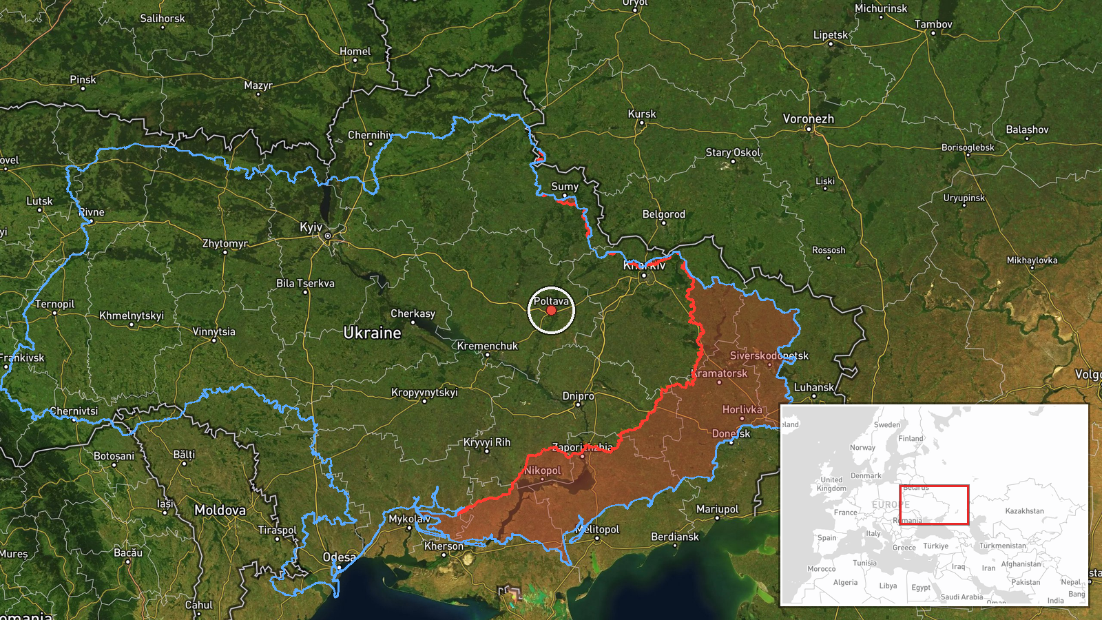
Ukrainian air monitoring reported one Russian jet-powered Shahed, designated Geran-3, passing Poltava Oblast on 20 October 2026 at about 05:40 UTC and heading west. The original Ukrainian-language post, published by the Telegram channel @kpszsu, describes a jet-type drone passing near Lubenshchyna in Poltava region and moving in a westerly direction. The post names no impact point and reports no damage, casualties or interception. Because the report comes from a single channel, the detail is best treated as a monitoring observation rather than a confirmed event. The map places the marker at regional level only, reflecting the general area named in the post rather than a precise track coordinate.
Context and assessment
This report belongs to a cluster of five Geran-3 transit reports across Poltava Oblast within roughly thirteen hours on 19 and 20 October. The earliest, at 15:02 on 19 October, tracked a drone from Poltava Oblast toward Novi Sanzhary. A later report at 17:03 described a northwest heading, followed by a sighting west of Poltava at 20:59 with a southerly heading. A Shahed-type drone was then reported passing Myrhorod at 00:37 heading north, and another Poltava-district sighting at 04:02 showed a westward course, consistent with the present report. Multiple tracks crossing the same central oblast over a single day suggest either several drones operating in the area or a single airframe whose heading changed repeatedly, though the reports cannot distinguish between these. Shifts in direction are typical of drones being rerouted, loitering or re-tasked, and repeated passage through the region may indicate sustained use of the corridor rather than a single one-off flight. Poltava sits on major road and rail links in central Ukraine, which helps explain why monitoring networks report transits here frequently. These are hedged inferences from the data and should not be read as confirmed intent or target selection.
Sources and confidence
All five related reports come from Ukrainian air monitoring feeds, and this item rests on one Telegram channel, @kpszsu, with no independent cross-confirmation in the dataset. Single-channel monitoring posts are generally reliable for the existence of an airborne track but less reliable for precise position and timing. The confidence score of 8.0 reflects that the source is official-channel monitoring with a consistent pattern across related reports, offset by the absence of a second source and by the lack of precise coordinates. Confidence would rise with corroboration from another monitoring source or a matching regional air alert, and would fall if the cluster were found to reflect duplicated reporting of a single drone.
Location
The marker sits at the approximate centre of Poltava Oblast, with precision recorded only at regional level and location confidence rated low. The post refers to the Lubenshchyna area, but no settlement-level coordinate was supplied, so the point should be read as a general reference. Poltava Oblast is a flat, largely agricultural region of central-eastern Ukraine, drained by the Vorskla and other tributaries of the Dnipro. The terrain offers few natural barriers to low-flying drones, and the oblast is crossed by major transport corridors.
Related events nearby
- Ukrainian air monitoring: 1 Russian jet-powered Shahed (Geran-3) drone passing Poltava Oblast, heading northwe2026-10-19 17:03 UTC · Drone Transit · Poltava Oblast, Ukraine
- Ukrainian air monitoring: 1 Russian jet-powered Shahed (Geran-3) drone passing Poltava district, heading west.2026-10-20 04:02 UTC · Drone Transit · Poltava district, Ukraine
- Ukrainian air monitoring: 1 Russian jet-powered Shahed (Geran-3) drone from Poltava Oblast toward Novi Sanzhar2026-10-19 15:02 UTC · Drone Transit · Novi Sanzhary, Ukraine
- Ukrainian air monitoring: one Russian jet-powered Shahed (Geran-3) drone tracked west of Poltava, heading sout2026-10-19 20:59 UTC · Drone Transit · West of Poltava, Poltava Oblast, Ukraine
- Ukrainian air monitoring: 1 Russian Shahed-type drone passing Myrhorod, heading north.2026-10-20 00:37 UTC · Drone Transit · Myrhorod, Ukraine
▶ View this event on the live map

Intel Mapper aggregates open-source reports from monitored Telegram and X channels, geolocates them, cross-checks duplicates across sources and assigns a confidence score. Entries are updated as new confirmations arrive. Read how we verify events.