Jet-powered Shahed drone reported transiting Oleksandriia district, Kirovohrad Oblast
What happened
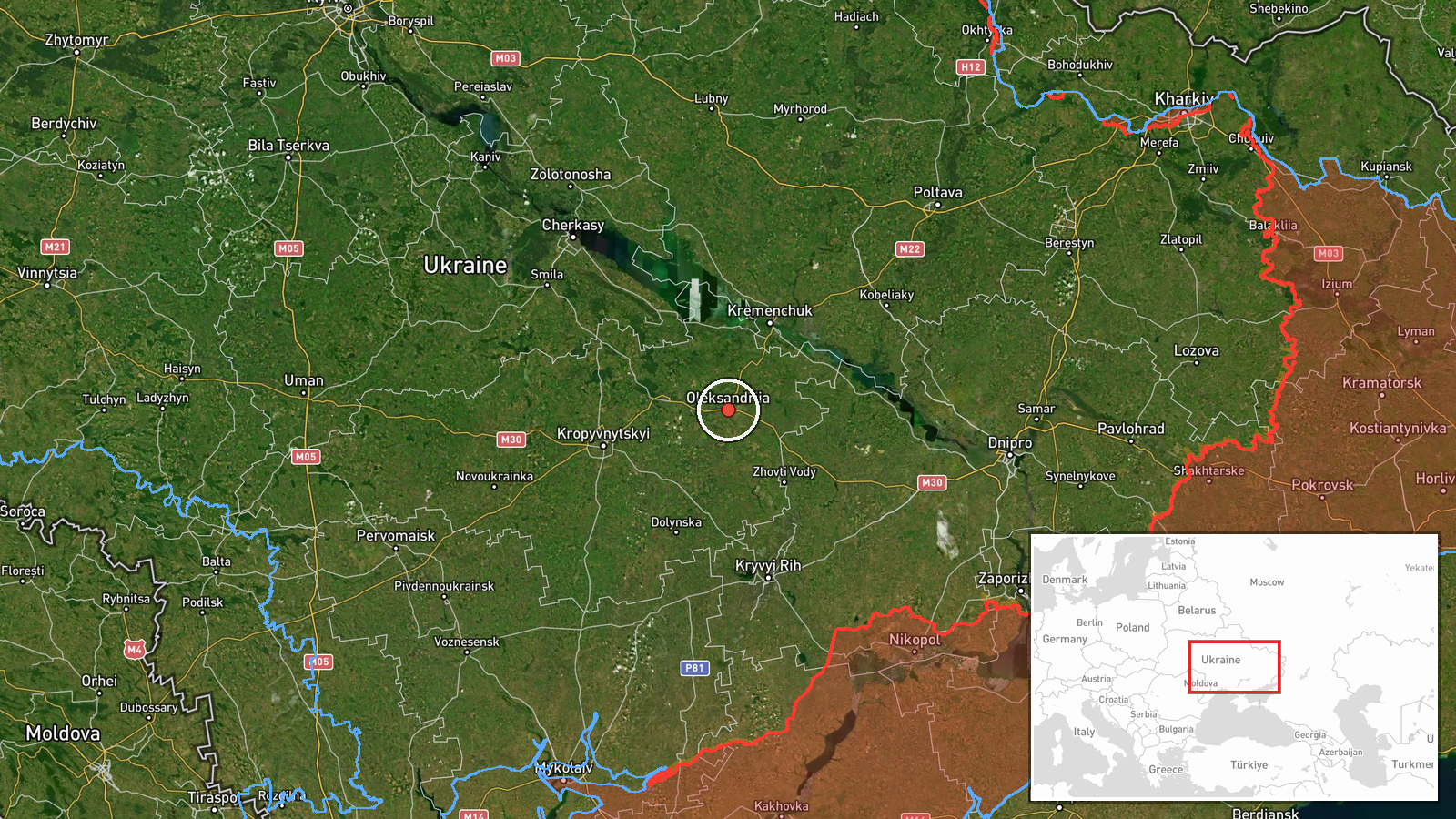
Ukrainian air monitoring, reported through the Telegram channel @kpszsu, stated that one Russian jet-powered Shahed, described in the report as a Geran-3, was passing through Oleksandriia district in Kirovohrad Oblast and heading northwest. The event is timestamped 20 October 2026 at 01:25 UTC. The source wording refers to a 'реактивний БпЛА' (jet-powered unmanned aerial vehicle) moving in a northwest direction. The report does not mention impact, damage, casualties, or a specific target. It is a transit notice rather than a strike report, and the attribution to Russia comes from the channel's framing in the event data.
Context and assessment
Oleksandriia district sits in a corridor of central Ukraine that Shahed-type drones have crossed repeatedly in the days before this report. Between 19 and 20 October 2026, monitoring entries place similar jet-powered Geran-3 drones over Kropyvnytskyi, Adzhamka, Kremenchuk, north of Kryvyi Rih, and central Kirovohrad Oblast, with headings that shift between west and northwest. Kremenchuk, with its large hydroelectric dam and industrial base, has been a recurring name in this kind of reporting across the wider conflict. The sequence consists of single-aircraft or small-group tracks moving along a similar axis rather than a concentrated salvo against one aim point. Operationally, this pattern may indicate long-range drones routed through central Ukraine toward targets further west or north, with each stage observed and reported by air-warning networks. Such a pattern does not by itself reveal the intended target, and the record does not show whether any drone reached or struck a site. Analysts would normally look for follow-on impact reports along the same corridor before judging whether these transits were precursors to attacks.
Sources and confidence
Only one channel, Telegram @kpszsu, appears in this record, and the source count is one. No independent outlet, second monitoring account, or radar feed cross-confirms this specific track, so the confidence score of 8.0 reflects a credible monitoring post with no corroboration. That score supports publishing the item as a transit report but leaves doubt about the exact track and timing. Confidence would rise if a second air-warning source or a regional military administration reported the same track. It would fall if the channel corrected the heading, altitude, or drone designation, or if later reports contradicted the timing.
Location
The coordinates are set at settlement precision for Oleksandriia district, and the location confidence is rated high. The marker represents an area-level placement inside Kirovohrad Oblast in central Ukraine rather than a specific facility or the exact flight path of the drone. The district lies in the central-southern part of the oblast, on relatively flat steppe terrain drained by tributaries of the Dnipro basin. Readers should treat the marker as the district as a whole, not a precise position.
Related events nearby
- Ukrainian air monitoring: 1 Russian jet-powered Shahed (Geran-3) drone passing Nova Praha, heading northwest.2026-10-20 01:31 UTC · Drone Transit · Nova Praha, Ukraine
- Ukrainian air monitoring: 1 Russian jet-powered Shahed (Geran-3) drone passing Kropyvnytskyi, heading toward A2026-10-19 03:19 UTC · Drone Transit · Adzhamka, Ukraine
- Ukrainian air monitoring: 1 Russian jet-powered Shahed (Geran-3) drone heading toward Kremenchuk.2026-10-19 18:46 UTC · Drone Transit · Kremenchuk, Ukraine
- Ukrainian air monitoring: 1 Russian jet-powered Shahed (Geran-3) drone passing north of Kryvyi Rih, heading we2026-10-19 03:30 UTC · Drone Transit · north of Kryvyi Rih, Ukraine
- Ukrainian air monitoring: jet-powered Shahed (Geran-3) drones tracked over central Kirovohrad Oblast, heading 2026-10-19 04:43 UTC · Drone Transit · Central Kirovohrad Oblast, Ukraine
▶ View this event on the live map

Intel Mapper aggregates open-source reports from monitored Telegram and X channels, geolocates them, cross-checks duplicates across sources and assigns a confidence score. Entries are updated as new confirmations arrive. Read how we verify events.