Single jet-powered Shahed (Geran-3) drone reported transiting north of Kryvyi Rih, heading west
What happened
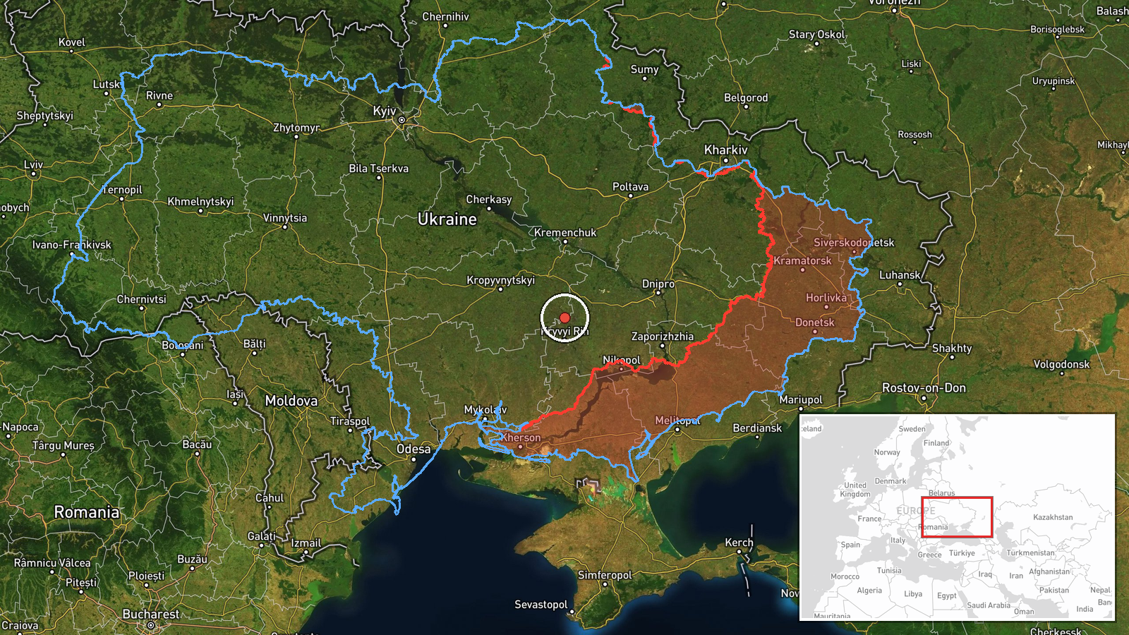
Ukrainian air monitoring channel @kpszsu reported on Telegram that one Russian jet-powered Shahed (Geran-3) drone was passing north of Kryvyi Rih in central Ukraine's Dnipropetrovsk region, travelling on a westward course. The report was posted with a timestamp of 19 October 2026, 03:30 UTC. The original Ukrainian wording describes a 'jet-powered UAV' (Реактивний БпЛА) on a course to the west, with no reported impact, damage or casualties. The message is a brief transit notice rather than a strike report. Because it comes from a single channel, the sighting is recorded as reported and has not been independently verified.
Context and assessment
Kryvyi Rih is a large industrial city and a recurring focus of Russian long-range strikes, given its steel and mining base and its position on the central front's rear corridor. The event sits within a cluster of related reports from 18 and 19 October 2026. On 18 October, a mini cruise missile group was tracked passing Apostolove toward Kryvyi Rih, and several Geran-3 drones were logged across Dnipropetrovsk, Mykolaiv and Kirovohrad oblasts, some moving toward Krynychky, Novyi Buh and Adzhamka. Early on 19 October, another Geran-3 was tracked near Kropyvnytskyi heading toward Adzhamka, and a further drone was logged in southern Kirovohrad Oblast heading north. The pattern suggests sustained, multi-axis drone traffic crossing central and southern Ukraine, with the westward track possibly indicating routes toward western or southwestern targets rather than a single aim point. Transit reports of this kind are typically used by air defence units and the public to track threats, and their frequency reflects the tempo of launches rather than the outcome of any individual flight.
Sources and confidence
The event is based on one Telegram channel, @kpszsu, which relays Ukrainian air monitoring messages. No second channel, official statement or media outlet has been found to confirm this specific sighting in the provided data. The confidence score of 8.0 reflects that single-source status, the absence of impact reporting and the approximate nature of the location. Confidence would rise if other monitoring channels, regional military administrations or wire services reported the same track, or if debris or impact reports appeared near the route. It would fall if later corrections changed the drone type, timing or direction, or if the track proved to belong to a different flight in the same period.
Location
The coordinates are approximate and were assigned at regional precision, since the source only places the drone north of Kryvyi Rih without a specific settlement or facility. The point sits roughly on the northern edge of the city's urban area, in Dnipropetrovsk Oblast's central-southern steppe. The surrounding terrain is largely open agricultural land, with the Inhulets and Dnipro river systems to the west and east. The location should be read as the general airspace over the area, not a precise flight position.
Related events nearby
- Ukrainian air monitoring: 2+ Russian Banderol mini cruise missiles passing Apostolove, heading toward Kryvyi R2026-10-18 09:12 UTC · Cruise Missile · Kryvyi Rih, Ukraine
- Ukrainian air monitoring: 1 Russian jet-powered Shahed (Geran-3) drone passing Kropyvnytskyi, heading toward A2026-10-19 03:19 UTC · Drone Transit · Adzhamka, Ukraine
- Ukrainian air monitoring: 2+ Russian jet-powered Shahed (Geran-3) drones passing south of Kropyvnytskyi, headi2026-10-19 04:36 UTC · Drone Transit · south of Kropyvnytskyi, Ukraine
- Ukrainian air monitoring: 1 Russian jet-powered Shahed (Geran-3) drone passing southern Kirovohrad Oblast, hea2026-10-19 03:13 UTC · Drone Transit · southern Kirovohrad Oblast, Ukraine
- Ukrainian air monitoring: jet-powered Shahed (Geran-3) drones tracked over central Kirovohrad Oblast, heading 2026-10-19 04:43 UTC · Drone Transit · Central Kirovohrad Oblast, Ukraine
▶ View this event on the live map

Intel Mapper aggregates open-source reports from monitored Telegram and X channels, geolocates them, cross-checks duplicates across sources and assigns a confidence score. Entries are updated as new confirmations arrive. Read how we verify events.