Single jet-powered Shahed (Geran-3) drone reported heading toward Rivne from the northeast
What happened
Ukraine's Air Force Telegram channel, @kpszsu, reported at 01:43 UTC on 20 October 2026 that one jet-powered Shahed drone, identified as a Geran-3, was moving toward Rivne from the northeast. The Ukrainian-language alert read 'Реактивний БпЛА у напрямку Рівного з північного сходу', which translates roughly as a jet-powered unmanned aerial vehicle heading toward Rivne from the northeast. The post uses the term БпЛА, the standard Ukrainian abbreviation for unmanned aerial vehicle, and says nothing about impact, damage or casualties. The event is classed as a drone transit rather than a confirmed strike. Attribution to Russia rests on the Geran-3 designation, the jet-powered variant of the Russian Shahed family.
Context and assessment
Rivne sits in northwestern Ukraine, a region that has seen fewer strikes than the east and south but is repeatedly used as a transit corridor for long-range drones heading toward western targets. The related reports in this sequence show a steady build-up over roughly one hour, from a single drone passing Berezne at 00:47 to several reports of one or more drones bound for Rivne between 00:54 and 01:50. One report places a drone moving from Zhytomyr Oblast toward Rivne Oblast at 01:44, which suggests the track crossed from the north-central part of the country rather than originating locally. Repeated alerts along one axis may indicate that operators are routing drones through a consistent approach path, possibly to test air defence coverage, to saturate alert systems, or to reach infrastructure beyond Rivne. Because the channel reports only trajectories and not outcomes, the purpose of these flights cannot be established from the data alone. The sequence is best read as a pattern of transit activity rather than evidence of a specific target.
Sources and confidence
Only one channel is attached to this event, the official Telegram account of the Ukrainian Air Force, which is widely used for real-time air alerts and generally considered authoritative on drone movements. No independent outlet, radar report or second channel in the data confirms the trajectory, so cross-confirmation is absent. The confidence score of 8.0 reflects the authority of the source and the specificity of the alert, offset by its single-source status. Confidence would rise with corroboration from regional military administration statements, additional monitoring channels, or subsequent reports of the drone's end point. It would fall if the Air Force later revised or withdrew the alert, or if the track were reassigned to another object.
Location
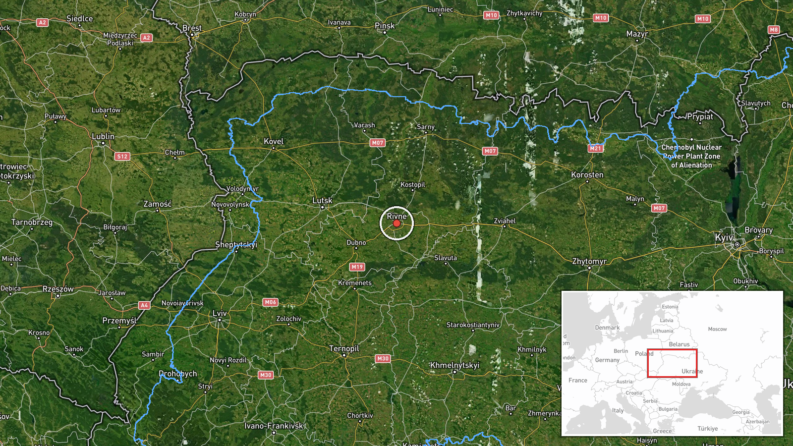
The location is recorded at settlement level, centred on Rivne city at approximately 50.62 N, 26.25 E, and was assigned with high confidence because the alert names the city directly. The drone's approach was described only as coming from the northeast, so the exact track is approximate. Rivne lies in the Polissia lowlands, an area of forest, marsh and farmland. It is roughly 60 to 70 kilometres from the Belarusian border and about 150 kilometres from the Polish border, which places it within easy reach of drone routes from the north.
Related events nearby
- Ukrainian air monitoring: 1 Russian jet-powered Shahed (Geran-3) drone heading toward Rivne.2026-10-20 02:06 UTC · Drone Transit · Rivne, Ukraine
- Ukrainian air monitoring: 2+ Russian jet-powered Shahed (Geran-3) drones heading toward Rivne.2026-10-20 01:50 UTC · Drone Transit · Rivne, Ukraine
- Ukrainian air monitoring: 1 Russian jet-powered Shahed (Geran-3) drone from Zhytomyr Oblast toward Rivne Oblas2026-10-20 01:44 UTC · Drone Transit · Rivne Oblast, Ukraine
- Ukrainian air monitoring: 2+ Russian jet-powered Shahed (Geran-3) drones heading toward Rivne.2026-10-20 01:09 UTC · Drone Transit · Rivne, Ukraine
- Ukrainian air monitoring: 1 Russian jet-powered Shahed (Geran-3) drone heading toward Rivne.2026-10-20 00:54 UTC · Drone Transit · Rivne, Ukraine
▶ View this event on the live map

Intel Mapper aggregates open-source reports from monitored Telegram and X channels, geolocates them, cross-checks duplicates across sources and assigns a confidence score. Entries are updated as new confirmations arrive. Read how we verify events.