Single Russian jet-powered Shahed drone reported moving toward Krasiatychi, Kyiv Oblast, per Ukrainian monitoring
What happened
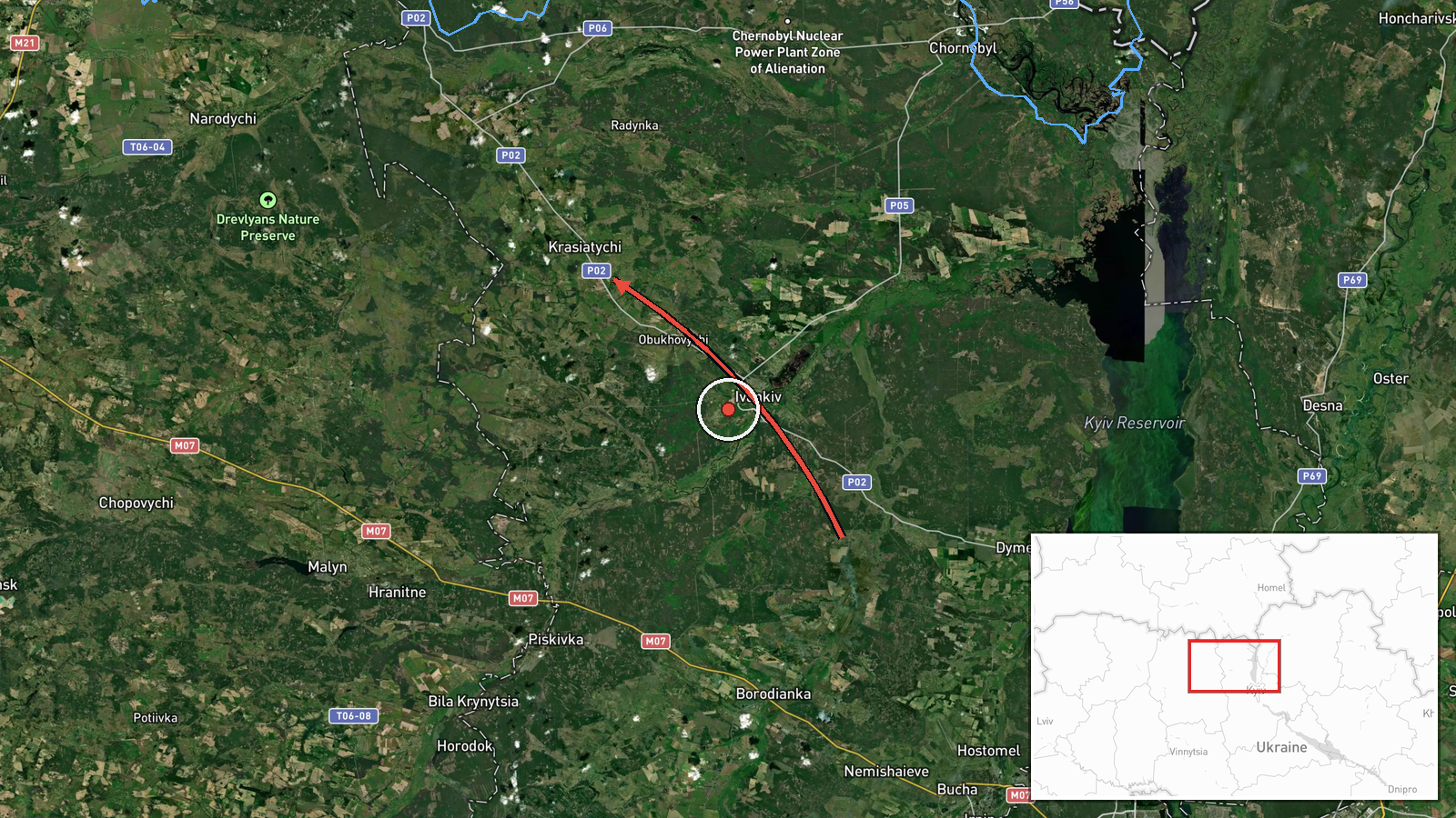
Ukraine's air monitoring channel on Telegram (@kpszsu) reported a single Russian jet-powered Shahed (Geran-3) drone approaching the settlement of Krasiatychi in Kyiv Oblast from the east, with the post logged at 04:30 UTC on 20 October 2026. The original Ukrainian-language wording describes a jet-type unmanned aerial vehicle moving on Krasiatychi from the east. The report does not state any impact, damage, or casualties, and it names no origin point beyond the directional description. A related earlier alert at 17:19 UTC on 19 October also referenced one drone heading toward Krasiatychi, indicating the same settlement was named in successive warnings.
Context and assessment
Krasiatychi lies in the northwest of Kyiv Oblast, in the Polissia belt that Russian Geran-type drones have repeatedly crossed on routes toward central and western Ukraine. The related events show a dense overnight pattern on 19 to 20 October: drones passing Narodychi heading west around 00:55 UTC, a drone from Zhytomyr Oblast toward Malyn at 02:48, and multiple drones from northern Chernihiv Oblast toward northern Kyiv Oblast at 02:38 and 03:25. Taken together, these reports suggest a sustained flight path through the north of the country rather than a single isolated incursion. Settlement-level reports of this kind typically reflect the drone's reported heading and do not necessarily indicate the intended target. Jet-powered Geran-3 variants are generally faster and harder to intercept than older piston-engine Shaheds, which may be one reason monitoring channels issue frequent transit warnings. Operationally, the pattern may point to probing or saturation of air-defence coverage across multiple oblasts, though the data alone cannot confirm intent.
Sources and confidence
The report rests on a single Telegram channel, @kpszsu, which relays Ukrainian air monitoring alerts. No independent outlet or second channel in the data confirms this specific sighting. Related alerts from the same overnight window are also single-channel entries, which supports pattern consistency but not independent verification. The confidence score of 8.0 reflects a clear, official-style monitoring post with a specific settlement and time, tempered by the lack of cross-confirmation and the reliance on one source. Confidence would rise with corroboration from Ukrainian Air Force statements, regional military administrations, or independent tracking. It would fall if later updates revised the drone count, retracted the heading, or showed no airspace activity over the settlement.
Location
The location is recorded at settlement level for Krasiatychi, with coordinates near 51.08 N, 29.64 E, and location confidence rated high. Krasiatychi is a small community in northwestern Kyiv Oblast, close to the Zhytomyr and Chernihiv border zone. The area is marked by forest, wetland, and river terrain typical of Polissia, including the nearby Teteriv river valley, which can affect low-altitude drone tracking and radar coverage.
Related events nearby
- Ukrainian air monitoring: 1 Russian jet-powered Shahed (Geran-3) drone heading toward Krasiatychi.2026-10-19 17:19 UTC · Drone Transit · Krasiatychi, Ukraine
- Ukrainian air monitoring: 2+ Russian jet-powered Shahed (Geran-3) drones passing Narodychi, heading west.2026-10-20 00:55 UTC · Drone Transit · Narodychi, Ukraine
- Ukrainian air monitoring: 1 Russian jet-powered Shahed (Geran-3) drone from Zhytomyr Oblast toward Malyn.2026-10-20 02:48 UTC · Drone Transit · Malyn, Ukraine
- Ukrainian air monitoring: 1 Russian jet-powered Shahed (Geran-3) drone from northern Chernihiv Oblast toward n2026-10-20 03:25 UTC · Drone Transit · northern Kyiv Oblast, Ukraine
- Ukrainian air monitoring: 2+ Russian jet-powered Shahed (Geran-3) drones from northern Chernihiv Oblast toward2026-10-20 02:38 UTC · Drone Transit · northern Kyiv Oblast, Ukraine
▶ View this event on the live map

Intel Mapper aggregates open-source reports from monitored Telegram and X channels, geolocates them, cross-checks duplicates across sources and assigns a confidence score. Entries are updated as new confirmations arrive. Read how we verify events.