Jet-powered Geran-3 drones reported transiting northern Kyiv Oblast, one heading toward Oster
What happened
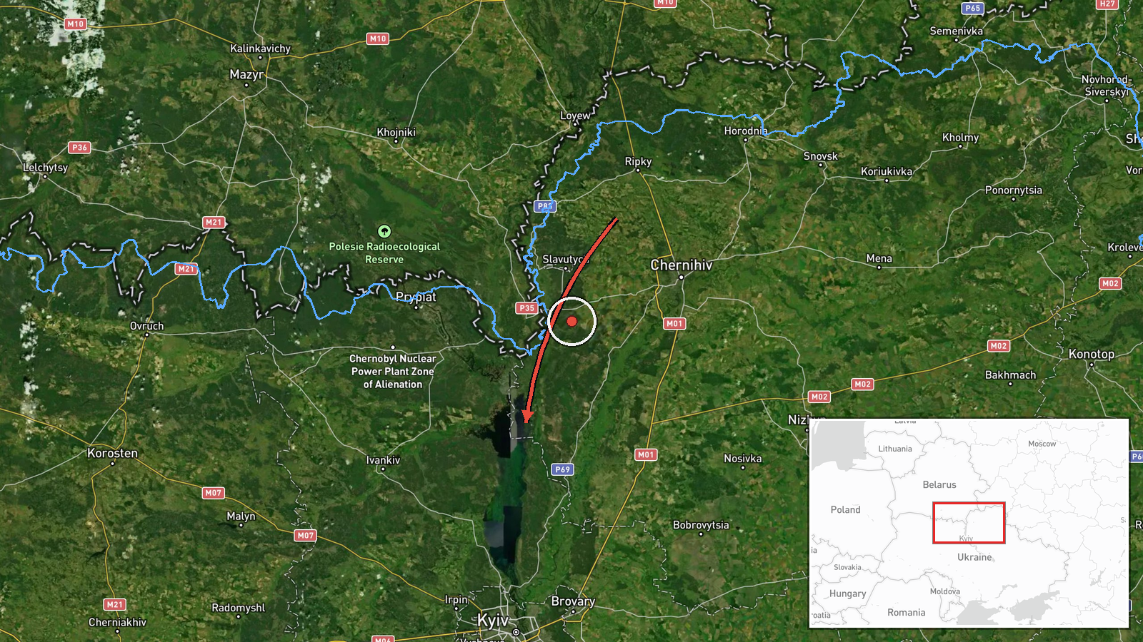
Ukraine's Air Force monitoring channel on Telegram (@kpszsu) reported at about 03:25 UTC on 20 October 2026 that one jet-powered Shahed-type drone, described in Ukrainian reporting as Geran-3, was moving from northern Chernihiv Oblast toward northern Kyiv Oblast. A second line in the same post reported a separate jet-powered drone heading toward Oster and the Desna River from the north. The original Ukrainian wording refers to a reactive UAV and names the Oster/Desna direction, but gives no impact location, damage, or casualty information. The report is a transit alert rather than a confirmed strike. Attribution to Russia rests on the channel's identification of Geran-3 drones, a Russian-designed system widely used against Ukraine.
Context and assessment
Northern Kyiv Oblast and the Desna corridor lie on routes that Russian long-range drones have repeatedly used to approach Kyiv from the north and northeast, so transit alerts here are a recurring feature of the air campaign rather than an isolated incident. The related events in this dataset show a steady sequence over roughly 36 hours. On 19 October at 05:21, two or more drones passed northern Kyiv Oblast heading southwest. Later that day, a single Geran-3 moved from Chernihiv Oblast toward the Kyiv Reservoir at 14:02, and another single drone moved from Chernihiv Oblast toward northern Kyiv Oblast at 16:02. A cruise missile toward Kozelets was logged earlier on 19 October. The 02:38 report on 20 October describes a larger group of two or more drones on the same Chernihiv to northern Kyiv axis. Operationally, the pattern suggests drones routed over Chernihiv Oblast and steered through Kyiv's northern approaches, possibly to probe air defence coverage, draw interceptors, or reach targets further south or west. These readings remain tentative, because transit reports indicate direction of movement rather than intended targets.
Sources and confidence
All information comes from a single Telegram channel, @kpszsu, which is the Ukrainian Air Force's official monitoring account and is generally treated as a primary source for aerial threat warnings. No second channel, official statement, or independent flight-tracking record in the dataset corroborates this specific transit, so it is recorded as single-source. The confidence score of 8.0 reflects the channel's authority and the specificity of its directional report, tempered by the lack of cross-confirmation and the transit-only nature of the message. Confidence would rise with corroboration from other military monitoring outlets, regional administrations, or reports of impact. It would fall if updates revised the drone count or direction.
Location
The marked point, approximately 50.995 N and 30.520 E, is a region-level approximation placed in northern Kyiv Oblast, because the report names only directions and corridors rather than a settlement or facility. Oster, named in the second line, lies along the Desna River, which forms a broad floodplain corridor across the region's north. The terrain is largely rural, with forest, wetlands, and river channels that complicate low-altitude tracking. The marker should not be read as a target location.
Related events nearby
- Ukrainian air monitoring: 2+ Russian jet-powered Shahed (Geran-3) drones from northern Chernihiv Oblast toward2026-10-20 02:38 UTC · Drone Transit · northern Kyiv Oblast, Ukraine
- Ukrainian air monitoring: 1 Russian jet-powered Shahed (Geran-3) drone from northern Chernihiv Oblast toward n2026-10-19 16:02 UTC · Drone Transit · northern Kyiv Oblast, Ukraine
- Ukrainian air monitoring: 2+ Russian jet-powered Shahed (Geran-3) drones passing northern Kyiv Oblast, heading2026-10-19 05:21 UTC · Drone Transit · northern Kyiv Oblast, Ukraine
- Ukrainian air monitoring: 1 Russian jet-powered Shahed (Geran-3) drone from Chernihiv Oblast toward Kyiv Reser2026-10-19 14:02 UTC · Drone Transit · Kyiv Reservoir, Ukraine
- Ukrainian air monitoring: Russian jet-powered Shahed (Geran-3) drone tracked toward Velyka Dymerka/Brovary, Ky2026-10-20 03:29 UTC · Drone Transit · Velyka Dymerka, Brovary, Ukraine
▶ View this event on the live map

Intel Mapper aggregates open-source reports from monitored Telegram and X channels, geolocates them, cross-checks duplicates across sources and assigns a confidence score. Entries are updated as new confirmations arrive. Read how we verify events.