Russian Geran-3 jet drones reported over northern Kyiv Oblast, heading southwest
What happened
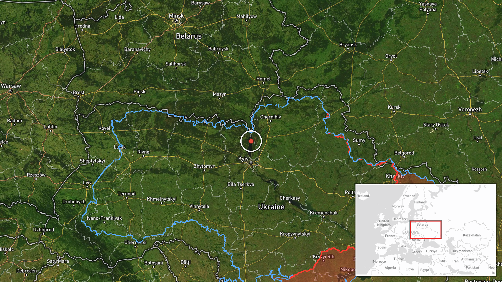
Ukrainian air monitoring reported on 19 October 2026 at 05:21 UTC that at least two Russian jet-powered Shahed-type drones, identified as Geran-3, were passing over northern Kyiv Oblast and heading southwest. The report was posted on the Telegram channel @kpszsu as a single-source alert, with no independent confirmation attached. The original Ukrainian-language wording refers to jet drones over the north of Kyiv and Zhytomyr regions, a broader description than the 'northern Kyiv Oblast' label used in the event summary. No impacts, casualties or intended targets are mentioned.
Context and assessment
Northern Kyiv Oblast lies on a main air corridor used by Russian long-range drones and missiles travelling toward the capital, central Ukraine and the west, so transit reports here recur during sustained strike campaigns. The related events show a consistent sequence over about 24 hours. On 18 October a group of at least two Geran-3 drones was reported heading west, followed by a single Shahed-type drone reported moving toward Dymer, a settlement in the same area. That evening a Banderol mini cruise missile was tracked passing the Kyiv Reservoir toward Vyshhorod, and in the early hours of 19 October another single jet drone was logged heading west. The most recent cruise missile report, toward Kozelets, lies further northeast in Chernihiv Oblast, which suggests the routes may be spreading across a wider northern arc. Operationally, the pattern is consistent with flights that pass through or skirt the Kyiv area to reach other targets, or with decoy and saturation tactics that stretch air defence attention. Transit reports alone do not establish intended targets, and this report's southwestward heading would suggest movement away from the capital region.
Sources and confidence
All evidence rests on one Telegram channel, @kpszsu, which published the alert. The confidence score is 8.0 with a source count of 1. That score reflects the channel's role in publishing air-monitoring alerts and the consistency of the wider sequence of related reports, which come from the same type of feed. However, no second outlet, imagery or official statement has been found to confirm this specific drone count or heading. Confidence would rise with corroboration from a second monitoring source, an official Ukrainian Air Force statement, or radar or debris reports. It would fall if later updates revised the drone count, the heading or the region.
Location
Location is classed as region precision with low location confidence. The coordinates, about 50.995 N and 30.520 E, are a generalised point for northern Kyiv Oblast rather than a settlement, because the report names no specific place. The area is mainly forested Polissia-edge lowland, with rivers, wetlands and the Dnipro valley to the east. The Kyiv Reservoir lies to the south, and the capital itself is roughly 60 to 70 km to the south.
Related events nearby
- Ukrainian air monitoring: 1 Russian jet-powered Shahed (Geran-3) drone passing northern Kyiv Oblast, heading w2026-10-19 02:45 UTC · Drone Transit · northern Kyiv Oblast, Ukraine
- Ukrainian air monitoring: 1 Russian Shahed-type drone from northern Kyiv Oblast toward Dymer.2026-10-18 06:56 UTC · Drone Transit · Dymer, Ukraine
- Ukrainian air monitoring: 1 Russian cruise missile heading toward Kozelets.2026-10-19 03:43 UTC · Cruise Missile · Kozelets, Ukraine
- Ukrainian air monitoring: 1 Russian Banderol mini cruise missile passing Kyiv Reservoir, heading toward Vyshho2026-10-18 19:41 UTC · Cruise Missile · Vyshhorod, Ukraine
- Ukrainian air monitoring: 1 Russian Banderol mini cruise missile passing Brovary district, heading toward Vysh2026-10-18 19:40 UTC · Cruise Missile · Vyshhorod, Ukraine
▶ View this event on the live map

Intel Mapper aggregates open-source reports from monitored Telegram and X channels, geolocates them, cross-checks duplicates across sources and assigns a confidence score. Entries are updated as new confirmations arrive. Read how we verify events.